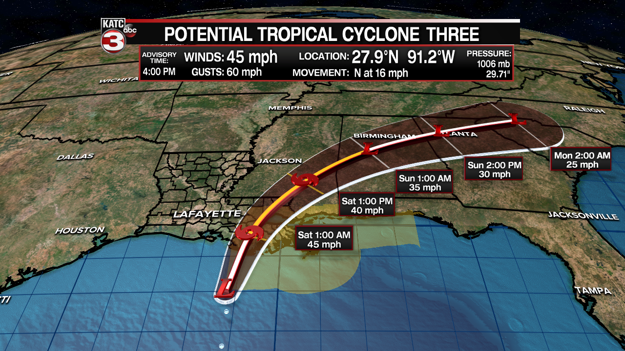
Potential Tropical Cyclone #3 continued to slowly get more organized Thursday afternoon and is still expected to become a tropical storm, or a subtropical storm with a "name" prior to landfall late tonight/early Saturday morning across Southeastern Louisiana.

The system was sporting 45 mph winds and was moving to the north near 16 mph.
If PTC#3 gets a more defined and focused center of circulation prior to landfall it will become a tropical storm, if so its name will be "Claudette".

This system will primarily bring the threat of heavy, possibly flooding rains to extreme Southeast Louisiana into Mississippi, Alabama, portions for the Florida Panhandle and eventually Georgia overnight and into this weekend.

The primary impacts of PTC#3 will remain well east of Acadiana with only a few scattered tropical showers possible for the area into Friday night.

In fact, drier air behind the system in its southwestern flank will bring lower rain chances and partly sunny skies to Acadiana Saturday.
Deeper tropical moisture will move into the region for Sunday, allowing for a good chance (60%) of scattered daytime showers and thunderstorms.

The pattern for Acadiana appears to stay wetter than normal (60-70%) Monday and Tuesday before rain chances settle back down to a more typical 20-40% range for the latter part of next week and into the following weekend.
See the KATC 10 Day Forecast for the latest.
------------------------------------------------------------
Stay in touch with us anytime, anywhere.
To reach the newsroom or report a typo/correction, click HERE.
Sign up for newsletters emailed to your inbox. Select from these options: Breaking News, Evening News Headlines, Latest COVID-19 Headlines, Morning News Headlines, Special Offers


