

Potential Tropical Cyclone 26 has formed in the central Caribbean Sea.
Here is the latest track and intensity forecast:
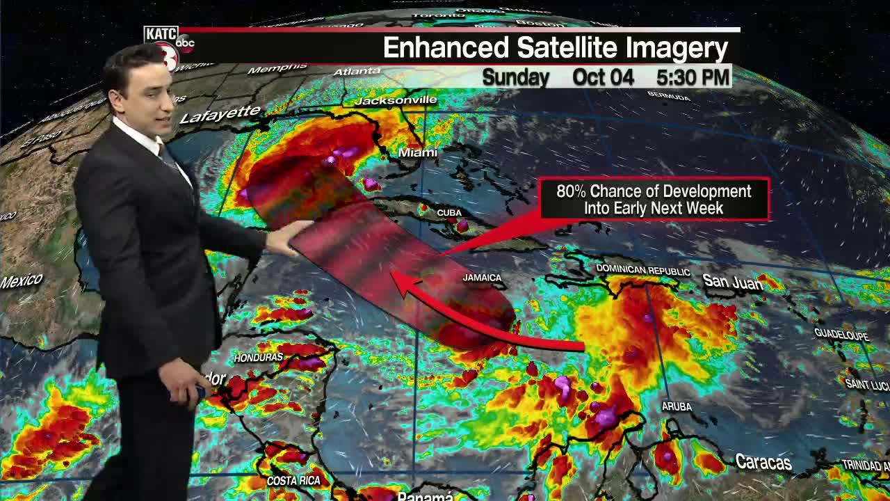
Here is the latest from the NHC:
"At 500 PM EDT (2100 UTC), the disturbance was centered near latitude 16.7 North, longitude 76.6 West. The system is moving toward the west-northwest near 10 mph (17 km/h). A west-northwestward to northwestward motion at a slightly faster forward speed is expected over the next few days.
On the forecast track, the center of the disturbance is expected to pass near or just southwest of Jamaica tonight and early Monday, move near or over the Cayman Islands Monday night, and approach the Isle of Youth and western Cuba Tuesday afternoon or evening.
The system is forecast to move into the southeastern Gulf of Mexico Tuesday night or early Wednesday.
Maximum sustained winds are near 35 mph (55 km/h) with higher gusts.
Strengthening is expected during the next 2 to 3 days and the system is forecast to be a tropical storm when it nears the Cayman Islands, and a hurricane when it moves near or over western Cuba."
*
*
We will continue to closely monitor the progression of the storm.
Still way too early to get into any specific impact details for Acadiana as uncertainty in the forecast grows 5+ days out and changes are likely.
Best course of action is to remain prepared as we are still in the midst of hurricane season.
Make sure to continue to follow us for the very latest.
