Acadiana will see little change to the weather pattern into the weekend, but next week is shaping up to be different, and in a good way.
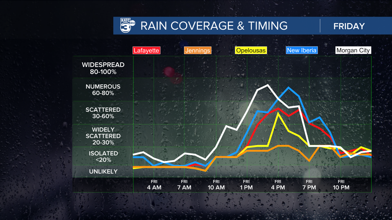
In the near term, a weak upper level low is expected to drift over Southern Louisiana through Saturday, allowing for partly sunny skies for most of the day accompanied by scattered afternoon/early evening showers and thunderstorms.

Rain chances Friday will be in the 50% range and near 50-60% Saturday.
Highest rain chances locally are expected to be Lafayette on eastward through Saturday although we could see a little more coverage to the west Saturday in concert with the upper low drifting westward.

Daytime highs will continue to max out in the upper 80s to near 90° before any shower activity begins.
Overnight lows have been a little more comfortable thanks to a light northerly flow at the surface that was established a few days back...look for morning readings right near 70°.
By Sunday, the upper low is expected to weaken and open up to a wave while getting shuttled eastward thanks to another upper trough that will be swinging through the Mississippi Valley.

This will allow for fewer afternoon storms Sunday into early next week with more comfortable humidity and temperatures expected for the majority of the week.
Look for mostly sunny skies for most of next week with highs in the mid-upper 80s while overnight lows are expected to duck down into the mid-upper 60s for a few days mid-week.
Humidity should gradually return by next weekend with the chance of scattered showers returning shortly thereafter.
See the KATC 10 Day Forecast for the latest.
Meanwhile in the tropics, while Danielle in the North Atlantic was downgraded to a post tropical cyclone today, Hurricane Earl near Bermuda continues to get better organized with 100 mph winds Thursday afternoon.

Tropical storm warnings and a hurricane watch are in effect for Bermuda but the bulk of the worst conditions are expected to remain east of the island.
Earl is expected to become a major hurricane for a few days prior to weakening in the North Atlantic later this weekend.
Elsewhere, a couple of tropical disturbances in the Eastern/Central tropical Atlantic while having some potential for development, are expected to remain Atlantic systems and may have limited futures.
There appears to be no immediate tropical threats to the Gulf of Mexico for the next week to 10 days.
------------------------------------------------------------
Stay in touch with us anytime, anywhere.
To reach the newsroom or report a typo/correction, click HERE.
Sign up for newsletters emailed to your inbox. Select from these options: Breaking News, Evening News Headlines, Latest COVID-19 Headlines, Morning News Headlines, Special Offers


