


Another chilly-cold one tonight with overnight lows heading for the upper 30s to lower 40s.
You could make the argument for some patchy fog in spots, but the signals are not all that strong at this time.
Shaping up to be a nice Thursday with mostly sunny skies.

Temperatures will be slightly milder in the lower 70s by the afternoon.
A ridge of high pressure aloft will begin to expand and build in for the end of the week and heading into the holiday weekend.
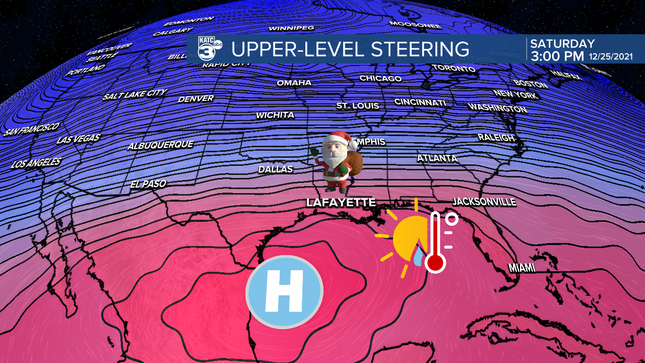
That will yield to warmer than normal conditions across our part of the world.
Winds will pick up out of the south at ~12-20 mph as well.

Expect highs on Christmas Eve to push the mid-upper 70s.

We'll likely see temperatures in the upper 70s to lower 80s Christmas Day... that will be after a morning start in the mid-60s.
However, that ridge will also keep rain chances slim to none this weekend, so any outdoor plans you may have will not be hindered by precipitation.
The pattern will look to remain warmer than normal through much of next week as well.
In fact, I am not seeing another front until the new year!
Some isolated rain chances may return during the mid-latter parts of next week.
Have a good one!
