


Acadiana will be on the receiving end of nice and mild weather for our Friday, but big changes are on tap for the weekend, including scattered showers Saturday followed by a windy, winter chill Saturday night into Sunday.
In the near term, clear skies, light winds and a dry atmosphere will allow temperatures to chill into the low-mid 40s overnight through Friday morning.
Mostly sunny skies and mild temperatures are expected for our Friday afternoon with highs pushing into the lower 70s.
Temperatures will be milder Friday night into Saturday morning, holding closer to the mid-50s as breezy southerly winds from the Gulf of Mexico take over.

A strong cold front is expected to push through Acadiana by midday Saturday with scattered showers a good bet, although rain chances do not appear to be terribly high (in the 60% range) with any thunderstorms bow looking less likely.
Best rain chances Saturday look to be during the morning into the early afternoon hours.
Temperatures early Saturday will be in the mid-upper 60s, perhaps near 70° in a few spots, but breezy and sharply colder air will be moving in for the afternoon with temperatures likely dropping into the upper 40s to lower 50s by sunset...wind chill not included.

Windy and cold conditions will follow Saturday night into Sunday morning with temperatures likely dropping into the mid-upper 30s along with wind chills likely plummeting into the mid-upper 20s!
Temperatures Sunday will likely mostly hold in the upper 40s to perhaps lower 50s, but in and out cloud cover along with gusty northwest winds will make it feel like a "full" winter day as wind chills stay mostly in the 30s.
The same system that will bring this cold front through our area Saturday will likely go on to becoming one of the bigger winter storms of the season for portions of the interior Eastern U.S.

Snow totals of a foot or more will be likely across the high terrain of the Appalachians into Pennsylvania and Upstate New York.
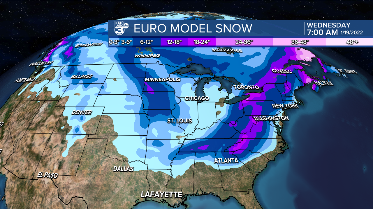
Unfortunately, there will be near zero chances of any flurry activity on the backside of this system here in Acadiana, but there could be some significant snows farther north from the Ozarks into Eastern Arkansas and perhaps extreme northern Mississippi.
The longer range forecast starts next week off on a cold note with readings near freezing across northern portions of Acadiana to mid-30s across the I-10 corridor southward.
MLK Day will be sunny with temperatures warming back into the upper 50s to near 60°.
Milder weather is expected through mid-week before our next front arrives late Wednesday.
Cooler conditions will follow toward the end of the week into the following weekend.
See the KATC 10 Day Forecast for the latest.
------------------------------------------------------------
Stay in touch with us anytime, anywhere.
To reach the newsroom or report a typo/correction, click HERE.
Sign up for newsletters emailed to your inbox. Select from these options: Breaking News, Evening News Headlines, Latest COVID-19 Headlines, Morning News Headlines, Special Offers
