


10pm Update Wednesday
Potential Tropical Cyclone #5 has been officially declared a tropical system...now named Tropical Depression #5.

No significant changes to the forecast track and intensity at this time with a possible Florida threat by Monday.

----------------------------------------------------------------------------------
The National Hurricane Center (NHC) upgraded the tropical disturbance in the mid-tropical Atlantic to Potential Tropical Cyclone #5 Wednesday afternoon.
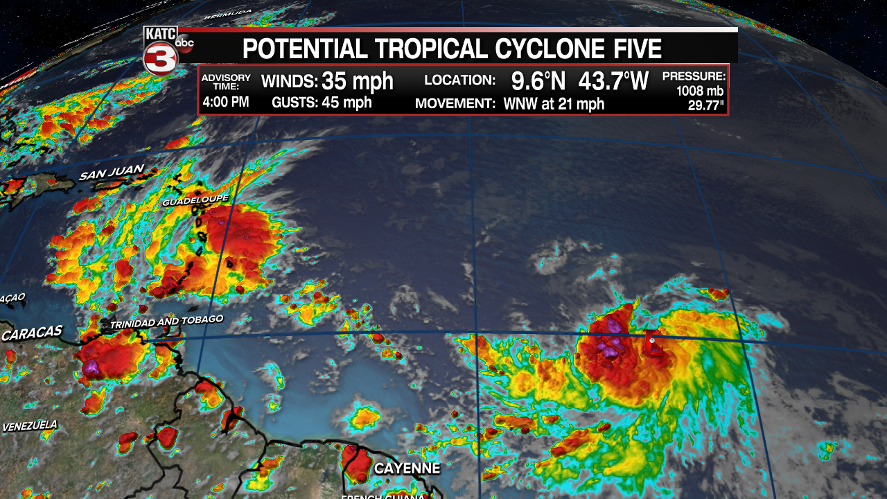
The system, which has shown more organization in the last 24 hours, is expected to become a tropical storm by Thursday, and if so, it will get the name "Elsa".
PTC#5 is expected to navigate into the Caribbean Sea by late Friday through the weekend, and possibly threaten portions of the Gulf of Mexico into next week if it survives any potential land interactions and other storm-limiting factors that may be ahead of it.

For now, the official NHC forecast calls for the system to remain a tropical storm through the next 5 days citing upper shear, quick movement of the surface system, and possible interactions with land areas as inhibiting factors.
It remains way too early to determine whether this system could be of any threat to Louisiana.
Meanwhile locally in Acadiana, shower and thunderstorms activity covered less of the area Wednesday, and is expected to continue into Thursday (near 30%).
A frontal system however will approach the Friday afternoon which will allow for a high chance of thunderstorms, some of which may contain strong and gusty winds and very likely some torrential downpours.

Activity should diminish later into Friday evening, but a good chance of daytime showers and storms is expected to remain likely for the entire holiday weekend as the frontal system stalls across the region.
For now it appears that our rain chances will ramp back up to near 70-80% Friday and Saturday and settle closer to 60% into early next week.
The longer range projections, barring any tropical surprises, looks a little drier and hotter toward the end of next week and perhaps into the following weekend.
See the KATC 10 Day Forecast for the latest.
------------------------------------------------------------
Stay in touch with us anytime, anywhere.
To reach the newsroom or report a typo/correction, click HERE.
Sign up for newsletters emailed to your inbox. Select from these options: Breaking News, Evening News Headlines, Latest COVID-19 Headlines, Morning News Headlines, Special Offers
