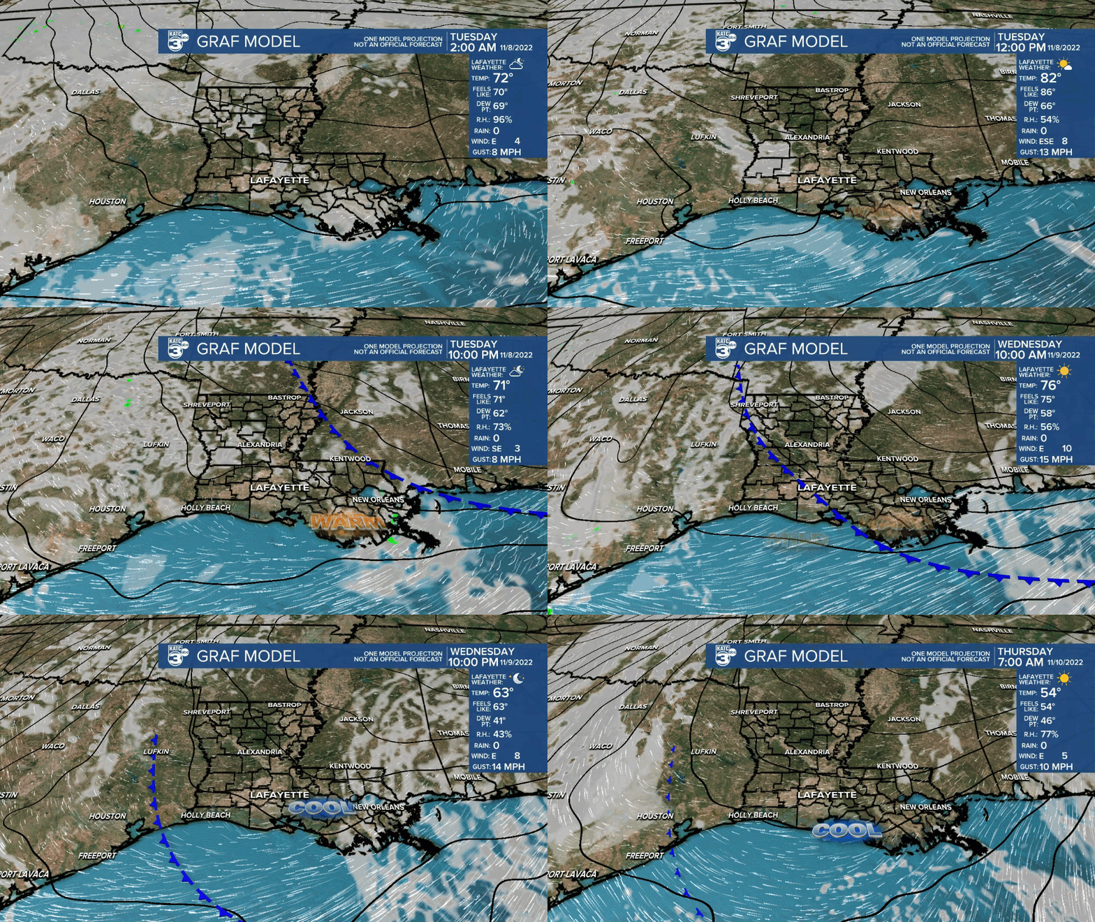
Acadiana will see a mostly sunny and warm one for Election Day with temperatures nearing the record of 88° set back in 1927 during the afternoon.
In the near-term, expect fair to partly cloudy skies overnight with mild temperatures holding in the mid-upper 60s.
Some patchy fog may once again develop toward daybreak Tuesday.

Meanwhile, predawn hour Tuesday will be filled by lunar eclipse of the Beaver Moon.
The Blood Moon will be for early risers...or all-nighters, and will peak at 4:59 am CST Tuesday.
Greater than 50% partiality will start at 3:44 am and will ending at 6:14 am.

The viewing of the eclipse could be most picturesque as dawn breaks and the moon gets low in the western horizon between 5:00 and 6:00 am.
Generally fair skies, a few clouds and some patchy fog are expected in Acadiana for the eclipse.
After an unseasonably warm Tuesday it should get a touch cooler Wednesday through Friday as a little backdoor cool front traverses the region Wednesday helping to reduce afternoon highs closer to the upper 70s to lower 80s for the rest of the week, while more importantly, overnight lows cool back into the 50s.

A much more robust front should arrive with low rain chances Friday followed by much cooler fall conditions this weekend into early next week.
Daytime temperatures this weekend into early next week should mostly top out closer to the upper 50s to lower lower 60s while night-time/morning readings will drop into the 40s.
And behind Friday's front, plenty of clouds and an overrunning precipitation pattern may develop sometime this weekend into early next week but confidence remains low on the details.
See the KATC 10 Day Forecast for the latest.
Meanwhile, in the tropics, it has become apparent that hurricane season is not over yet, especially for the Bahamas and Florida.
As of Tuesday afternoon hurricane warnings were issued for the Northwestern Bahamas including the Abacos, Berry Islands, Bimini and Grand Bahama.
Sub-Tropical Storm Nicole with 45 mph winds Monday afternoon is expected to strengthen and acquire tropical characteristics Tuesday night into Wednesday and possibly become a hurricane threatening Florida (and the Bahamas) Wednesday into Thursday.

In addition to gusty winds, Nicole will have widespread surge, battering wave, and rip current impacts across a large part of the East Coast with most pronounced conditions in Florida with a prolonged 3-5ft surge.
This system will not impact Louisiana.
------------------------------------------------------------
Stay in touch with us anytime, anywhere.
To reach the newsroom or report a typo/correction, click HERE.
Sign up for newsletters emailed to your inbox. Select from these options: Breaking News, Evening News Headlines, Latest COVID-19 Headlines, Morning News Headlines, Special Offers


