


It was another unseasonably warm day as highs pushed the upper 70s to lower 80s.
We once again tied the record high in Lafayette of 81°.
Mild tonight with overnight lows only in the mid-upper 60s under partly-mostly cloudy skies.

As has been the case the last couple of days, clouds will stick around for much of the morning, but will thin a bit into the afternoon leaving us with a sun/cloud mix out there.
Temperatures will remain well above average and top out in the upper 70s to near 80° by the afternoon.
Winds will be out of the SSW at around 12-16 mph.
Similar temperature setup (all near-record territory) will be in place for the rest of the week.
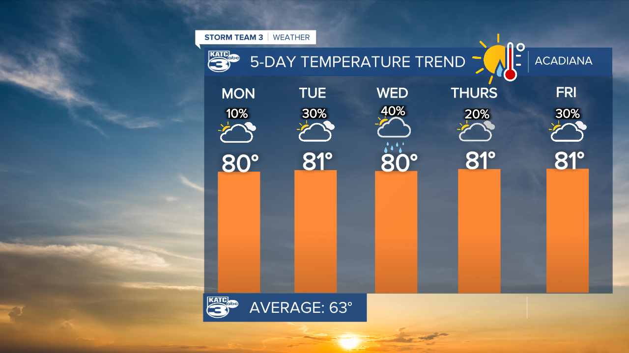
Slightly better chance at a passing shower Tuesday as the upper ridge begins to break down a bit and slide eastward.
Winds will be even a little breezier at around 15-22 mph.
A front will approach but stall to the north on Wednesday.
Still, it'll give us a chance to see a few scattered showers throughout the day.
That boundary won't actually push through, so expect mild-warm conditions to continue through New Year's.
It does look dry, but mild as we ring in the New Year at midnight.
A more promising front looks poised to advance into the region and usher in some cooler weather by the end of the weekend and into first parts of the first week of January.
It could get rather chilly with lows in the 30s/40s and highs in the 50s/60s, but we'll have more to say on that in the days ahead as the pattern comes into better focus.
In the short-term, it's all about the warm end to the year...
Have a great week!
