


Acadiana's weather pattern will return to a more summer "feel" with milder temperatures at night and warmer readings in the afternoon.
In addition, on Wednesday a weak surface disturbance in the Gulf of Mexico will drift northward toward Louisiana while a few pockets of upper level instability will aid in producing scattered showers, and possibly one or two isolated thunderstorms.

Highest rain chances (and the risk of thunder) for the Acadiana look to be from Lafayette Parish (40%) on eastward (50-60%) while lower rain chances are anticipated toward Southwest Louisiana (near 20%).
Rain shower activity Wednesday should be limited to mostly the afternoon into the early evening.
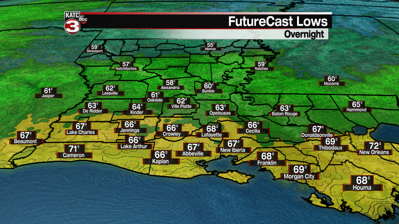
Temperatures overnight through Wednesday morning should be some 10° or more milder (we were in the mid-50s Tuesday morning) with lows generally in the mid-upper 60s while daytime highs Wednesday push well into the mid-80s.
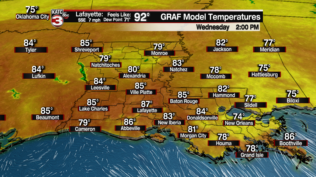
And with higher dew points/humidity it appears that our heat index will be creeping back toward the lower 90s!
It will stay warm into Thursday with a slight chance of a shower or storm (20-30%) as a weak surface trough tries to push through the area from the north.
This feature should dry us out Friday and could lower our overnight/morning lows from near 70° Thursday morning back down into the mid-60s into this weekend.
All in all, do expect more warm afternoons Friday into the weekend with highs planted well in the mid-80s.
Rain chances will be near 10% or less Friday and Saturday, but could increase to 20-30%, perhaps more, Sunday afternoon.
The longer range forecast keeps above normal temperatures in the region through mid-next week, with the promise of a cool front arriving between next Wednesday and Thursday.

Rain chances will remain on the lower end early next week until the frontal system approaches mid-week, and the pattern might support not only thunderstorms ahead of the front, but there may be a severe weather element to some storms that may manifest nearby based on our forecast guidance.
With any luck, we could see a pretty nice weekend to follow, but it may not last through that Sunday.
See the KATC 10 Day Forecast for the latest.
------------------------------------------------------------
Stay in touch with us anytime, anywhere.
To reach the newsroom or report a typo/correction, click HERE.
Sign up for newsletters emailed to your inbox. Select from these options: Breaking News, Evening News Headlines, Latest COVID-19 Headlines, Morning News Headlines, Special Offers
