


A good chance of showers and thunderstorms remains in the forecast Acadiana Friday as deep tropical moisture and instability will remain in place.
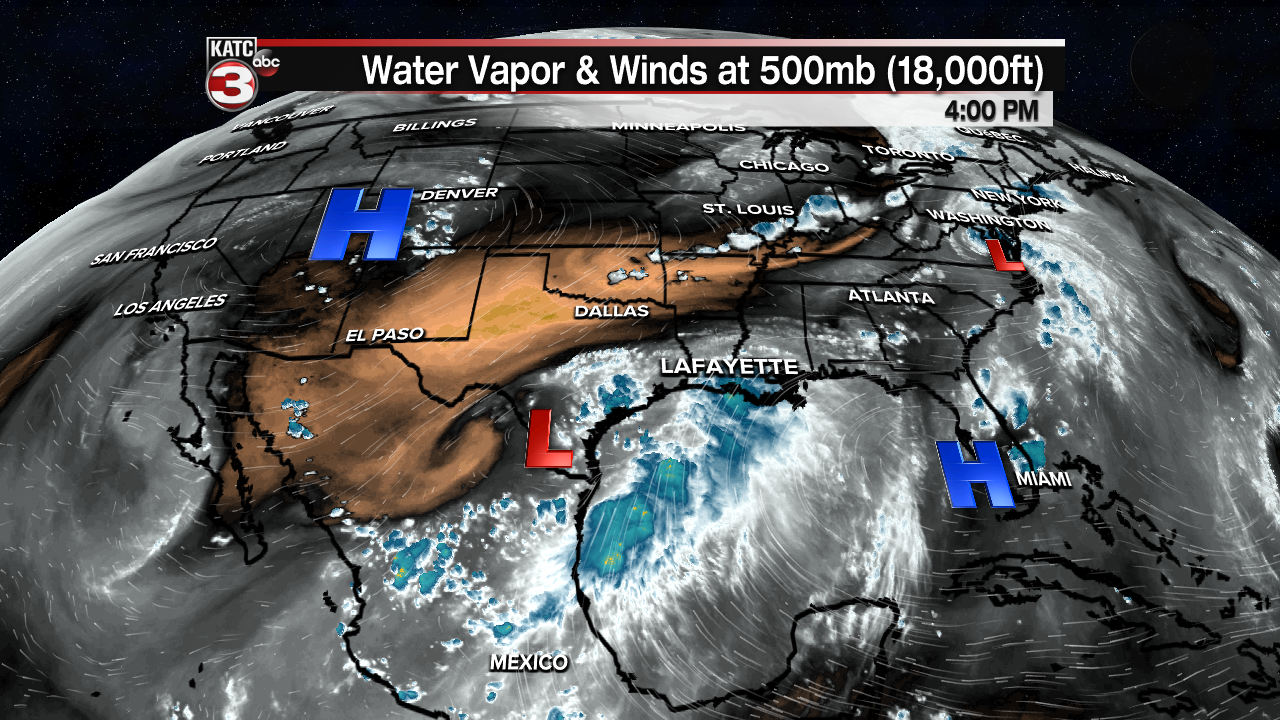
A weak upper level and surface low in South Texas fueling storms in the Gulf of Mexico will continue to be responsible for our above normal rain chances into the weekend, but there are signs that fewer storms will enter the forecast this weekend, but there will still be a decent chance of scattered afternoon storms.
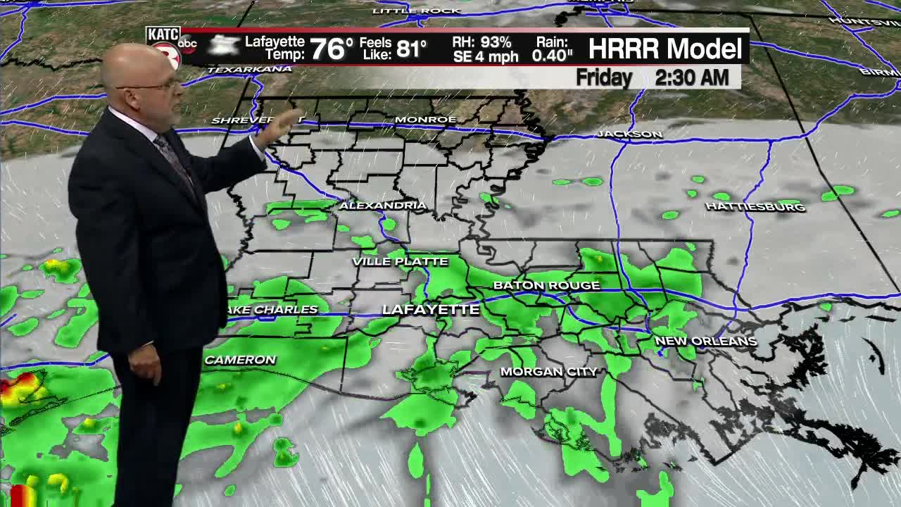
In the near term, high rain chances (80-90%) late Thursday will be very slow to taper overnight with temperatures holding in the mid-70s.
Friday will bring a 70% chance of scattered showers and storms to the area with a few locally very heavy downpours possible. Rain chances Friday will be near 70%.

Temperatures will once again hold in the low-mid 80s Friday thanks to the clouds, showers and storms.
Scattered storms will remain a good bet Saturday (60%) with fewer storms in the mix for Sunday (40%).
Temperatures this weekend should push the upper 80s to near 90° by Sunday.
Moving into early next week, rain chances could get enhanced again as another fizzling frontal trough approaches the region from the north.

Rain chances look to lower (but won't be out) mid-late in the week and likely into the following weekend as atmospheric moisture levels slowly decrease...which will lead to hotter days ahead.
The prospects of showers and storms may go lower than indicated on the KATC 10 Day Forecast into next week, as there are positive signs that some storm inhibiting African Dust will enter the Gulf and perhaps move into our region beginning early next week...we'll see!

Meanwhile in the tropics, Tropical Storm Elsa (yes it's still a storm) was moving into Virginia Thursday afternoon and is expected to impact the rest of the East Coast from the Mid-Atlantic today through the Northeast and New England Friday before impacting the Canadian Maritimes (New Brunswick & Newfoundland) this weekend, then eventually dissipating in the North Atlantic graveyard.

Elsewhere, the rest of the tropics are extremely quiet...thanks in part to the aforementioned dust crossing the Atlantic Basin.
------------------------------------------------------------
Stay in touch with us anytime, anywhere.
To reach the newsroom or report a typo/correction, click HERE.
Sign up for newsletters emailed to your inbox. Select from these options: Breaking News, Evening News Headlines, Latest COVID-19 Headlines, Morning News Headlines, Special Offers
