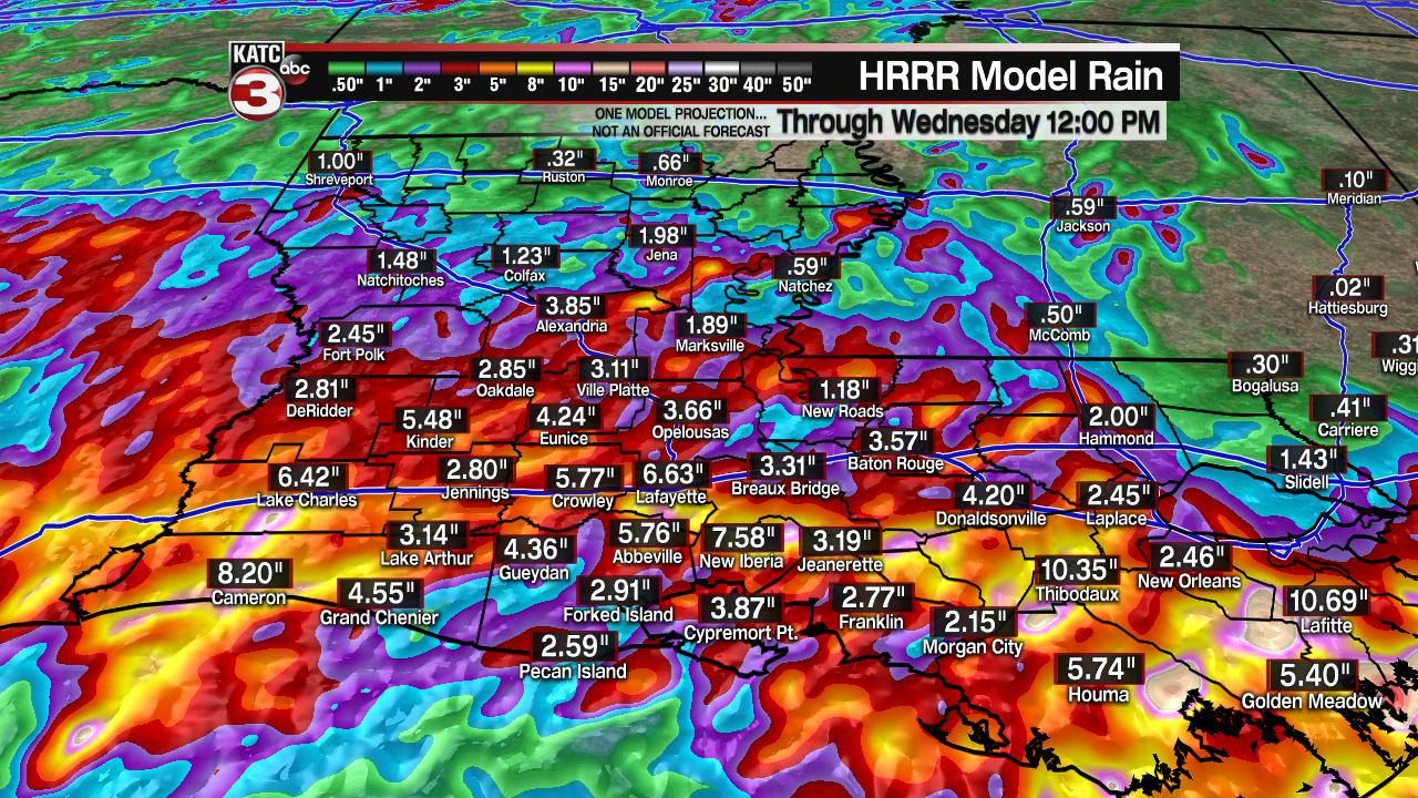
After an extremely active day of weather across Acadiana, strong storms and torrential downpours continue across the region this evening.
Be on the lookout for flooded roadways and flooding in low-lying areas.
Gusty winds may accompany some of the storms as well.
Additionally, an isolated tornado can not be ruled out.
We’ll likely catch a bit of a break overnight tonight, but more rounds of showers and storms will be on the way for Tuesday.

The weather pattern will remain pretty stagnant as an upper-level low off to our west continues to send in impulses of energy that will tap in to abundant Gulf moisture.
Some of the storms could once again be on the stronger side and capable of producing very heavy rainfall in a very short period of time on Tuesday.
More rounds of showers and storms are expected on Wednesday, Thursday and perhaps into early Friday as well before a ridge of high pressure builds in from the west by the weekend to help finally dry things out.
As a result of an extended period of rainfall, flooding will remain a concern for the area.

An ADDITIONAL 3-6” of rainfall will be possible with locally higher amounts of 5-10+” as well (in those training, slow-moving thunderstorms).
A FLASH FLOOD WATCH is in effect through Thursday evening.
The NWS is highlighting that significant flash flooding could be possible in some areas.
Be sure to stay with the KATC storm team for the latest information.
------------------------------------------------------------
Stay in touch with us anytime, anywhere.
To reach the newsroom or report a typo/correction, click HERE.
Sign up for newsletters emailed to your inbox. Select from these options: Breaking News, Evening News Headlines, Latest COVID-19 Headlines, Morning News Headlines, Special Offers

