


More summer-like heat remains in the forecast for Acadiana through the end of the week, but changes including a better chance of showers and storms are anticipated into the weekend.
In the near term, look for another warm and humid night with low temperatures in the low-mid 70s.
After some morning clouds, expect another mostly sunny and hot Thursday with highs topping out in the lower 90s.

On the good news side, we should have a breezier afternoon with winds coming in more directly from the Gulf of Mexico.
Those southerly breezes will continue Thursday into Friday perhaps shaving our daytime highs down a few degrees but it will likely come at the expense of higher dew points and humidity.
The area should remain relatively rain-free through Friday with rain chances staying below 10%.
Changes should occur this weekend as high pressure aloft breaks down opening the door for more upper atmospheric instability (and disturbances) as a weakening surface frontal trough approaches the region.
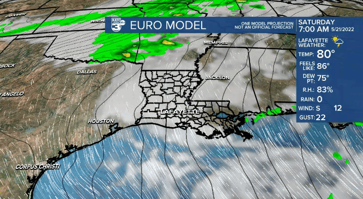
This will likely translate to a good chance of scattered showers and thunderstorms by Saturday afternoon, with plenty of clouds and lingering chances of storms likely to continue Sunday.
Daytime highs this weekend will be in the upper 80s to near 90° before storms kick in Saturday afternoon, while Sunday we may hold closer to the low-mid 80s.
In general an inch or two of rain should fall this weekend, but there is the possibility of much heavier amounts, but where they may actually occur remains unclear.

Look for changes to our rainfall outlook in the days ahead.
Next week, the weather pattern continues to look rather summer-like, only with a daily chance of scattered afternoon showers and storms limiting our daytime highs closer to the upper 80s to near 90°.
See the KATC 10 Day Forecast for the latest.
Meanwhile in the tropics, it's the same tropical story, but a different day.
A tropical wave in Southwest Caribbean combined with broad Central American Gyre expected to bring heavy rains toward Central America by this weekend.
The Euro remains unimpressed on any development, other than perhaps eventually in the Eastern Pacific.
Meanwhile the GFS model continues to want to generate a more substantial system by the Yucatan a week out.

But this would be in the face of a solid dose of Saharan Dust heading for the region which makes the GFS solution more suspect and discounted at this time.
And per the National Hurricane Center, there is no tropical development expected over the next 5 days, but that status could change to a lower end risk in the Western Caribbean before the week is done.
------------------------------------------------------------
Stay in touch with us anytime, anywhere.
To reach the newsroom or report a typo/correction, click HERE.
Sign up for newsletters emailed to your inbox. Select from these options: Breaking News, Evening News Headlines, Latest COVID-19 Headlines, Morning News Headlines, Special Offers
