


A weak "back-door" cool front (coming in from the east-northeast) is expected to bring more comfortable temperatures, humidity and cooler nighttime temperatures to Acadiana for the rest of the week.
Thereafter, a much stronger front arriving late Friday is expected to bring more winter-like temperatures this weekend and most of next week.
In the near term, it will be another mild night/morning for Acadiana through Wednesday morning with a few patches of fog possible, but the fog might be less likely than the last two nights/mornings.
Lows by morning will again be in the mild mid-upper 60s.
Mostly sunny and pleasant weather is expected for the rest of the week with highs Wednesday in the low-mid 80s, but closer to the upper 70s to near 80° for Thursday and Friday.

Night time temperatures will drop into the more seasonable 50s.

A much stronger front followed by a winter chill is expected to arrive Friday night followed by what looks to be a week's worth of below normal temperatures akin to the winter months.
There also looks to be a fair bit of cloud cover from this weekend into next week with some opportunities for showers Saturday morning and then again developing for mid-next week.
By looking at the last 7 days of KATC 10 Day Forecast, it's obvious that it will be jacket, sweater and gumbo weather for a while!
Meanwhile in the tropics, Tropical Storm Nichole acquired tropical characteristics earlier today, has been strengthening, and is expected to become a hurricane Wednesday.

A wide swath of tropical storm wind, surge and surf impacts are expected from Florida to Carolinas with this system.
And based on the current NHC track, hurricane or near hurricane conditions possible from West Palm Beach northward to the Space Coast Wednesday night into Thursday morning.
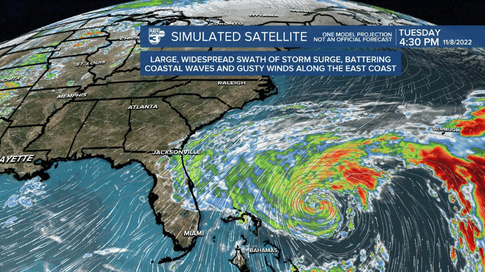
It is interesting to note that today's GRAF Model has trended to a little more eastward track (as it did yesterday) and has had an exemplary performance record with tropical systems to date...we'll see how the model does this time around.
------------------------------------------------------------
Stay in touch with us anytime, anywhere.
To reach the newsroom or report a typo/correction, click HERE.
Sign up for newsletters emailed to your inbox. Select from these options: Breaking News, Evening News Headlines, Latest COVID-19 Headlines, Morning News Headlines, Special Offers
