


The front that we have been mentioning for about a week now has stalled across the Gulf waters.
For us, drier air has slowly been filtering throughout the day courtesy of a northeasterly wind.
It was still humid out there, but it'll gradually start feeling a little better this evening and through the overnight period as dew points fall into the 60s.
Fair to mostly clear skies will be in place tonight.
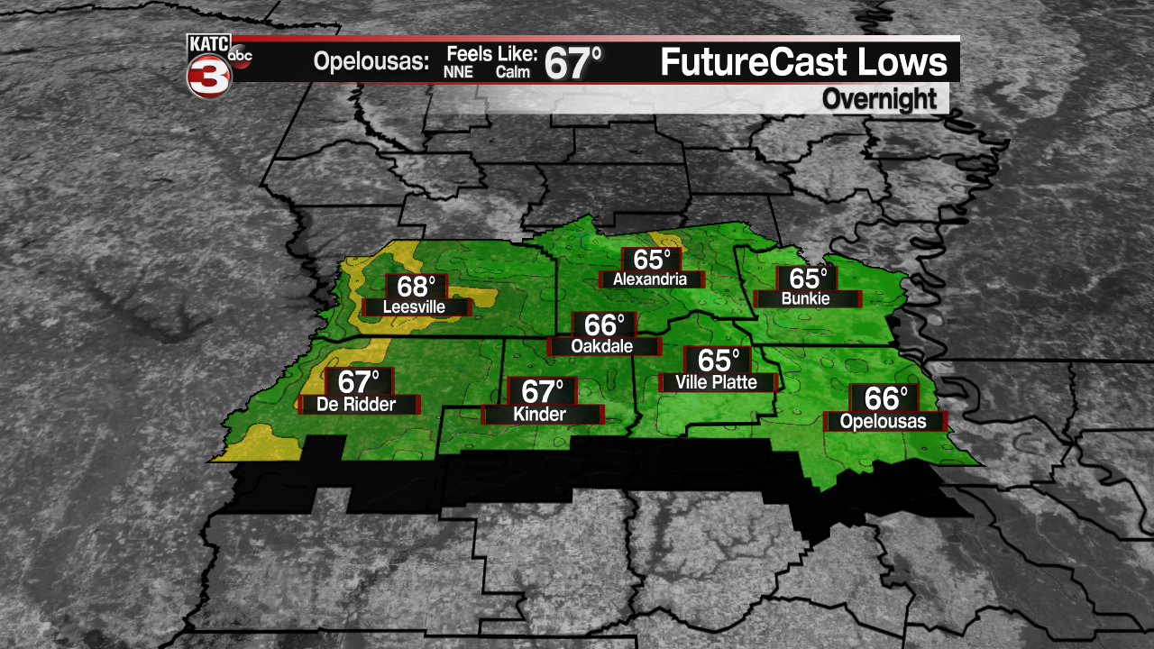
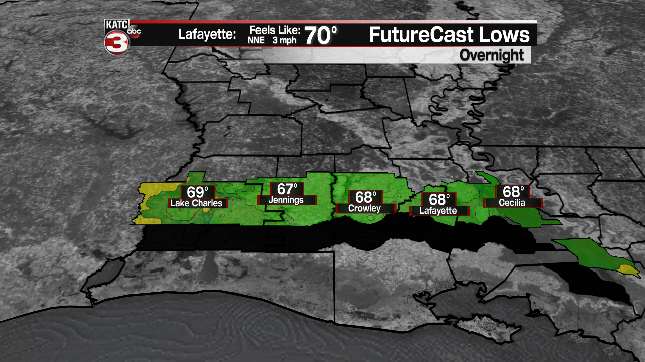
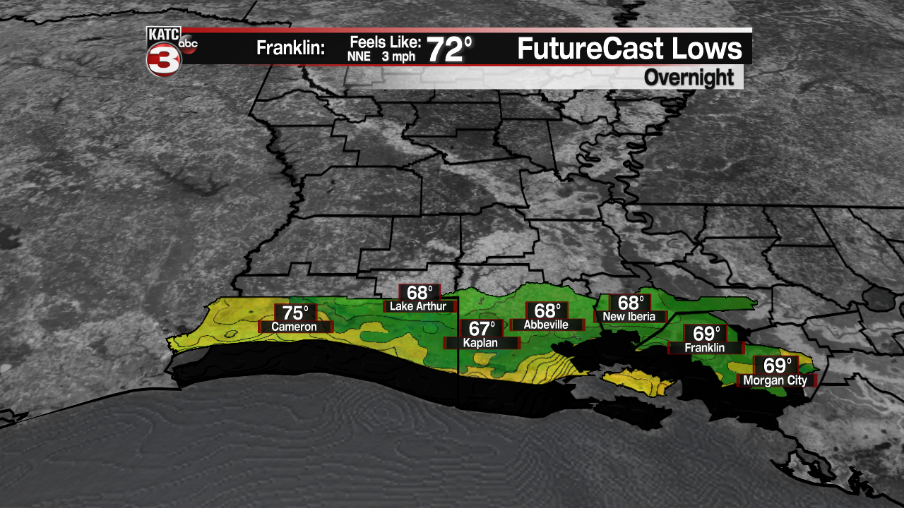
Overnight lows will range from the middle 60s for northern parishes to the upper 60s to near 70° for areas along and south of the I-10 corridor.
It will feel somewhat nice early tomorrow morning, especially for August standards!
Mostly sunny skies are expected on Thursday with the exception of some high-level cirrus clouds.
Temperatures will top out in the upper 80s to lower 90s... but with a light northeasterly wind and lower dew points, it won't "feel" too terribly bad.
Still hot, but a far cry from the triple digits a week ago.
It's the small victories this time of year!
Temperatures will head for the upper 60s to lower 70s by Friday morning.
We are then looking at a sun and cloud mix on Friday as humidity slowly starts to edge back upwards.
The humidity and those typical afternoon scattered showers and storms will be back for the weekend.
The forecast looks a lot like early-mid August heading into next week as well.
In the tropics:
A couple areas of interest way out in the Atlantic.
They either have a low or medium chance of development at this time.
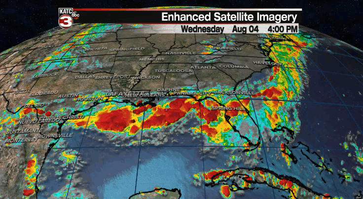
None appear to be a threat to the Gulf at this point, but we'll continue to keep an eye on things.
