

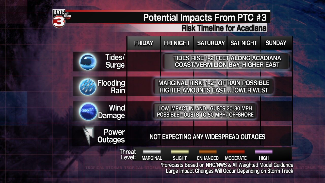
There was little change with the potential tropical cyclone in the Gulf of Mexico Thursday evening, while the latest suite of models are beginning to insist that the worst weather with this system should stay mostly east of the Acadiana area.

Potential Tropical Cyclone #3 is still expected to become a low-end tropical storm prior to landfall somewhere in southern or southeastern Louisiana Friday night into Saturday morning with the main impact being the threat of heavy rainfall staying east of Acadiana.

For now, it appears that the greatest risk of tropical showers and a few storms will arrive in the area Friday afternoon into Friday night but may just exit the area by Saturday morning.
Stay with KATC, katc.com and social media for the latest.
------------------------------------------------------------
Stay in touch with us anytime, anywhere.
To reach the newsroom or report a typo/correction, click HERE.
Sign up for newsletters emailed to your inbox. Select from these options: Breaking News, Evening News Headlines, Latest COVID-19 Headlines, Morning News Headlines, Special Offers
