


After a chilly start Tuesday morning, expect a nice warm-up into the upper 60s for the afternoon under fair to partly cloudy skies...it will be even milder Wednesday before the next cold front arrives Wednesday night.
In the near term, it will be quite chilly again tonight with most folks in the area seeing morning lows in the mid-30s, but it should be several degrees colder in the northern portions of Acadiana where a light frost will be possible.

After the chilly start Tuesday our temperatures will rise into the mid-upper 60s into the afternoon under fair to partly cloudy skies while breezy S/SE winds develop during the latter part of the afternoon.
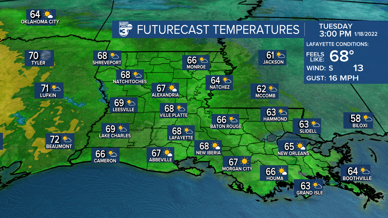
Those southerly winds will hold our temperatures closer to the upper 50s Tuesday night and we'll begin to feel some of that Gulf moisture/dampness during the overnight hours.
Wednesday is looking rather spring-like with temperatures pushing well into the mid-70s. A few scattered passing showers will be possible Wednesday afternoon but a better chance of storms are expected Wednesday night.

Rain chances Wednesday night will be near 80%.
And per the Storm Prediction Center, there could be a couple of isolated severe thunderstorms with our next strong front Wednesday night, with the main concern being the possibility of storms containing damaging winds.
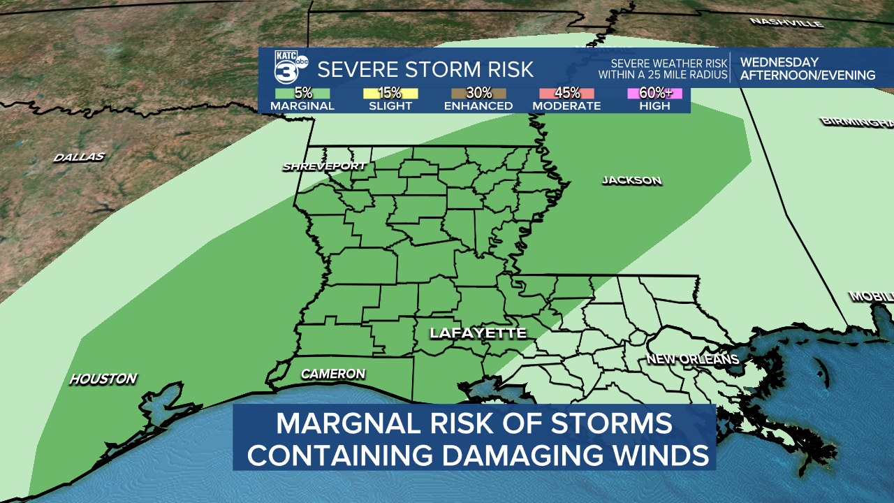
But for now, the severe weather risk is quite low Wednesday night with a "marginal/5%" risk of a few intense storms.
It'll be back to windy and colder conditions into Thursday, but the forecast thereafter is wrought with an unsettled, at at this point a difficult forecast.
Our long-range models are offering very extremely different solutions with the Euro going for a colder drier pattern Thursday, Friday and Saturday, while the GFS is not as cold but with chilly rains possible Thursday, maybe Friday, and then into Saturday.

And if we take the average of the two models there may be some rain, with the possibility of sleet or freezing rain being in the mix at some points.
It should be noted, if our weather leans to drier, we could see overnight lows dropping into the upper 20s!
For now, consult the latest KATC 10 Day Forecast and know that the details later this week into the weekend will likely change...stay tuned!
International Space Station Note:
Set your phone/watch alarms for 6:08 pm this evening. Conditions should be excellent in Acadiana for a direct flyover of the International Space Station.

It will be exactly straight up/overhead at 6:11 pm...enjoy the view as I'll be stuck on-air at that time!
There are currently 13 people on board the station!
------------------------------------------------------------
Stay in touch with us anytime, anywhere.
To reach the newsroom or report a typo/correction, click HERE.
Sign up for newsletters emailed to your inbox. Select from these options: Breaking News, Evening News Headlines, Latest COVID-19 Headlines, Morning News Headlines, Special Offers
