


While Acadiana will experience milder temperatures over the next couple of days, another cold front Thursday will usher in a winter chill again Friday, and the weekend is looking wetter.
In the near term you'll be able to uncover the plants for a couple of nights thanks to moderating southerly winds.
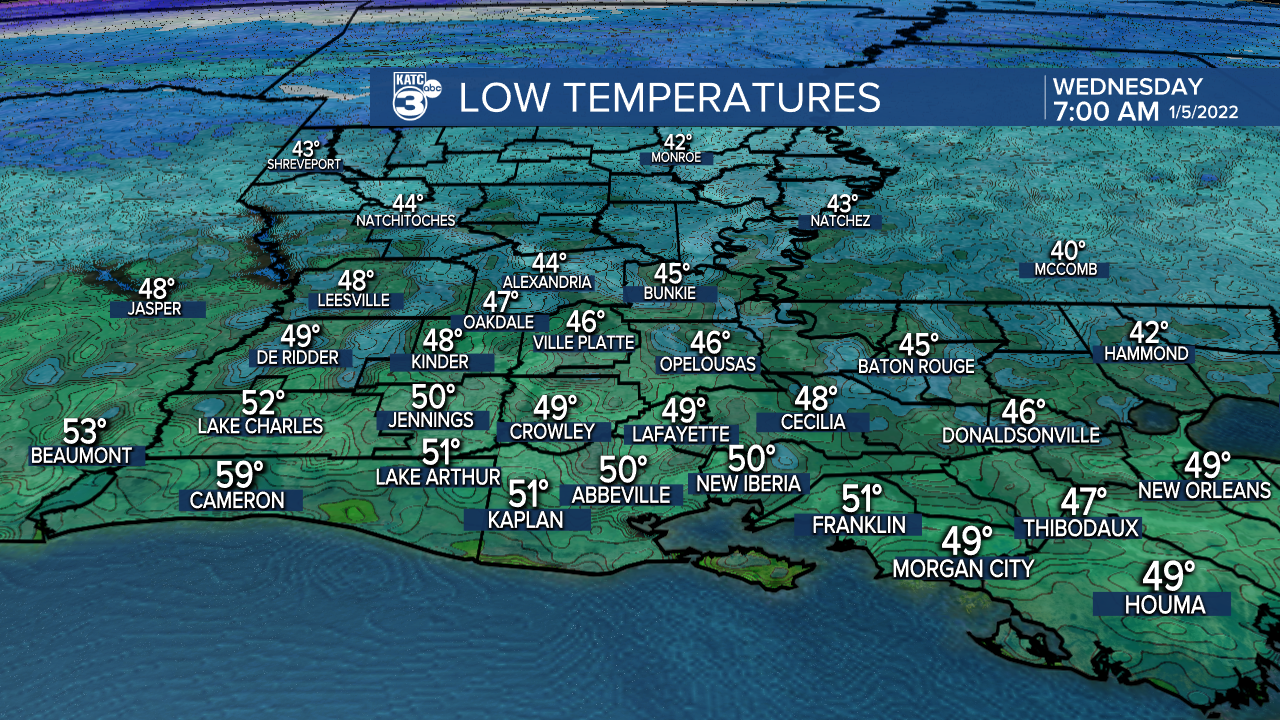
Temperatures overnight will hold in the upper 40s to lower 50s while some clouds advance into the area through daybreak Wednesday.
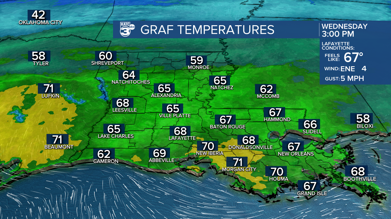
Tomorrow will bring a cloud and sun mix to the area while temperatures warm back into the upper 60s...normal for early January is 62°.
Balmy conditions will continue into Thursday morning with lows in the upper 50s and an early day high near 70°.

But a vigorous cold front will cut through the area midday Thursday bringing our temperatures sharply down for the afternoon with readings pushing the low-mid 40s by sunset!
There might be a few stray showers with the front Thursday, with rain chances no higher than 20-30%.
Temperatures will plummet again Thursday night into Friday morning with readings flirting with a light freeze for Friday morning.

Cool sunshine will finish our week Friday but a much more unsettled pattern is setting up for the weekend.
Scattered showers and a few embedded thunderstorms along with milder temperatures will be a good bet for both Saturday and Sunday with the next front arriving before the weekend is done.
A return to cool and a dry weather is anticipated for early to mid-next week but we could be setting up for a milder and another wet one for the following weekend.
Some changeable weather indeed, bit typical for January.
See the KATC 10 Day Forecast for the latest.
------------------------------------------------------------
Stay in touch with us anytime, anywhere.
To reach the newsroom or report a typo/correction, click HERE.
Sign up for newsletters emailed to your inbox. Select from these options: Breaking News, Evening News Headlines, Latest COVID-19 Headlines, Morning News Headlines, Special Offers
