


Although there were no substantial changes to the forecast track of Tropical Storm Ida 10pm Thursday, a Hurricane Watch was issued for most of Louisiana Coast.
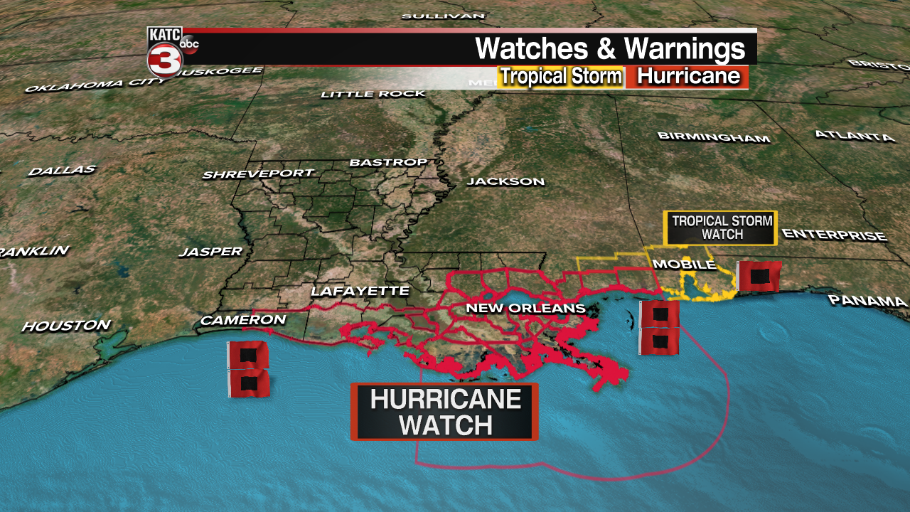
The hurricane watch spans from Eastern Cameron Parish eastward to the Mississippi/Alabama border.
The watch area includes Eastern Cameron, Vermilion, Iberia, St Mary & Lower St Martin Parishes.
The watch also includes the New Orleans metro area, LaPlace, Gonzales, Hammond, Mandeville, and Slidell.
A hurricane watch is issued for areas that are expected to experience hurricane conditions within 48 hours...which would translate to late Saturday night or early Sunday.
In addition, a Storm Surge Watch has been issued for the entire Louisiana Coast for the potential of a large surge near and east of where Ida makes landfall.

The latest National Hurricane Center forecast track as of Thursday night continued to depict a landfall near the Terrebonne/Lafourche parish line by Sunday afternoon or evening.

The average forecast track error 48-72 hours out from a storm landfall is from 65-96 miles respectively, in either direction...which is the size of the cone width.

Lafayette and Acadiana remain in the cone as the 10pm advisory Thursday.
Ida is still expected to make landfall very close to a major hurricane with more changes to the intensity and forecast tracks likely into the weekend.
Stay with KATC, katc.com and social media for the latest concerning this storm.
------------------------------------------------------------
Stay in touch with us anytime, anywhere.
To reach the newsroom or report a typo/correction, click HERE.
Sign up for newsletters emailed to your inbox. Select from these options: Breaking News, Evening News Headlines, Latest COVID-19 Headlines, Morning News Headlines, Special Offers
