


Hurricane Ida will continue to strengthen once in the Gulf as conditions will be ripe for further intensification--> very warm waters coupled with relatively low wind shear.
Latest track has it moving onshore in SE LA as a major category 4 storm on Sunday evening/night with maximum sustained winds of 140mph.
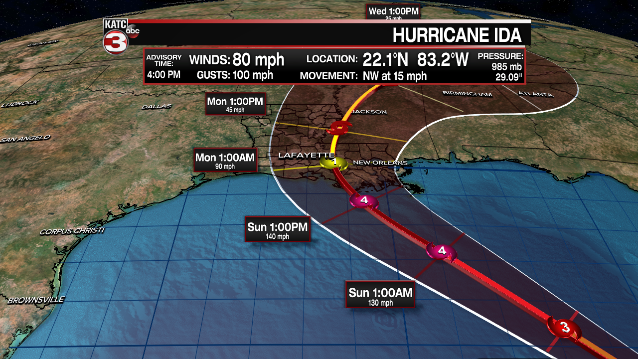
Center line of the track has it moving through St. Mary/Terrebonne parishes.
If the current track were to hold, the greatest impacts from the storm would tend to set-up just east of Acadiana, with the exception being Iberia and St. Mary.
BUT, any subtle wobbles in either direction will make a huge difference in ultimately who will see the worst of it.
Hurricane WARNINGS are now in effect for Cameron all the way over to the Mississippi/Alabama border.
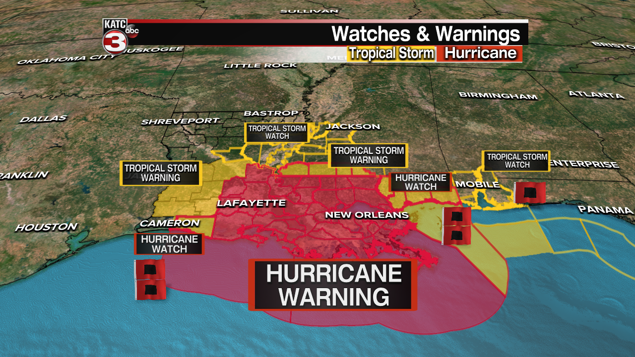
This means hurricane conditions are possible in the next 24-36 hours.
A storm surge WARNING is in effect from Sabine Pass over to the Alabama/Florida border.
All of Acadiana should remain prepared and have all final hurricane plans in place no later than Saturday evening.
Continue to watch the forecast closely and of course, we'll be here to get you through it all.
