


Hurricane Ida continues to look impressive on the visible satellite imagery this afternoon.
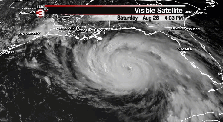
Healthy outflows extending away from the storm in all direction are really allowing the storm to "breathe" as it continues to strengthen.
Furthermore, there is not really anything in the Gulf that will prohibit the storm from intensifying over the next several hours.
Hurricanes love a low wind shear, warm water environment and this is exactly what Ida will have to work with over the next 18-24 hours.
Landfall is still expected to be across portions of southeastern Louisiana as a major category 4 hurricane with maximum sustained winds of 130 mph.
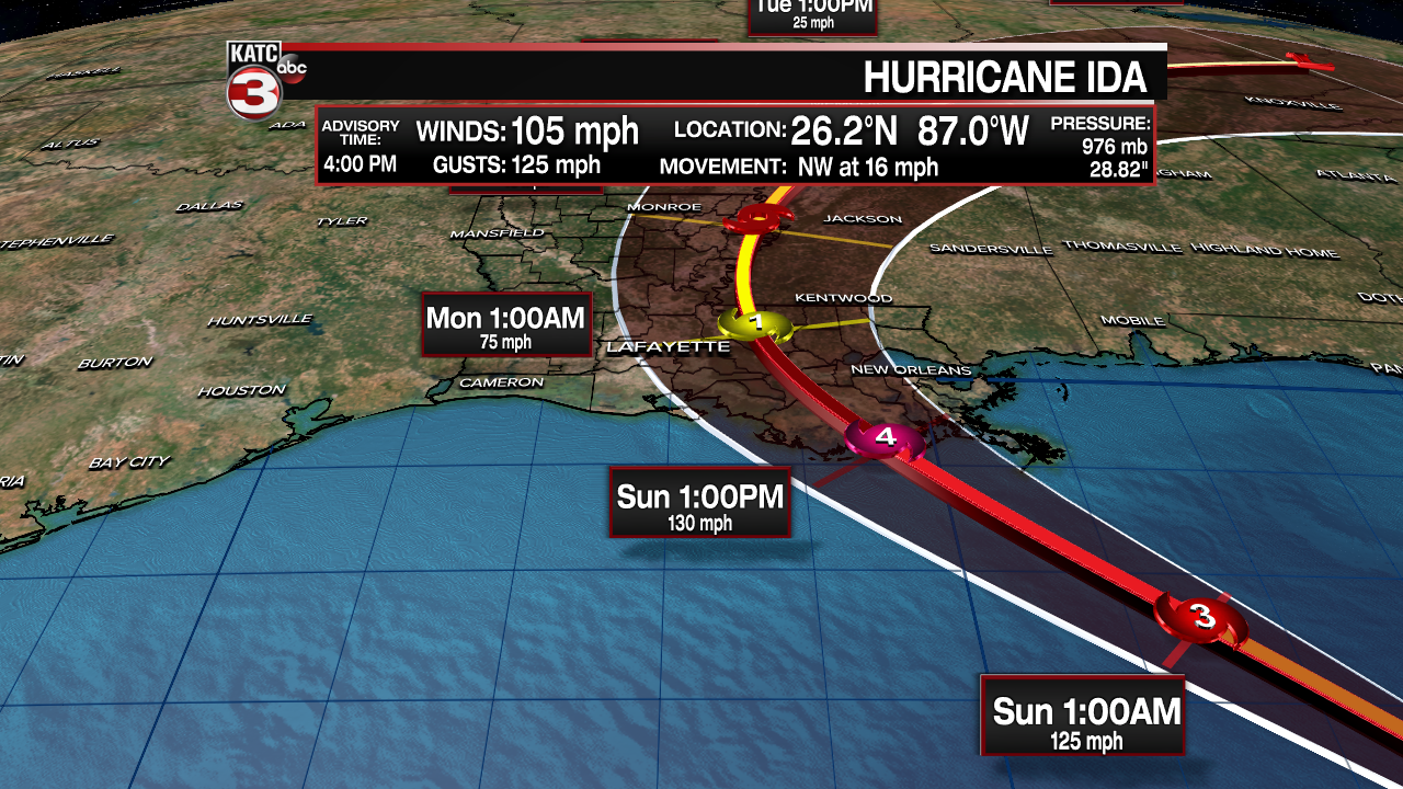
The latest 4pm track from the NHC has shifted slightly eastward.
Timing of landfall is still a little bit up in the air, but for now, we'll say anywhere from midday Sunday into Sunday afternoon.

With the current track, the major and worst impacts from the storm would stay mainly just east of the Acadiana region with obviously deteriorating conditions the father east you go.

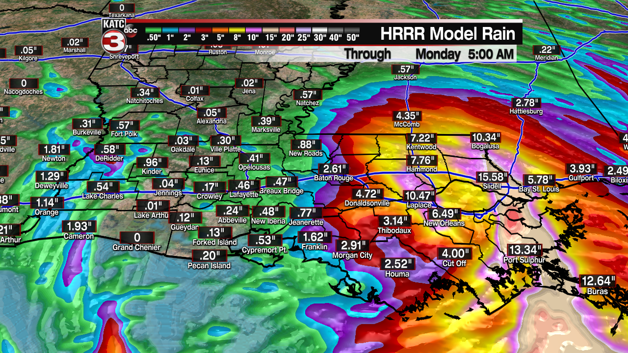
The storm should slow down just a bit once inland which means high rainfall totals are going to become a concern for southeastern Louisiana.
Here is the updated impacts graphic and what we can expect for all of Acadiana:
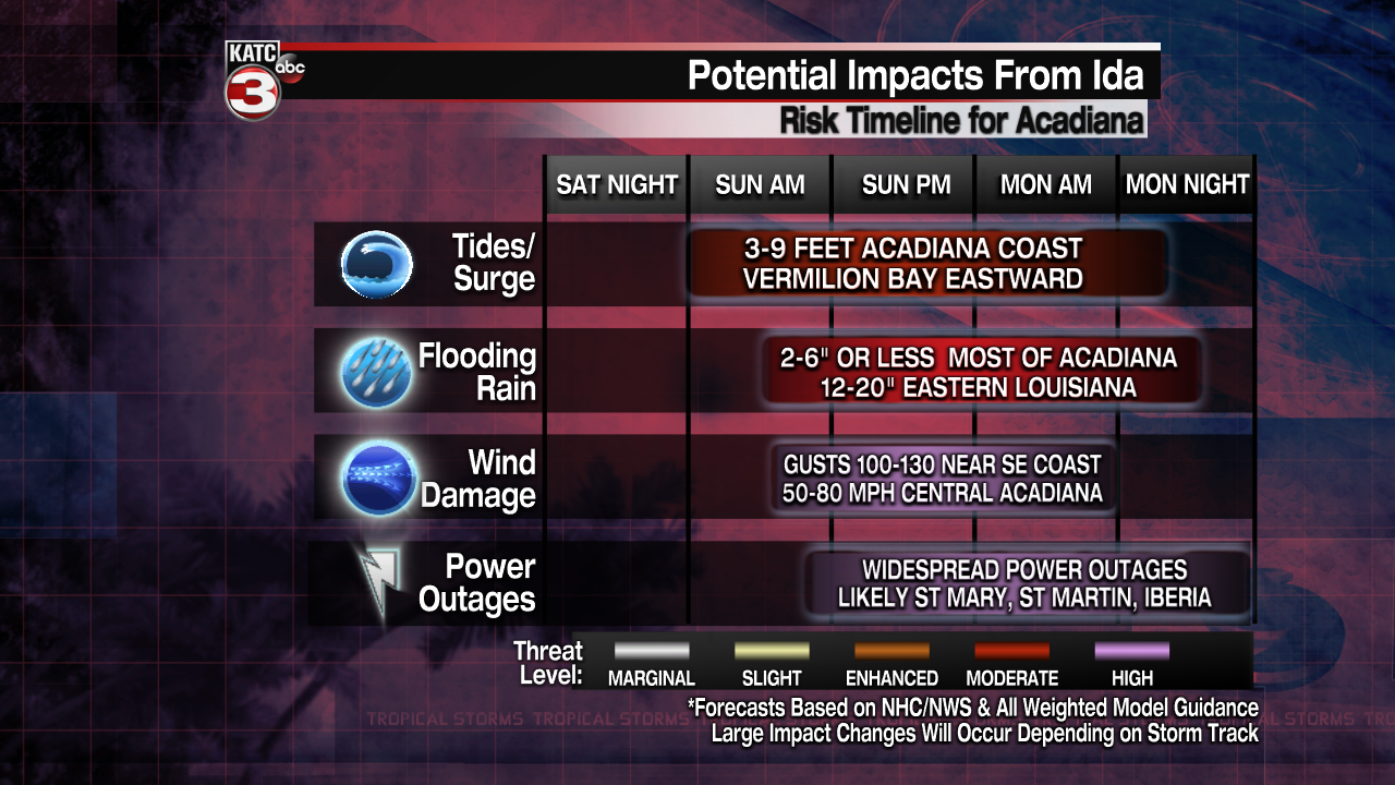
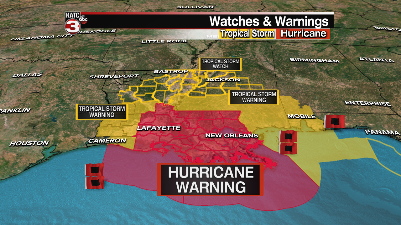
A HURRICANE WARNING remains in effect for most of Acadiana on eastward.
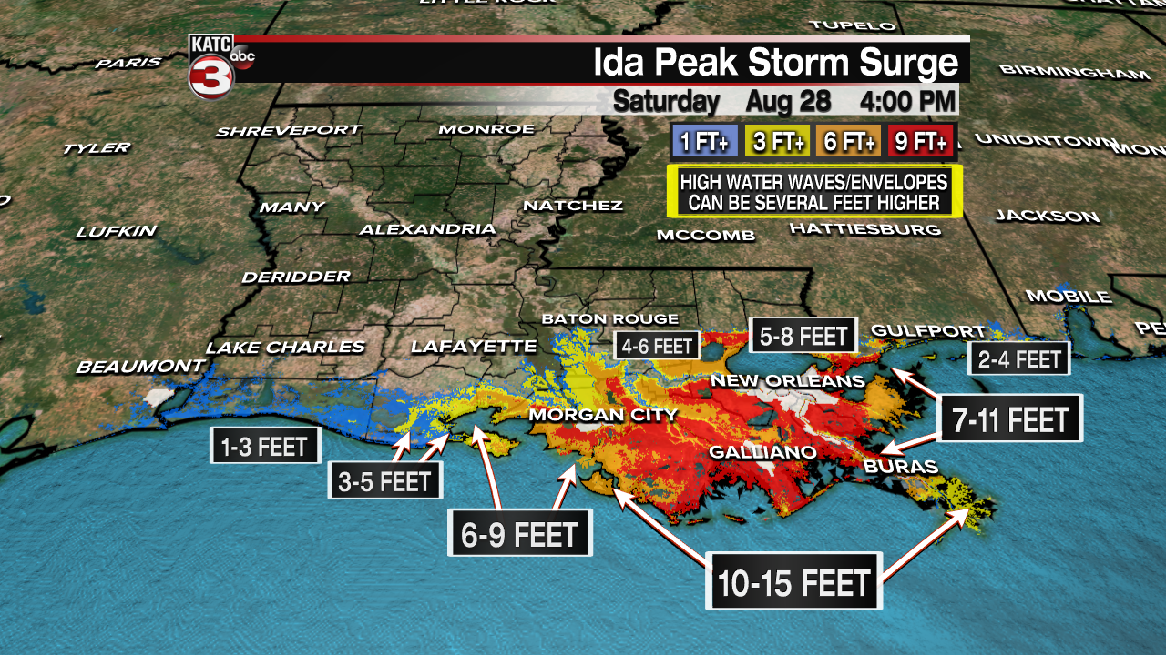
A STORM SURGE WARNING is also in effect. Here are the updated numbers:
Continue to stay with the KATC storm for the very latest information
