


A pretty typical summer looking sky across the region today as temperatures climbed into the lower 90s.
Overnight lows will only drop down into the mid-70s.
A little disturbance will be pushing through late tonight.
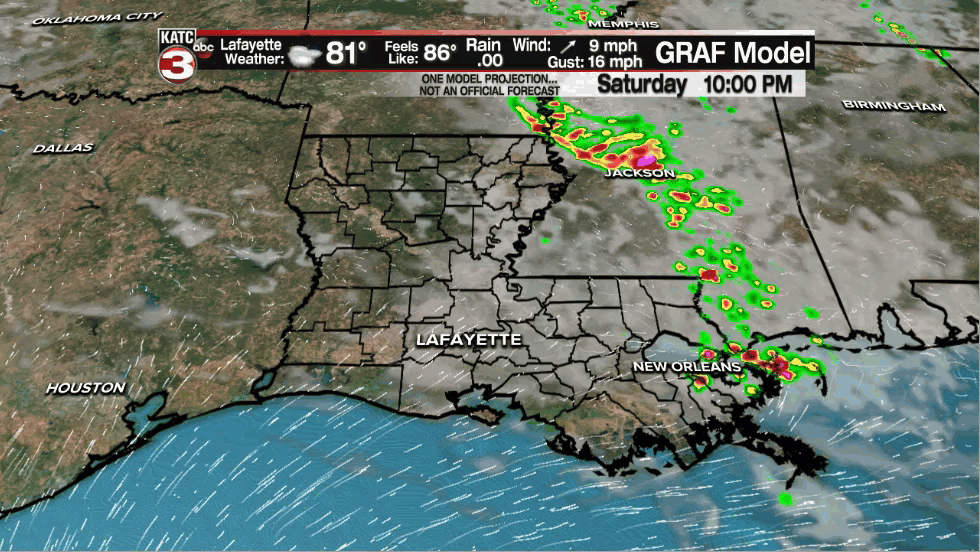
As a result, a few showers could be possible, especially for the eastern half of the viewing area.
The upper-level pattern remains pretty similar with a ridge of high pressure centered off to our west.
Smaller disturbances working on the outer periphery of that high, coupled with daytime heating will likely give us a slightly better chance to see scattered showers and thundershowers by Sunday afternoon.
Rain chances will sit at around 40%.
Afternoon highs will still manage to reach the lower 90s with some rain cooled air lurking around in spots.
Heat index will be in the upper 90s to lower 100s, so be sure to drink plenty of fluids out there.
A pretty typical June weather pattern will be in store through the middle parts of next week with afternoon storm chances at round 30% and high temperatures topping out in the lower 90s.
The forecast then becomes a bit more uncertain late next week and into the Father's Day weekend as it becomes more dependent on what comes about out in the tropics.
Models are still not in great agreement at this point.
For now, I have elevated our rain chances, but that is highly subject to change so stayed tuned...
Have a great rest of the weekend!
In the Tropics:
We continue to watch a decent amount of moisture across Central America and the Eastern Pacific.
With time, this will spill over into the extreme southwestern Gulf of Mexico.
That is the area the National Hurricane Center continues to highlight for potential development in the days ahead.
In fact , they are now giving a 40% chance for a depression to form in this area over the next few days.
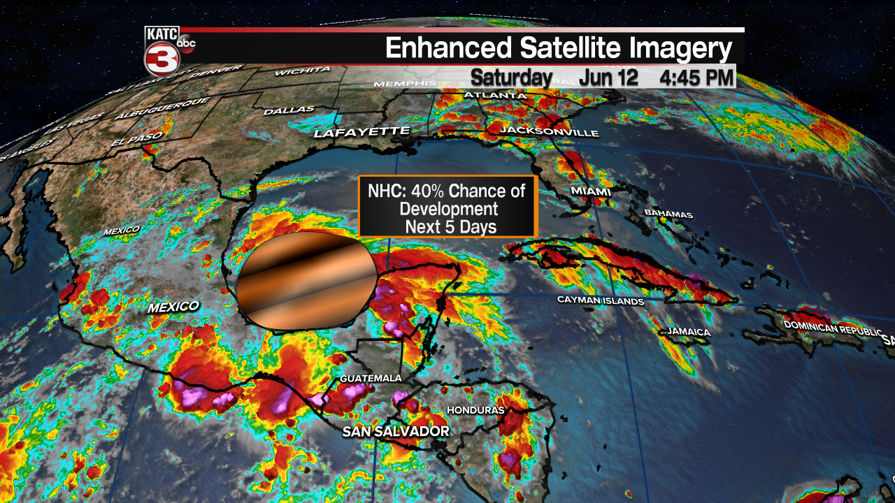
Moisture will continue to pool in the Bay of Campeche through mid-week.
Models agree that whatever tries to develop will stay fairly weak in nature (as is usually the case with most June systems).
However, they disagree on where the bulk of the tropical moisture will surge late next week and into the following weekend.
Euro has been consistent on Texas/Louisiana whereas the GFS has been farther to the east.
Regardless of any slow future developments, wherever this moisture sets up late next week is where a heavy rain potential is likely to set up as well.
We'll continue to watch the trends and keep you updated in the days ahead.
------------------------------------------------------------
Stay in touch with us anytime, anywhere.
To reach the newsroom or report a typo/correction, click HERE.
Sign up for newsletters emailed to your inbox. Select from these options: Breaking News, Evening News Headlines, Latest COVID-19 Headlines, Morning News Headlines, Special Offers
