


Any leftover showers on the radar late this afternoon will come to an end this evening.
Warm and muggy night ahead with temperatures only dropping into the middle and upper 70s.
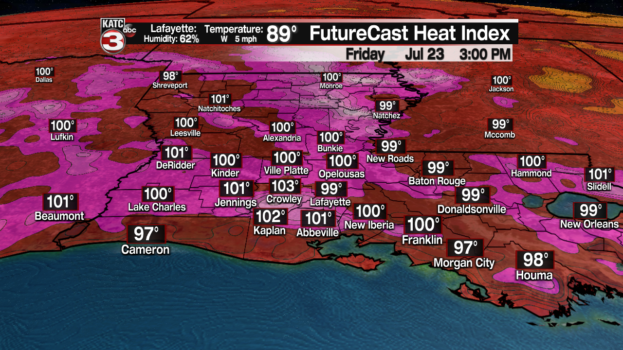
Pretty typical July weather out there on our Friday.

Expect a sun and cloud mix with afternoon highs climbing into the lower 90s.
That heat index will be sitting in the upper 90s to lower 100s.
A few isolated showers and storms will be possible through the afternoon, mainly along and south of the interstate.
Upper-level high pressure will continue to flex its muscle heading into the weekend.

As a result, it will be more about the heat as temperatures climb into the lower and even middle 90s.
There will still be the risk of a couple isolated afternoon storms, but the overall coverage will be lower.
Looking like late July as we head into next week with hot and humid conditions and a few afternoon storms.
Nothing too out of the ordinary as we start to eye down August...
In the tropics:
One little spot that the hurricane center is keeping an eye on.
It is actually currently over Georgia and is expected to eventually emerge into the western Atlantic.

Once that occurs, they are giving it a low, 30% chance to develop.
This feature does not appear like it will do much per the latest model guidance, but we'll continue to monitor it.
The rest of the tropical Atlantic is quiet at this time!
