


High winds along with a substantial severe weather threat is in the forecast for Acadiana Tuesday with storms arriving by the late afternoon into the evening.

In advance of what appears to be the most dynamic system for Acadiana this winter, a High Wind Warning has been issued for the entire area Tuesday afternoon and evening as a well-organized storm system is expected to rip through the area.
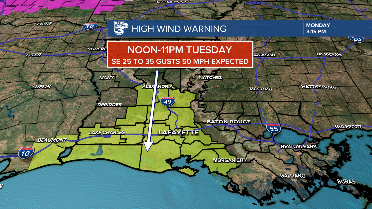
Per the National Weather Service (NWS), the high wind warning will be for wind gusts that will likely reach 40-50 mph Tuesday afternoon ahead and with the storms...gusts could approach 70 mph or more in the more organized intense storms.

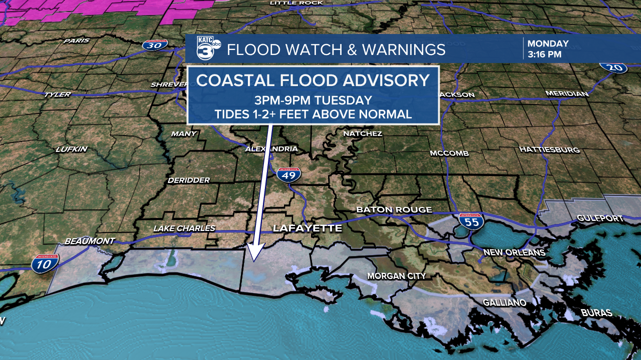
The NWS also has Coastal Flood advisories in place Tuesday for tides increasing 1-2 feet or more which will produce some minor inundations especially for areas such as Intracoastal City, the local ports and for Cypremort Point.
The Storm Prediction Center (SPC) also has Acadiana hatched in for a slight to enhanced risk (levels 2/3 out of 5) for severe storms.
While the primary severe weather threat will be damaging winds, a few isolated tornadoes might be possible, especially along the coastal parishes where dynamics could be more robust.

Per usual, the stabilizing factor of the marine layer may hamper some storms from becoming severe, but the dynamics with this system will be in place to perhaps overcome any storm inhibiting factors.

With this in mind, expect one or more tornado watches for Acadiana Tuesday afternoon and into the evening hours.
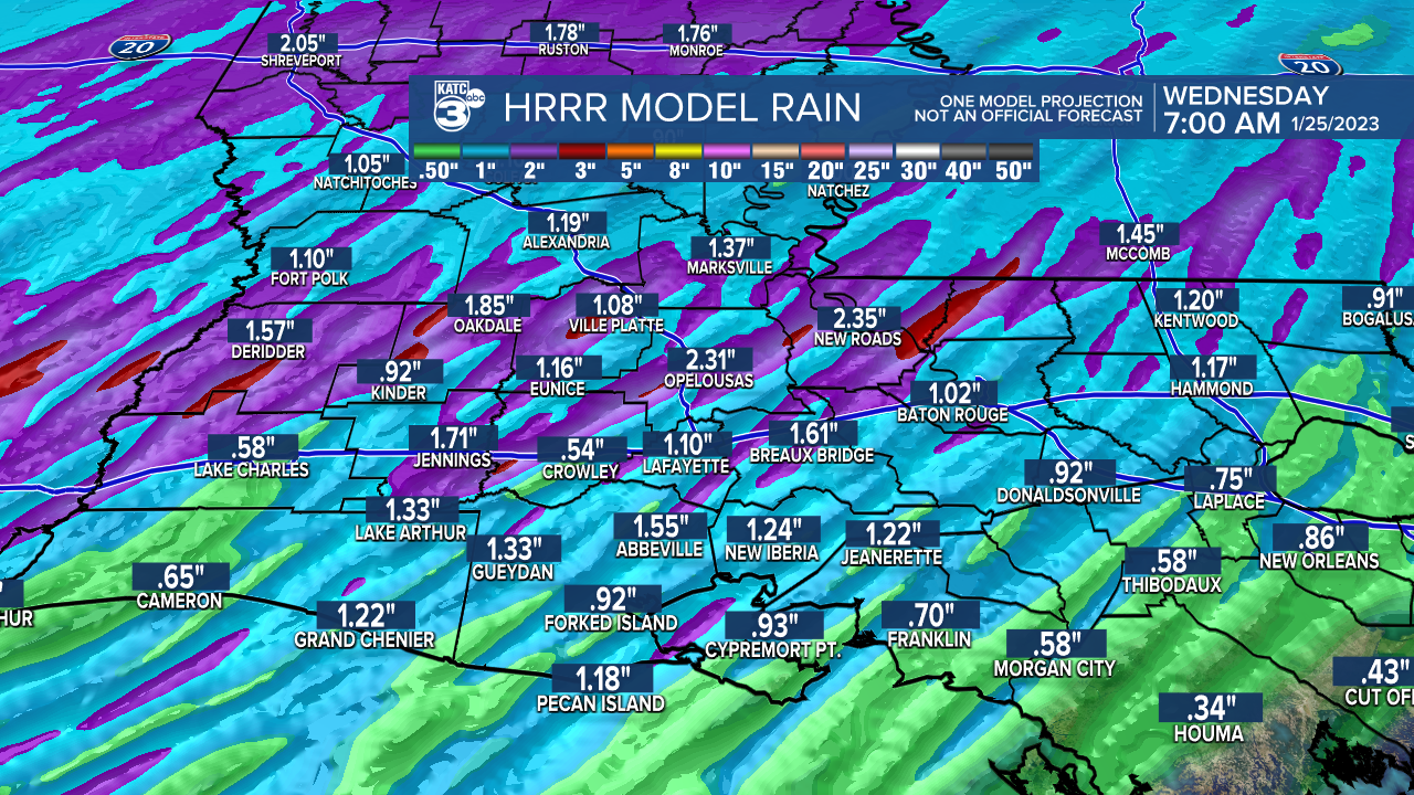
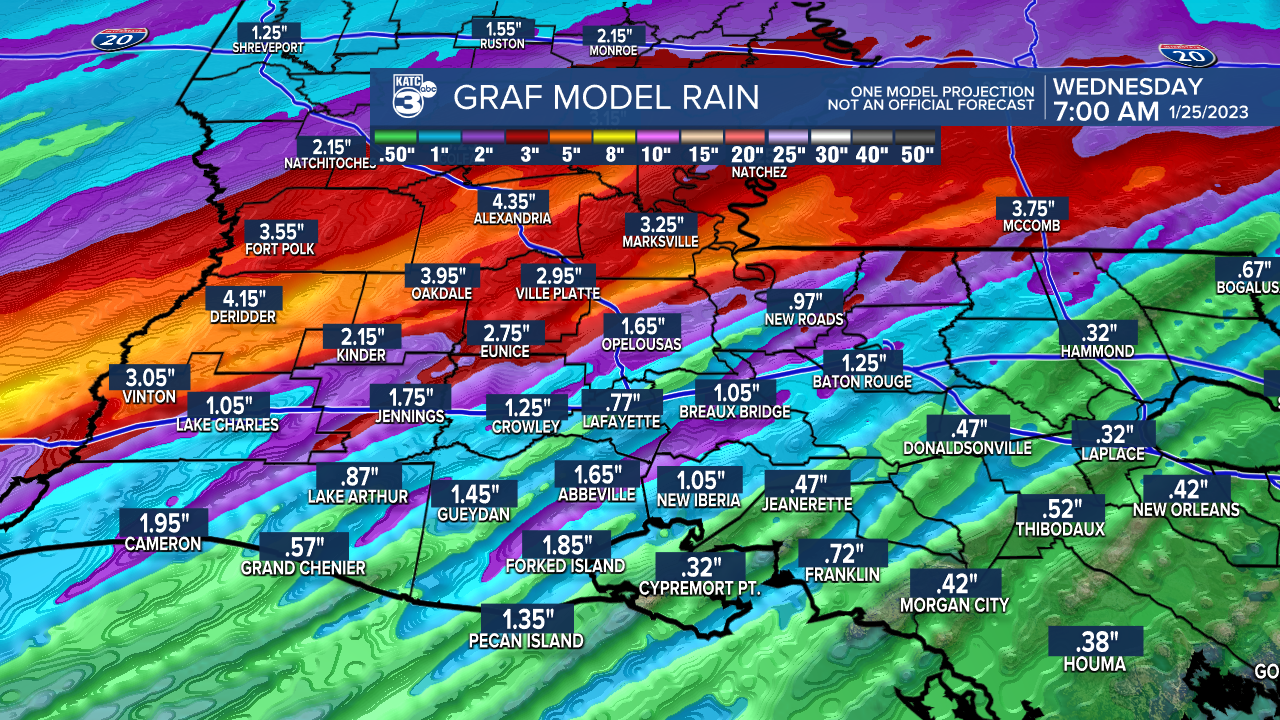
Fortunately this storm system will be moving at a fairly quick pace, but rainfall amounts of 1-3" will be likely with isolated areas possibly picking up to 3-5"...most of which will come in a one to two hour window, so some localized street flooding may be possible.
The storms will end from east to west clearing most of the area by 10-11pm.
Thereafter, it will be a fair and "coldish" weather pattern for the rest of the week.
Next chance of showers is expected to arrive by Sunday.
See the KATC 10 day forecast for the latest and stay with KATC, katc.com and our social media accounts for the latest on the weather threat Tuesday.
------------------------------------------------------------
Stay in touch with us anytime, anywhere.
To reach the newsroom or report a typo/correction, click HERE.
Sign up for newsletters emailed to your inbox. Select from these options: Breaking News, Evening News Headlines, Latest COVID-19 Headlines, Morning News Headlines, Special Offers
