


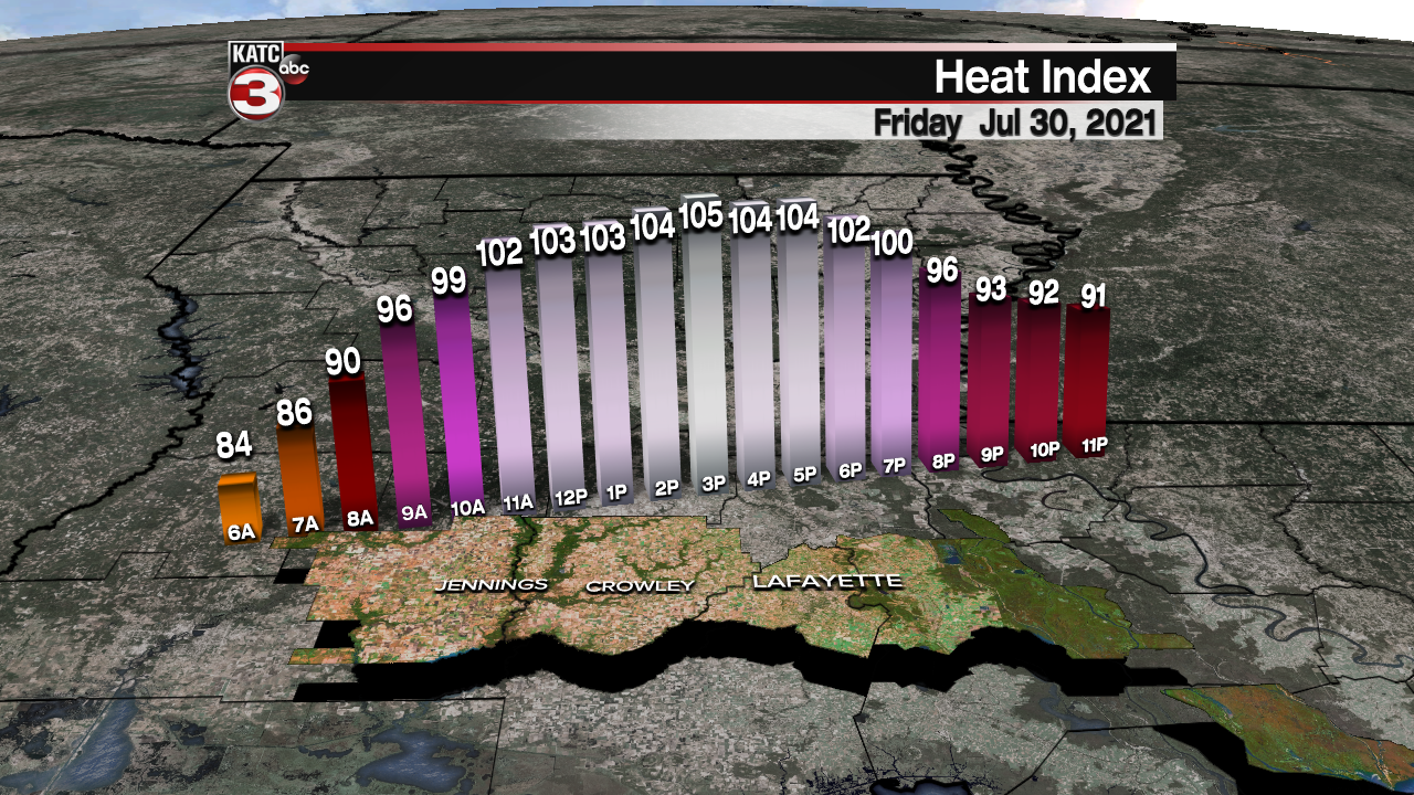
High summer heat will remain in Acadiana's forecast for Friday into the weekend with daytime highs persisting in the mid-90s while heat indices will push near or above 110°.
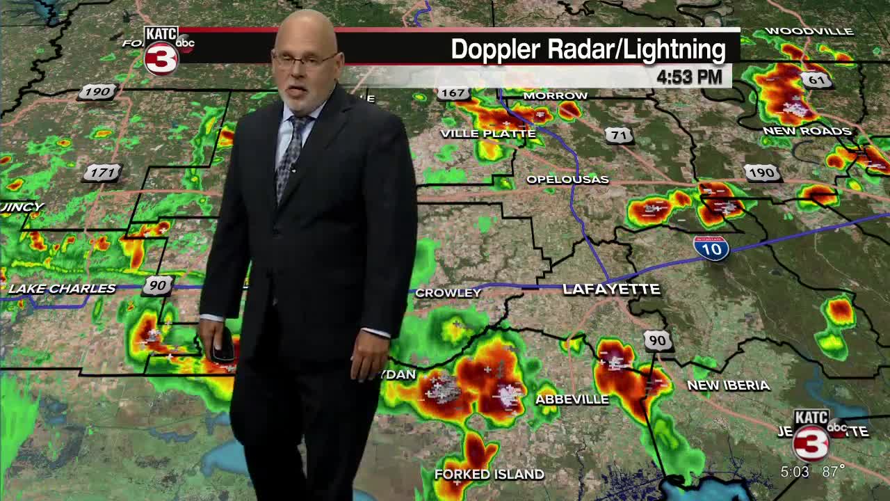
In the near term, look for warm and quite humid conditions Thursday evening after a few early evening showers and storms.
Temperatures overnight may barely get below 80° with heat indices persisting above 90° well past midnight.
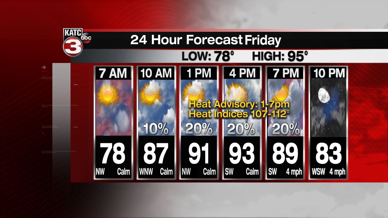
Friday will bring a hot sun and cloud mix with temperatures again pushing into the mid-90s...and with dew points in the mid-upper 70s we can expect heat indices to reach 107-112°.

A Heat Advisory is in effect for all of Acadiana Friday from 1-7 pm.
Just a few isolated cooling afternoon and/or early evening storms will be possible Friday with rain chances appearing to be closer to the 20% range.

Much the same is expected for Saturday with the risk of a shower or thunderstorm more likely coming toward the evening hours as instability begins to build into the region.

The additional instability will leave our area with a better chance of daytime storms Sunday (near 40%).
Highs Sunday will still manage to reach close to the mid-90s again.
A more significant change arrives early next week in the form of a slowing frontal boundary and upper level trough of low pressure.

This will likely leave us with a good chance of scattered showers and thunderstorms for Monday and Tuesday and at least take the edge off of the heat.
The frontal system is expected to become nearly stationary across our area or perhaps just offshore, but it will not be far enough away to significantly feel better, plus the front will waffle across the region for a few days keeping some elevated rain chances with us toward the end of next week.
At least our daytime highs for a few days next week will be limited to the mid-upper 80s.
See the KATC 10 Day Forecast for the latest.
Meanwhile, it remains quiet in the tropics with no major trouble spots expected through next week.
------------------------------------------------------------
Stay in touch with us anytime, anywhere.
To reach the newsroom or report a typo/correction, click HERE.
Sign up for newsletters emailed to your inbox. Select from these options: Breaking News, Evening News Headlines, Latest COVID-19 Headlines, Morning News Headlines, Special Offers
