


Most of Acadiana has seen a pretty decent soaking from Nicholas this morning and through the course of the early afternoon hours.

Keep in mind that doppler estimates tend to under do it in tropical systems.
Dry air has been trying to infiltrate into the system from the west which has really helped to erode some of the moisture,

Although some areas are catching a break this afternoon, models are suggesting that we see a flare-up of heavy rain bands this evening.

The rain will ease into the overnight hours, but convection near the center could flare-up during the early morning hours of Wednesday.
The center 'swirl' of Nicholas will be moving across the area tomorrow.
Although the system will essentially just be a remnant low by that point, showers and a few storms will remain possible... although more scattered in nature.
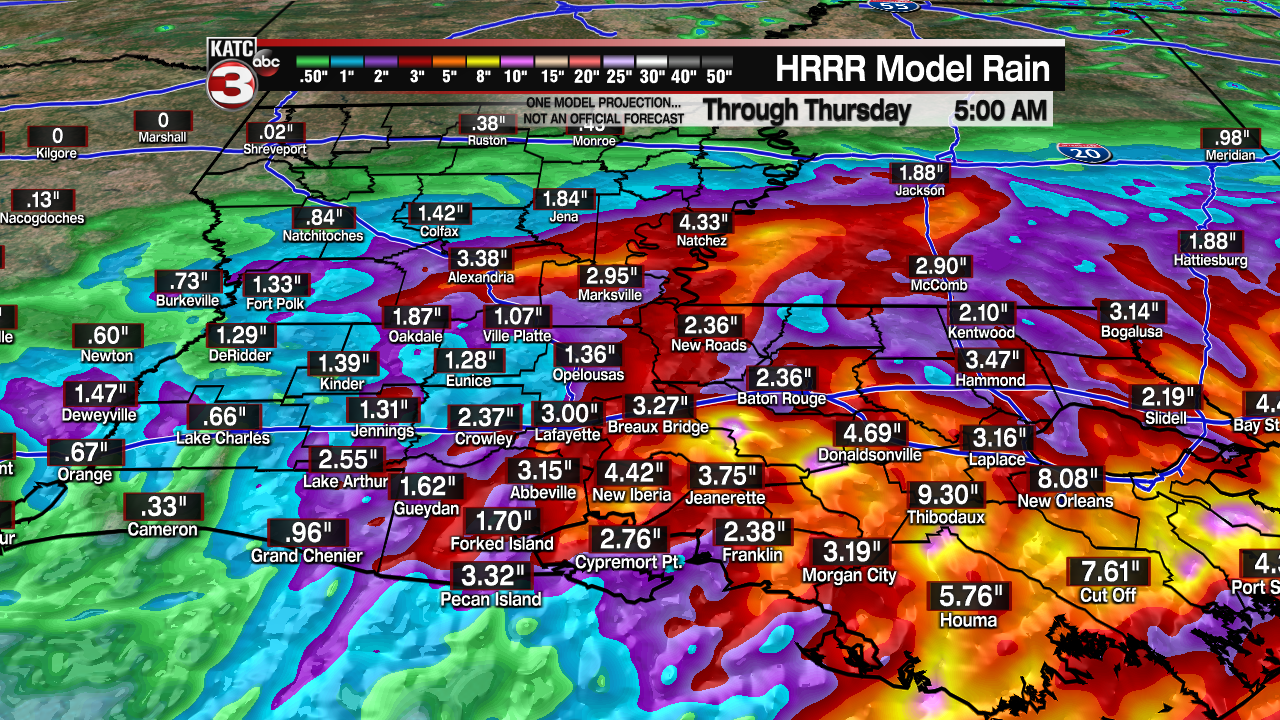
An additional 3-6" of rain through Thursday AM will be possible.
Slightly drier air may try and work in by Thursday behind the feature which may help to lower our rain chances.
Rain chances will settle into the 60% range heading into the weekend as a good amount of Gulf moisture remains in place.
Looks like a return to a more routine mid-September weather pattern into next week.
We are monitoring two other areas in the Atlantic, but there are no pending threats to the Gulf at this time.
