


Acadiana's early summer heat and humidity will continue into the weekend with minimal rain chances through Saturday, but scattered storms should return by Sunday.
In the near term, it appears that our moist grounds are beginning to dry out which has helped lower our dew points this week, and thereby allowing for temperatures at night to get closer to the mid-70s versus the upper 70s.

So expect fair skies with temperatures bottoming out near 74-75° for Friday morning.
Friday should bring another sun and cloud mix with sunshine dominating most of the day. Look for highs Friday to top out near 90-91°.

Rain chances Friday will be near 5% or less.
Heat index values will stay in the 95-100° Friday afternoon, with much the same anticipated into the weekend.
Saturday may bring even hotter conditions as drier air aloft which could allow for more surface heating...temperatures Saturday may max out closer to 92-93°!
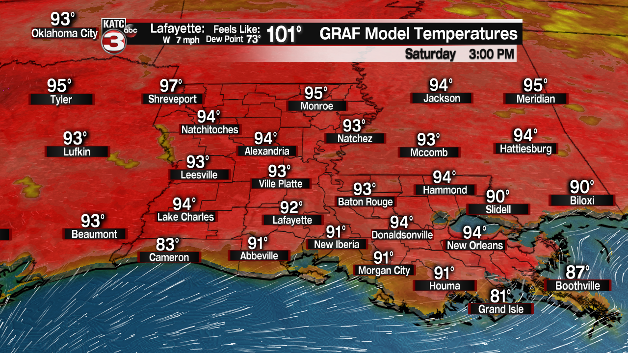
Rain chances Saturday will remain low or non-existent, near 10% for the possibility of an early evening storm that may drop in from the northeast late in the day.

More heat is anticipated Sunday, but an upper level trough/weakness in the atmosphere is expected to drop into the region from the northeast which should translate to at least a 40% chance of scattered storms. Some storms may develop as early as Saturday night.
This general atmospheric weakness should persist at least into mid-next week so expect the chance of scattered afternoon storms through much of the week.
Daytime highs will stay in the lower 90s through mid-next week...thereafter, we might see more clouds and some slight daytime cooling, possibly related to the tropics.
And speaking of the tropics, while there are no suspect areas in the tropical Atlantic at this time, deep tropical moisture continues to pool near Central America, Mexico, the Eastern Pacific, and into the Bay of Campeche.

Models continue to indicate that this moisture may move slowly northwestward with some development possible in the Southern/Western Gulf of Mexico in about a week's time.
Eventually Texas and/or Louisiana may have to reckon with this moisture in the 8-12 day time-frame, but it what form, if any, remains to be determined.
For now our 10 Day Forecast does recognize the possibility of more clouds and perhaps some of that tropical moisture impacting our area toward the end for the forecast period, but as we all know, that part of the forecast is always subject to change!
------------------------------------------------------------
Stay in touch with us anytime, anywhere.
To reach the newsroom or report a typo/correction, click HERE.
Sign up for newsletters emailed to your inbox. Select from these options: Breaking News, Evening News Headlines, Latest COVID-19 Headlines, Morning News Headlines, Special Offers
