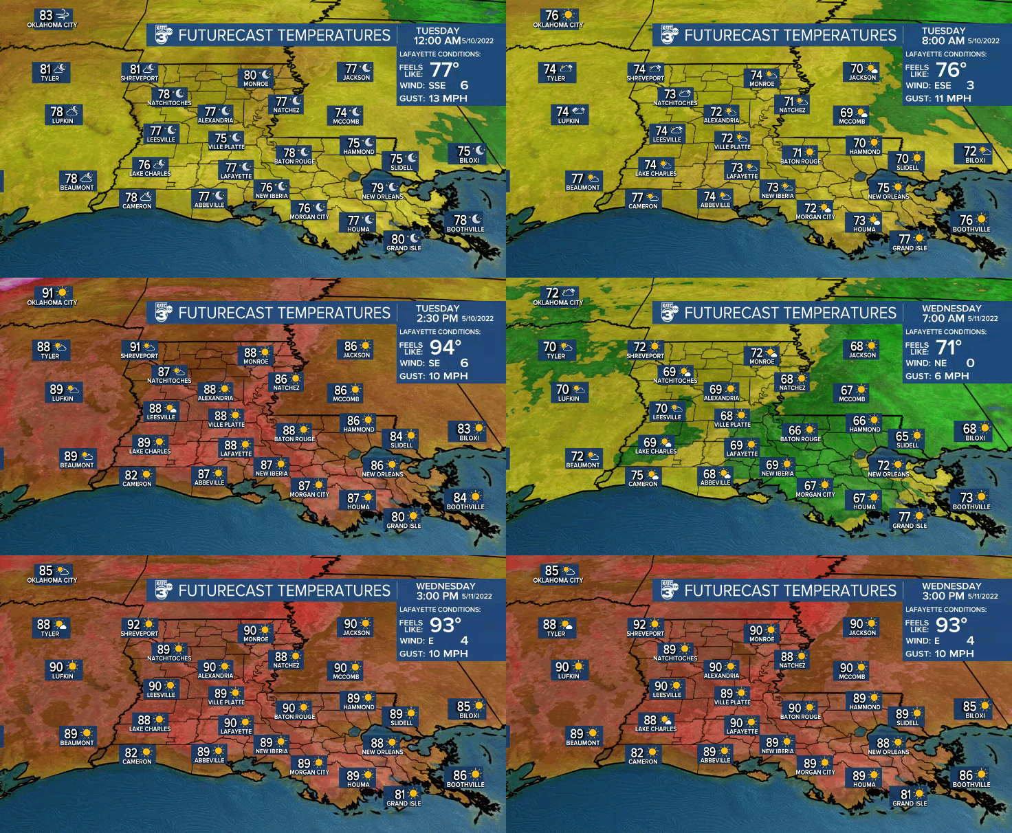
The hotter-than normal pattern for Acadiana will amplify through mid-week with daytime highs pushing toward the mid-90s by Thursday.
A ridge of high pressure will build in from the northeast over the next couple of days insuring mostly sunny and seasonably hot conditions.
By Thursday with orientation of the surface high and support aloft will allow our surface winds to turn toward the west and then northwest, which almost always translates to hotter temperatures this time of year, but at least, with lower dew points.

In the near-term, expect another warm evening Monday night with lows in the lower 70s and some clouds returning by morning.

Clouds will burn-off quickly Tuesday with mostly sunny skies allowing temperatures to hit 90° again.
Little change in the pattern is expected Wednesday, but with lighter winds and in the absence of a sea breeze, our temperatures will push toward 91-93°.
Fortunately our dew points will begin to drop, but nonetheless the heat index will be nearing the 100° mark.
By Thursday, with drier west to northwest winds, we'll have an excellent chance of beating the record of 93° set back 100 years ago, in 1922.

A few widely scattered storms may form to our east late Thursday afternoon with a few cells possible squirting westward toward Acadiana, thus rain chances at 20%.
Although our daytimes will be get hotter this week, at least with lower dew points we should see morning lows closer to the upper 60s.
Friday into the weekend sees a little bit of a break down of the upper ridge aloft which should translate to scattered primarily afternoon and early evening shower and thunderstorm activity.
At least with the chance of storms, our highs will be closer to the upper 80s this weekend.
Another ridge of high pressure looks to build back into the region next week, looking to bring more days with highs in the lower to possibly mid-90s.
See the KATC 10 Day Forecast for the latest.
Climate Notes: Monday made three days in a row of 90° heat in Lafayette with the promise of 3-4 more days of the same or hotter this week, and it's looking like another 4-5 days of the same next week.
Very different than last year when record smashing rains May into June kept us from reaching 90° until June 9th.

Overall, our springs are indeed getting warmer...by 2.1° since 1970, while the average number of warmer than mormal days in the spring during the same time-frame is plus 14.

These numbers are in lock-step with a much warmer Gulf of Mexico as compared with the 20th century average.
------------------------------------------------------------
Stay in touch with us anytime, anywhere.
To reach the newsroom or report a typo/correction, click HERE.
Sign up for newsletters emailed to your inbox. Select from these options: Breaking News, Evening News Headlines, Latest COVID-19 Headlines, Morning News Headlines, Special Offers


