Once again a hard freeze warning is in effect for Acadiana through Sunday morning, and with clear skies accompanied by light winds, a moderate to heavy frost is expected by morning.

So we should have a South Louisiana version of a White Christmas given you're up early enough before the frost melts...which should be around mid-morning.

Temperatures overnight through daybreak Sunday should be similar to what we saw Saturday morning...mostly in the lower 20s.

Plenty of sun is expected for Christmas day with our temperatures getting above freezing by mid-morning and rising into the mid-40s for the afternoon.

After the brief thaw, we'll go below freezing again Sunday night/Monday morning with lows generally closer to the mid-20s...and another healthy frost will be possible.

Milder temperatures are anticipated into next week with temperatures pushing toward the 50s Monday afternoon with a light freeze possible into Monday night/Tuesday morning.

After Tuesday morning we'll be done with freezing temperatures for at least a week.

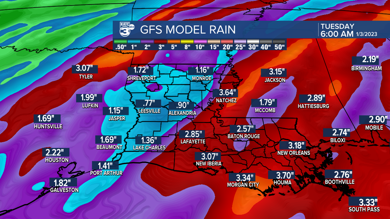
The area will likely see temperatures getting back into the 70s later next week, but it appears we'll be entering a more active and potentially wet weather pattern Friday into the following week with several rounds of some locally heavy rains and storms possible.

Although a little too far for our long range models, they are favoring the possibility of 3-6" between Friday's weather system and the one that may follow a few days later.

For now, it's too early to tell whether there will be any severe weather threats when the weather gets busy again.
See the KATC 10 Day Forecast for the latest.
------------------------------------------------------------
Stay in touch with us anytime, anywhere.
To reach the newsroom or report a typo/correction, click HERE.
Sign up for newsletters emailed to your inbox. Select from these options: Breaking News, Evening News Headlines, Latest COVID-19 Headlines, Morning News Headlines, Special Offers


