


Beautiful weather will continue for Acadiana Thursday with breezy conditions and a gradual warming expected into the weekend.
There may however, be a few scattered showers and storms in the area by Sunday.
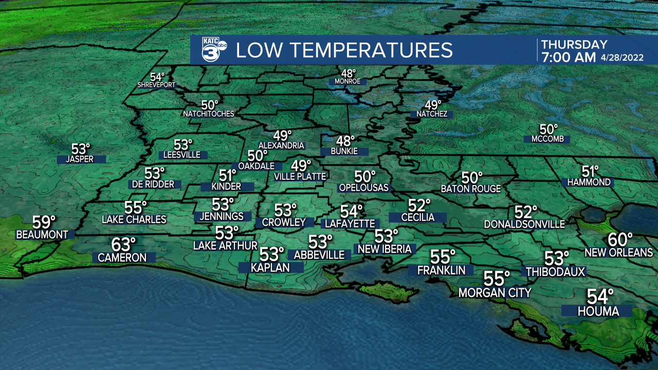
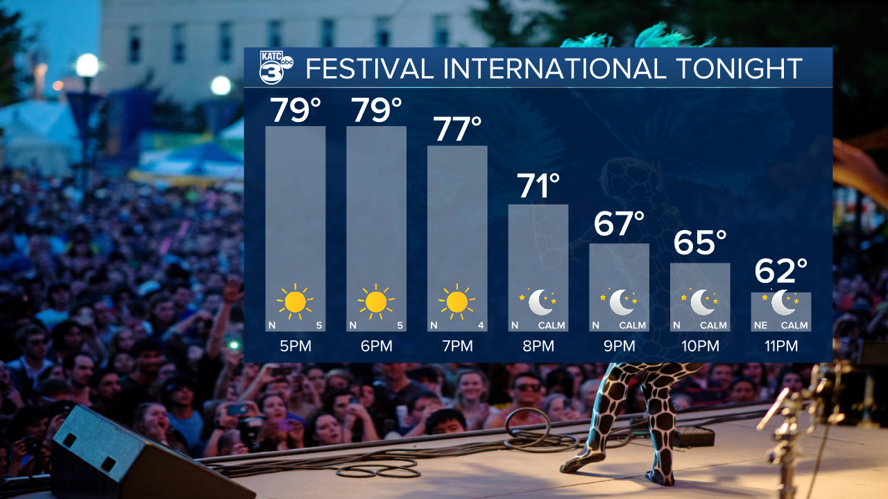
In the near term, expect a lovely evening for the start of Festival International de Louisane, with another cool night/morning as temperatures drop into the low-mid 50s again by Thursday morning.
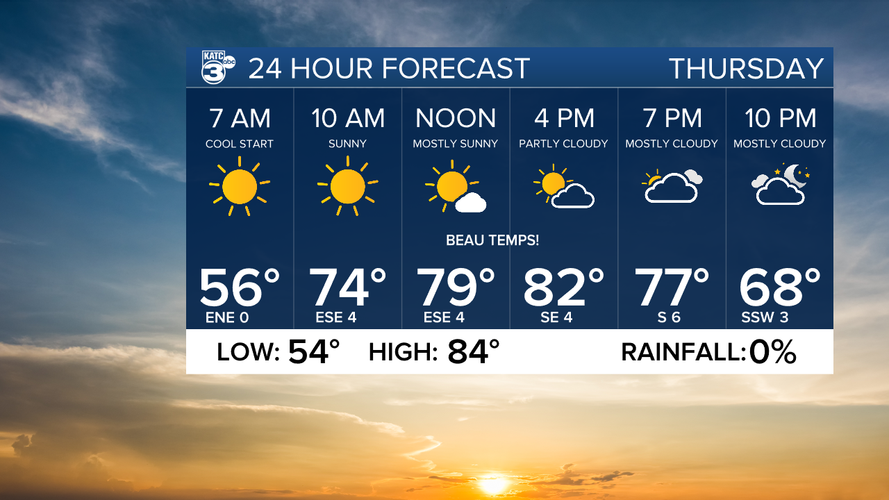
Thursday will bring a continuation of mostly sunny skies and comfortable humidity with afternoon temperatures warming into the mid-80s.
Friday and Saturday will become breezy with a sun and cloud mix expected along with daytime highs solidly in the mid-80s.

A few weak disturbances aloft and higher atmospheric moisture content may lead to an isolated shower Saturday, but rain chances look to be no higher than 10%.

By Sunday, there looks to be more atmospheric instability in the region with a chance (currently at 40%) of a few scattered showers and possibly a thunderstorm.

And like yesterday's models, the Euro is more bullish on rain chances versus the GFS Sunday.
Sunday shouldn't be a wash out, but there could be a few "shower disruptions" for Festival into Sunday afternoon.
The extended outlook into next week, is looking quite warm, quite humid, with a more summer-like feel in the air as temperatures start consistently pushing the upper 80s.
There are no cold fronts in the most recent KATC 10 Day Forecast, but there could be a little cooling arriving in the 11-14 day frame with any luck!
------------------------------------------------------------
Stay in touch with us anytime, anywhere.
To reach the newsroom or report a typo/correction, click HERE.
Sign up for newsletters emailed to your inbox. Select from these options: Breaking News, Evening News Headlines, Latest COVID-19 Headlines, Morning News Headlines, Special Offers
