


Well, it certainly did not feel like mid-November today as temperatures topped out in the upper 70s to lower 80s!
However, a cold front will sweep through tonight and that will get us back closer to November standards.

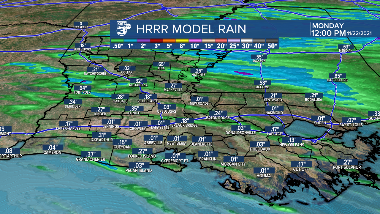
Expect a few showers, maybe a rumble of thunder or two as the boundary pushes through tonight.
Timing looks to be between midnight-4am (NW->SE movement).
Not much rain is expected.
In fact, 0.2" or less looks like about it.
Cooler and breezy conditions will filter in behind the front.
We'll likely see lingering cloud cover early Monday morning, but skies will gradually clear throughout the day.
Temperatures will only top out in the upper 60s Monday afternoon.
Winds will pick up out of the north at around 10-18mph with gusts in the 20-25mph range.

Turning downright chilly Monday night into Tuesday morning as overnight lows drop into the upper 30s to lower 40s.

Plenty of sunshine to go around on Tuesday as temperatures remain cool in the 60s.
Clouds will start to build on Wednesday as temperatures moderate and top out in the 70s by Wednesday afternoon.
Another cold front and scattered showers will approach the area heading into Thanksgiving.
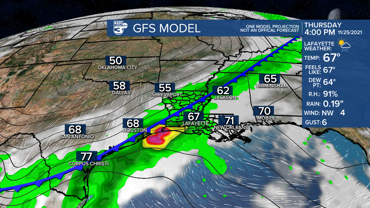
Timing of the rain for now looks to be during the second half of the day and going into Thanksgiving night.
We'll continue to iron out those specific details over the next couple of days, so stay tuned.
The weather pattern will then turn much cooler by the end of the week and into the weekend.
We could be talking morning lows in the 40s (some upper 30s) and afternoon highs in the lower to middle 60s.
Have a great week, y'all!
