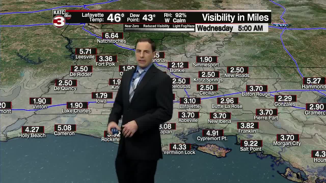


Tonight Acadiana will see more seasonable temperatures as lows hold in the low to mid 40s but we will have areas of patchy to dense fog developing by Wednesday morning dropping visibility to below one mile in many locations.
Once the fog and low clouds mix out it will be another fantastic afternoon with mostly sunny skies and temperatures warming up into the upper 60s to near 70.
Clouds thicken on Thursday but it will still be warm with highs in the lower 70s.
Our next chance for a few showers will be Friday morning as a fast moving shortwave swings across Acadiana but we will only see about a tenth to a quarter of an inch of rain and most of the showers should be done by lunchtime.
We will cool slightly behind this system on Saturday as high clouds linger over the region and with a northerly breeze highs will dip into the mid 60s.
Sunshine returns on Sunday pushing highs back above normal into the low to mid 70s.
We stay warm on Monday with temperatures climbing into the mid to upper 70s.
Late Monday night into Tuesday will be our next chance for everyone to see scattered showers as a cool front slides into Southeast.
Light showers will continue through much of Tuesday before the rains end Tuesday evening but again rainfall totals will be on the light side around a quarter to a half inch.
Once the rains move off to the east, breezy and cooler conditions will dive into Acadiana.
Highs next Wednesday will only top out in the upper 50s and overnight lows Thursday morning will drop into the mid to upper 30s.
