


A stalled frontal boundary in the Gulf waters will start to lift back northward overnight tonight into tomorrow morning.
That front could help to generate at least a few light showers out there across the area through the early Sunday morning time frame.
Nothing overly heavy.. mainly just sprinkles/misty conditions that could be enough to wet the pavement.
Otherwise, the main issue going into tomorrow morning will be the potential for some patchy-dense fog.
Latest model guidance going for visibility to be reduced to less than a quarter of a mile across most of Acadiana.
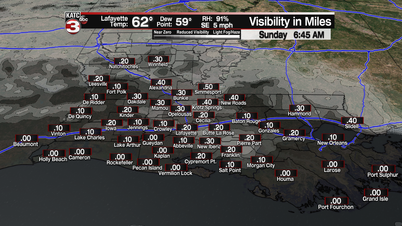
It could be closer to zero in spots, especially along the coastal parishes.
Temperatures will be holding steady in the upper 50s to lower 60s tomorrow morning.
Most of the fog will lift off by tomorrow afternoon with the thickest fog retreating back down to the immediate coastline.

Overall, we will have a lower cloud deck in place tomorrow.
Mostly cloudy skies expected throughout Sunday afternoon as highs push the lower 70s with southerly winds back in place.

Few peaks of late afternoon sun will be possible, but we can't necessarily bank on it.
We will be even milder to start Monday as temperatures struggle to fall back into the mid-60s with some patchy fog returning again.
Breezy and mild for Monday afternoon as winds could gust as highs as 25-30 mph ahead of a "cold" front.
Temperatures will be climbing into the lower and mid-70s under mostly cloudy skies.
That front will help to deliver on some scattered showers (perhaps a thunderstorm or two) on Monday afternoon, but no severe weather is expected across the area as the main surface low will tracking farther off to our north.
No significant rainfall amounts anticipated either.
The front will struggle to clear the are and sort of settle in along the coast going into Tuesday which will keep the cloud cover around.
We could also see some spotty showers on Tuesday, but I have rain chances no better than 20% for now.
Another quick moving system will push through the area on Tuesday night going into Wednesday morning.
That will help to give us some more rain chances during that time frame before we finally turn cooler and nicer heading into Thursday/Friday of next week.
In the short term, the clouds will be hard to shake...
Have a great rest of the weekend, y'all!
------------------------------------------------------------
Stay in touch with us anytime, anywhere.
To reach the newsroom or report a typo/correction, click HERE.
Sign up for newsletters emailed to your inbox. Select from these options: Breaking News, Evening News Headlines, Latest COVID-19 Headlines, Morning News Headlines, Special Offers
