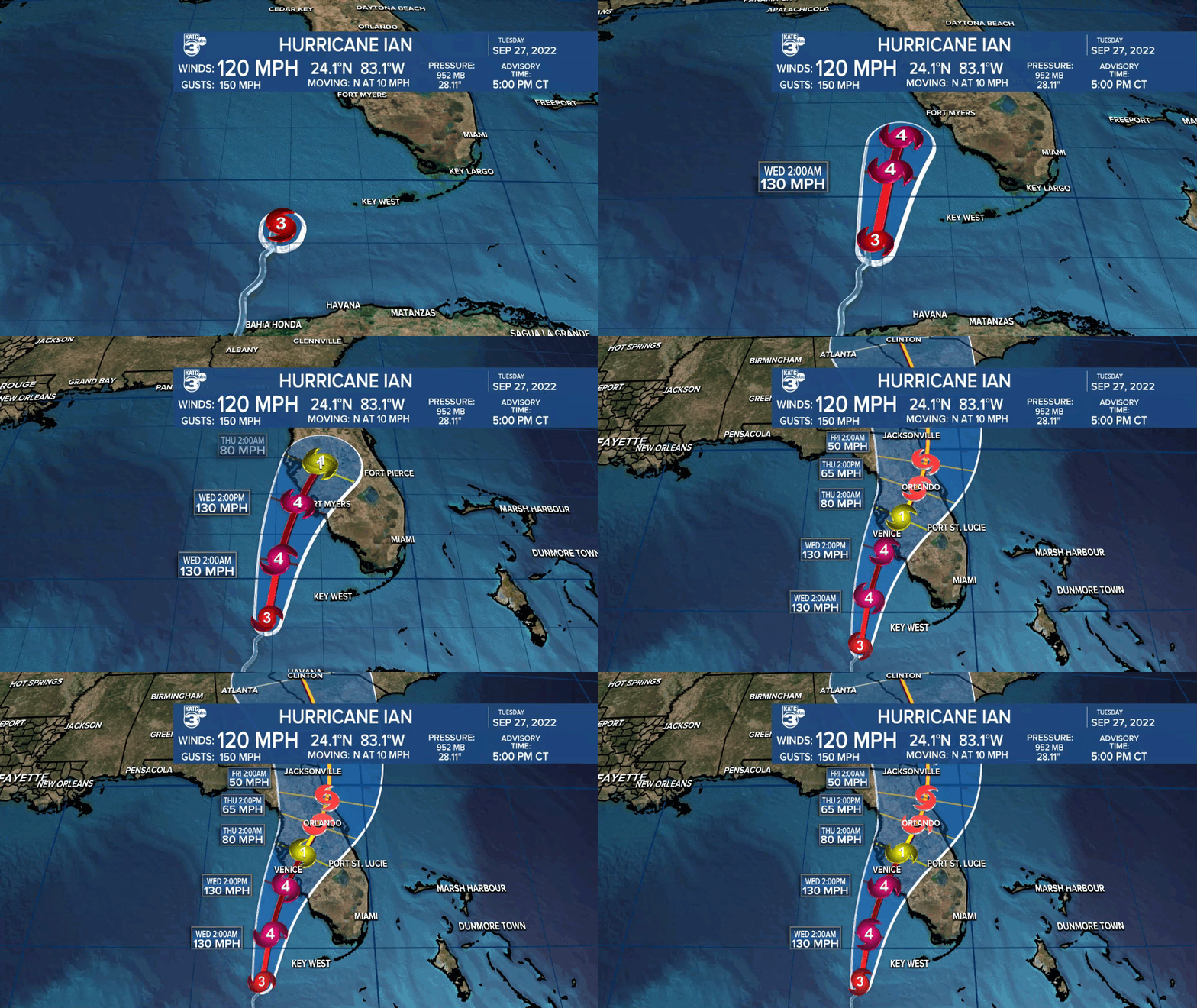
Acadiana will get a nice taste of some fall-like weather for the rest of this week while it's a different story in the Eastern Gulf of Mexico with a major hurricane.
Locally, Acadiana can expect temperatures to dip into the mid-upper 50s for most areas by morning.

Wednesday will be mostly sunny, breezy and pleasant with highs reaching the low-mid 80s.

Breezy northerly winds will continue with some gusts in the 20-28 mph range from mid-morning through the afternoon hours.
It should be a touch cooler tomorrow night/Thursday morning with lows in the low-mid 50s.
Nearly perfect weather can be expected Thursday and Friday with highs ranging from the upper 70s to lower 80s while overnight/morning lows stay planted in the refreshing 50s.
Sunshine and warmer afternoons can be expected this weekend with lots of sun and even warmer afternoon temperatures expected well into next week.
See the KATC 10 Day Forecast for the latest.

Meanwhile, in the Eastern Gulf of Mexico it's all about Major Hurricane Ian.

Ian, with 120 mph sustained winds Tuesday afternoon was continuing to show signs of strengthening after crossing Cuba.

The storm is expected to scrape obliquely along the west coast of Florida Wednesday afternoon at near Category 4 status and making landfall somewhere between Sarasota and Ft Meyers Florida.

In addition to destructive winds, Ian will bring up to a 12 foot storm surge and a swath of rainfall of up to 10-20" across the sunshine state through Thursday.
------------------------------------------------------------
Stay in touch with us anytime, anywhere.
To reach the newsroom or report a typo/correction, click HERE.
Sign up for newsletters emailed to your inbox. Select from these options: Breaking News, Evening News Headlines, Latest COVID-19 Headlines, Morning News Headlines, Special Offers


