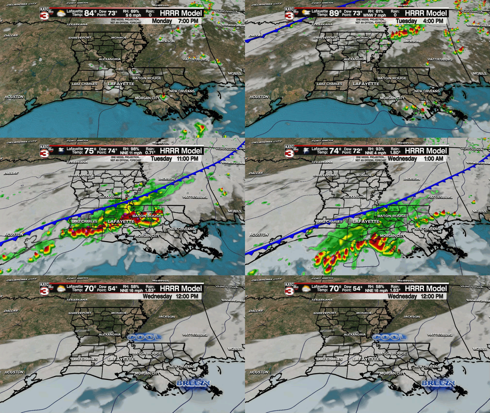
Acadiana's first "fall" cool front is set to arrive just before midnight Tuesday night with fall-like weather and temperatures likely to follow for the rest of the week and likely carry into the weekend.
The front itself will be preceded and accompanied by showers and thunderstorms.

Although the Storm Prediction Center does not have the area hatched in for organized severe weather, some storms could be strong producing gusty winds, frequent cloud to ground lightning and brief, torrential downpours.
Precipitation should end within a few hours of midnight (no flooding is expected) as temperatures begin to drop.
Look for highs Tuesday nearing 90° with temperatures behind the front dropping into the mid-60s overnight through Wednesday morning.
After some early cloud cover Wednesday, skies will begin to clear into the afternoon with temperatures topping out in the mid-upper 70s and accompanied by a fresh north wind.

Lots of sunshine and seasonably cool and dry weather is expected for the rest of the week into the weekend with lows dipping down into the 50s for 3 or 4 nights while daytime highs top out in the upper 70s to lower 80s.
The long range pattern shows drier than normal weather continuing for Acadiana over the next 10 days, with a secondary frontal system possible mid-late next week.

Meanwhile, the tropics remain active in the Atlantic. but there are no systems expected to impact the Gulf of Mexico.
In the Atlantic Basin, tropical storms Peter and Rose have limited futures along with the remnants of Odette in the North Atlantic.

Farther south and east, another tropical wave south of the Cabo Verde Islands near Africa has an 80% chance of becoming a tropical depression by the end of the week.
It's too early to declare tropical season is over with for Louisiana, but at least the next couple of weeks looks rather quiet for the Gulf.
However as always, left-over frontal boundaries in the Gulf of Mexico do require some monitoring for "spin-ups" this time of year.
------------------------------------------------------------
Stay in touch with us anytime, anywhere.
To reach the newsroom or report a typo/correction, click HERE.
Sign up for newsletters emailed to your inbox. Select from these options: Breaking News, Evening News Headlines, Latest COVID-19 Headlines, Morning News Headlines, Special Offers


