


A front is on the way this evening bringing no rain with it.. just the return of chilly temperatures for Friday and the weekend.
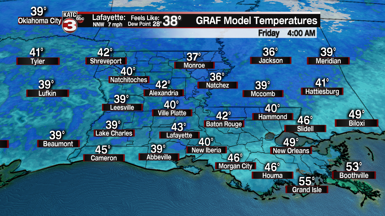
It will be chilly by tomorrow morning with temperatures in the upper 30s to lower 40s.
Plenty of sunshine can be expected as we head throughout the day on Friday.
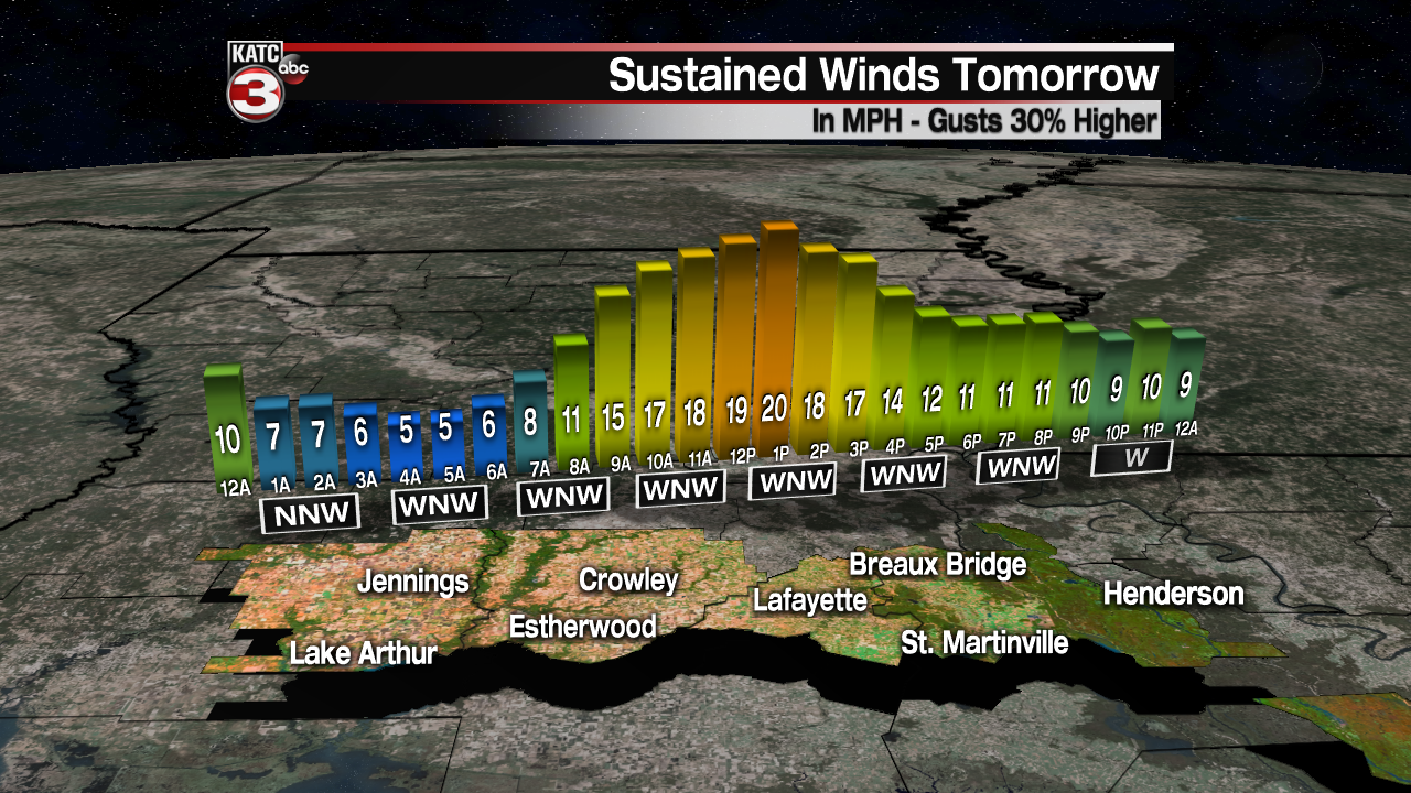
Temperatures will top out in the mid to upper 50s with a breezy northerly wind in place.

Upcoming weekend looks good and chilly as temperatures will start out in the 30s for both Saturday and Sunday mornings (We could get close to freezing on Sunday morning-- especially for northern parishes).
Mainly sunny skies are anticipated for both days with the exception of a few high-level clouds trying to move in by Sunday afternoon.
Temperatures will be settling into the mid to upper 50s.
Nice looking weather will stick around for MLK day on Monday.
Expect plentiful sunshine with high temperatures climbing into the lower 60s.

Partly to mostly cloudy skies return for Tuesday as afternoon highs push the upper 60s to lower 70s.
Rain chances start to increase slightly heading into Wednesday afternoon ahead of our next upper-level disturbance.
For now, best rain chances of next week arrive on Thursday as a surface low feature pushes through.
We are still a week out, so timing of that feature (and thus our rain chances) can certainly change a bit.
Stay with the katc storm team for the very latest.
It will be milder regardless into next week as highs continue to climb into the upper 60s to lower 70s through mid-week.
Y'all have a good one!
