


A significant and a more lasting change in the weather pattern is expected for the Acadiana area, with cloudy, breezy, cool and occasionally weather sets in Friday, through the weekend and very likely, into early next week.
In the near term, expect a mild night with increasing clouds overnight into Friday morning, with conditions remaining dry for the Ragin Cajun game against Southern Mississippi Thursday evening with temperatures holding in the low-mid 70s through the game.

Later on, a cool front will cross the area between 1-5am Friday...roughly 2am (give or take an hour) for Lafayette, with some shower activity expected along and following the front, mainly toward daybreak Friday.

Expect cloudy, breezy and cool weather for the area Friday with scattered showers and patchy light rain/drizzle and/or mist from time to time, especially during the afternoon and evening hours.
Bring the rain gear for Friday night football.
The same pattern continues Saturday with temperatures holding in the lower 60s most of the day with patchy light rain showers, drizzle and/or mist likely to continue.
It should be a little drier, but remain cloudy and cool for Sunday.

Rainfall this weekend will very light and more of a nuisance, with rain totals for most generally less than 1/10th of an inch...a few spots might see up to 1/2", if lucky.

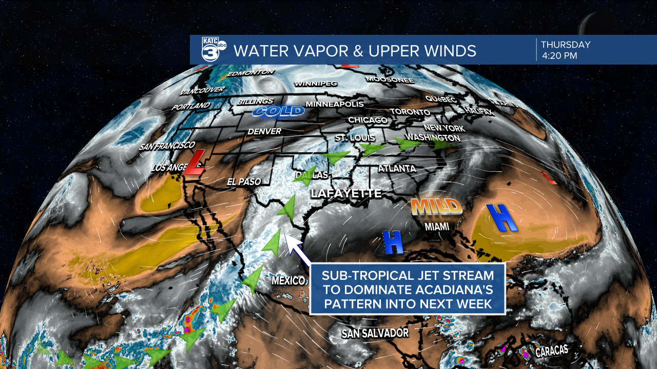
The bigger story is that both the GFS and Euro are coming into better agreement on a wet, potentially soaking weather system developing Monday into Tuesday within a more active sub-tropical jet stream.
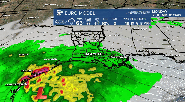
Some very heavy rainfall looks to fall mostly in the Gulf of Mexico, but today's model runs are showing more consistency that a couple to several inches of rain could be possible for the area Monday into Tuesday...with highest totals likely closer to the coast.
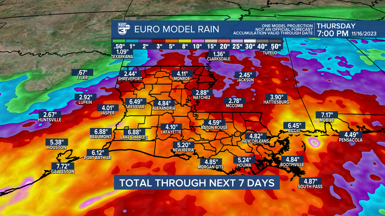
Even more concerning, both the Euro and GFS show huge totals of 8" or more very close by to our area over the next week...with the chance of flooding rains possibly clipping extreme Southeast Louisiana.
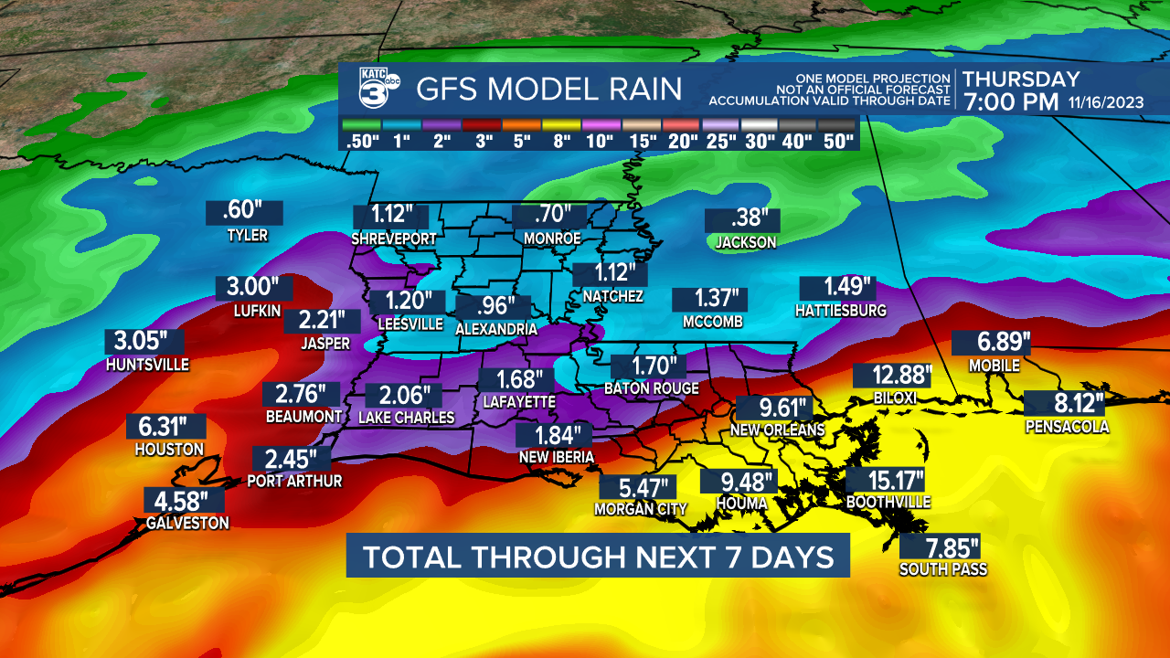
Stay with KATC for the latest rainfall estimates into next week.
Cloudy and cool conditions will last for a good part of next week with the chance of more rains possible at some point thanks to the southwest-oriented sub-tropical jet stream over our area, which is expected to come and go much more regularly into this winter thanks to the strengthening El Niño pattern.
See the KATC 10 Day Forecast for the latest.
------------------------------------------------------------
Stay in touch with us anytime, anywhere.
To reach the newsroom or report a typo/correction, click HERE.
Sign up for newsletters emailed to your inbox. Select from these options: Breaking News, Evening News Headlines, Latest COVID-19 Headlines, Morning News Headlines, Special Offers
