


The tropics are a little more active today with a newly minted tropical storm, while Acadiana will continue to see good chances of daily downpours continuing through this weekend.

Tropical Depression #4 off of the South Carolina coast strengthened Monday afternoon and Tropical Storm Danny was named.
The short-live, low end tropical storm with 45 mph winds will make landfall Monday evening in South Carolina where several inches of rain will be likely, but this system will not be a damaging storm and is not expected to intensify further prior to landfall.

Meanwhile, there's no significant end in sight for Acadiana's continued wet pattern with a good chance of scattered tropical showers and thunderstorms likely each day, especially from the late morning through the mid-afternoon hours...very similar to what we experienced Monday.

Rain chances will be near 70% Tuesday, near 60% Wednesday and will be closer to 40% Thursday as atmospheric moisture subtly decreases...if only for a day or so.
Deep tropical moisture will move back into place Friday into the weekend, leaving Acadiana with high daily rain chances through the entire holiday weekend as a fizzling frontal trough approaches from the north adding more atmospheric instability.

On the flip side, at least the wet pattern has been limiting our daytime high temperatures to the mid-80s...some 5 degrees below normal, where we will stay for the foreseeable future.
There could be light at the proverbial wet tunnel ahead as it appears that African Dust could move toward the Gulf of Mexico in about a week...then a day or two later into Louisiana, which could actually allow for diminishing rain chances...fingers crossed!

Consult the KATC 10 Day Forecast for the latest.
Elsewhere in the tropics, a tropical wave located over the central tropical Atlantic Ocean is producing disorganized showers and a few thunderstorms.
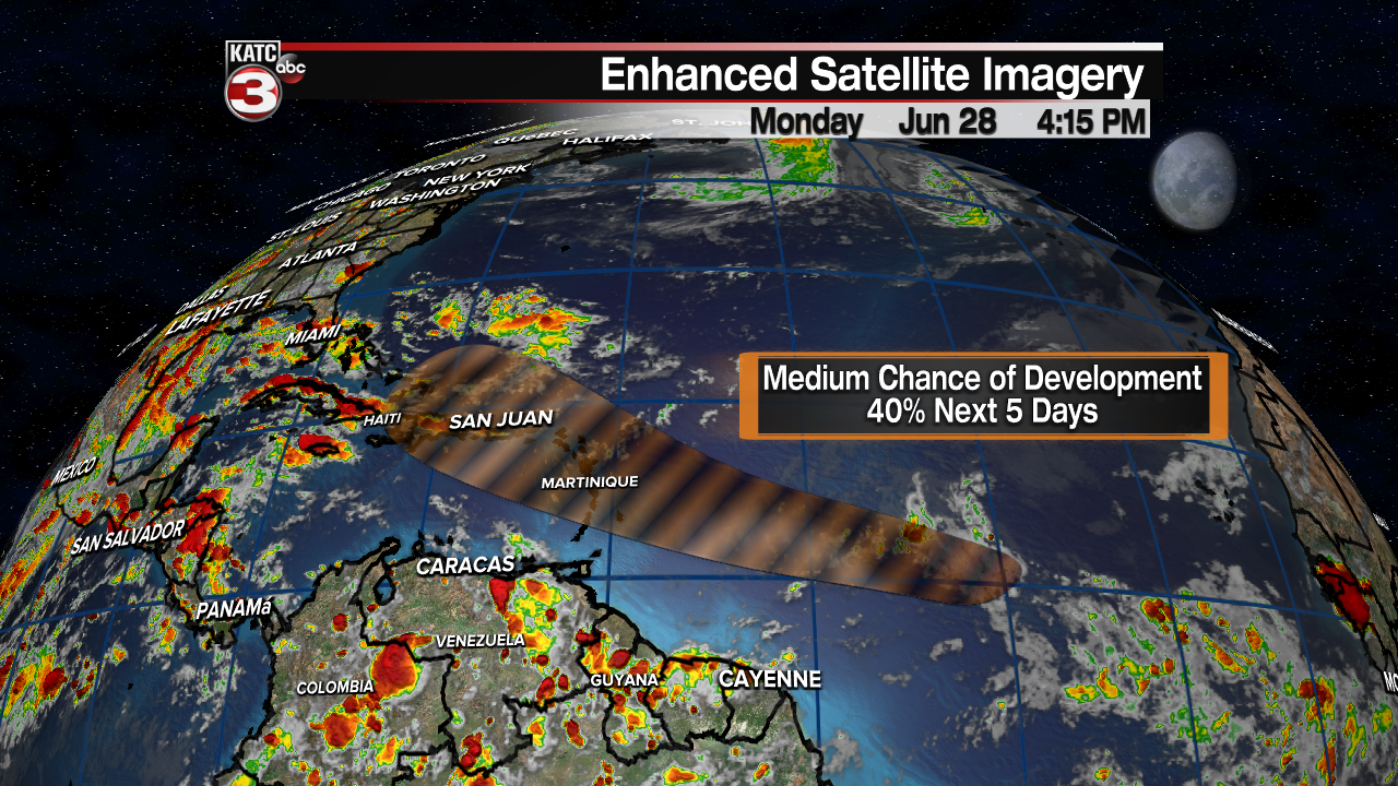
Some slow development of this disturbance is possible after the middle of the week while the system moves westward to west-northwestward at 15 to 20 mph, likely reaching the Lesser Antilles by Wednesday night.
------------------------------------------------------------
Stay in touch with us anytime, anywhere.
To reach the newsroom or report a typo/correction, click HERE.
Sign up for newsletters emailed to your inbox. Select from these options: Breaking News, Evening News Headlines, Latest COVID-19 Headlines, Morning News Headlines, Special Offers
