

Mild overnight with temperatures in the mid-upper 60s.
Warm Sunday as highs push the upper 70s.
We'll see another scattering of showers and storms as a cold front approaches.
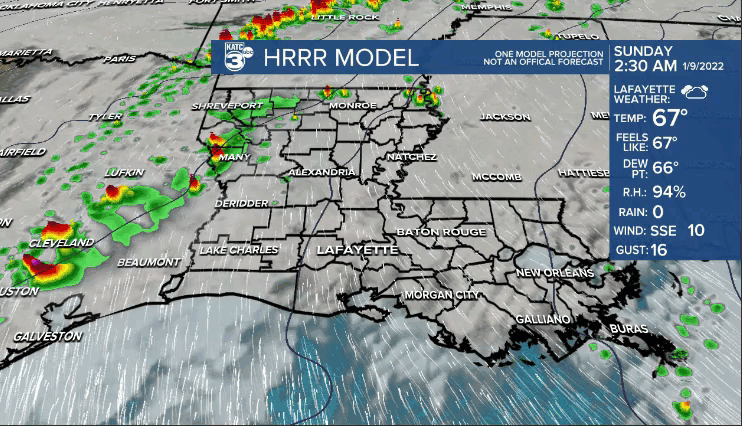
Some of the storms that develop could contain gusty winds.
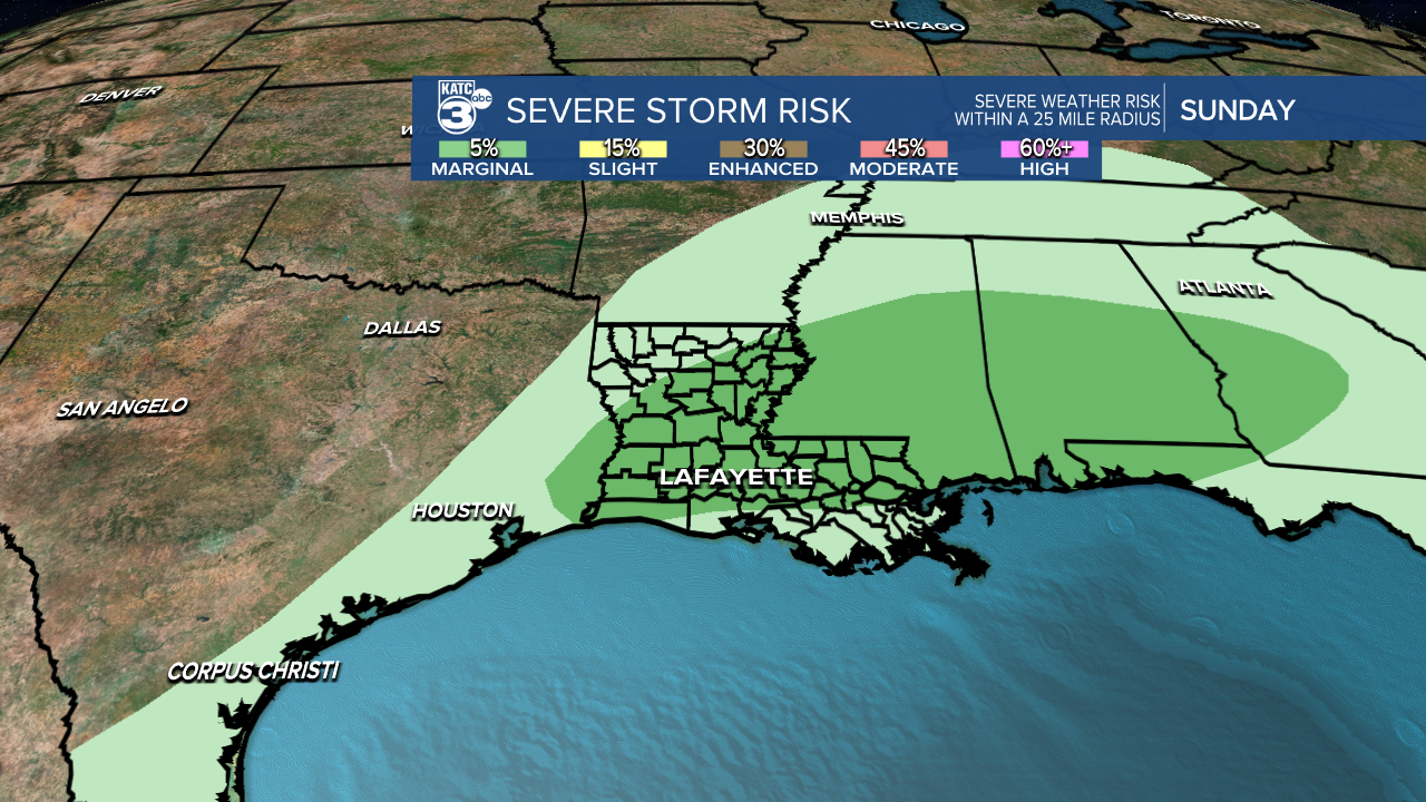
The day as a whole will not be a washout as activity remains on a scattered basis.
Back to a winter chill early next week.
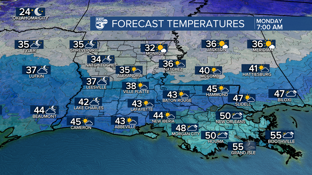
Lows on Monday will be in the upper 30s to lower 40s.
Winds will be brisk out of the north.
Breezy and chilly throughout Monday as highs only top out in the mid-upper 50s.
Skies will gradually clear throughout the day.
Cold mornings heading into Tuesday and Wednesday with readings in the 30s.
Afternoon highs will remain seasonably cool through mid-week.
Moderating temperatures expected by week's end.
Overall, shaping up to be a pretty quiet week ahead.
Scattered rain chances will return next Saturday ahead of another cold front.
Have a great rest of the weekend!
