


After a relatively sedate and cool weather pattern for Acadiana through Thursday, look for breezy and warmer conditions Friday into the weekend ahead of the area's next weather-maker that arrives late Saturday.
In the near term, expect fair and chilly conditions overnight through Thursday morning with lows range from the mid-upper 30s to near 40° in Lafayette.

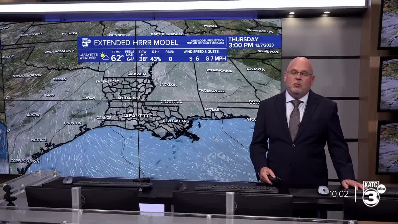
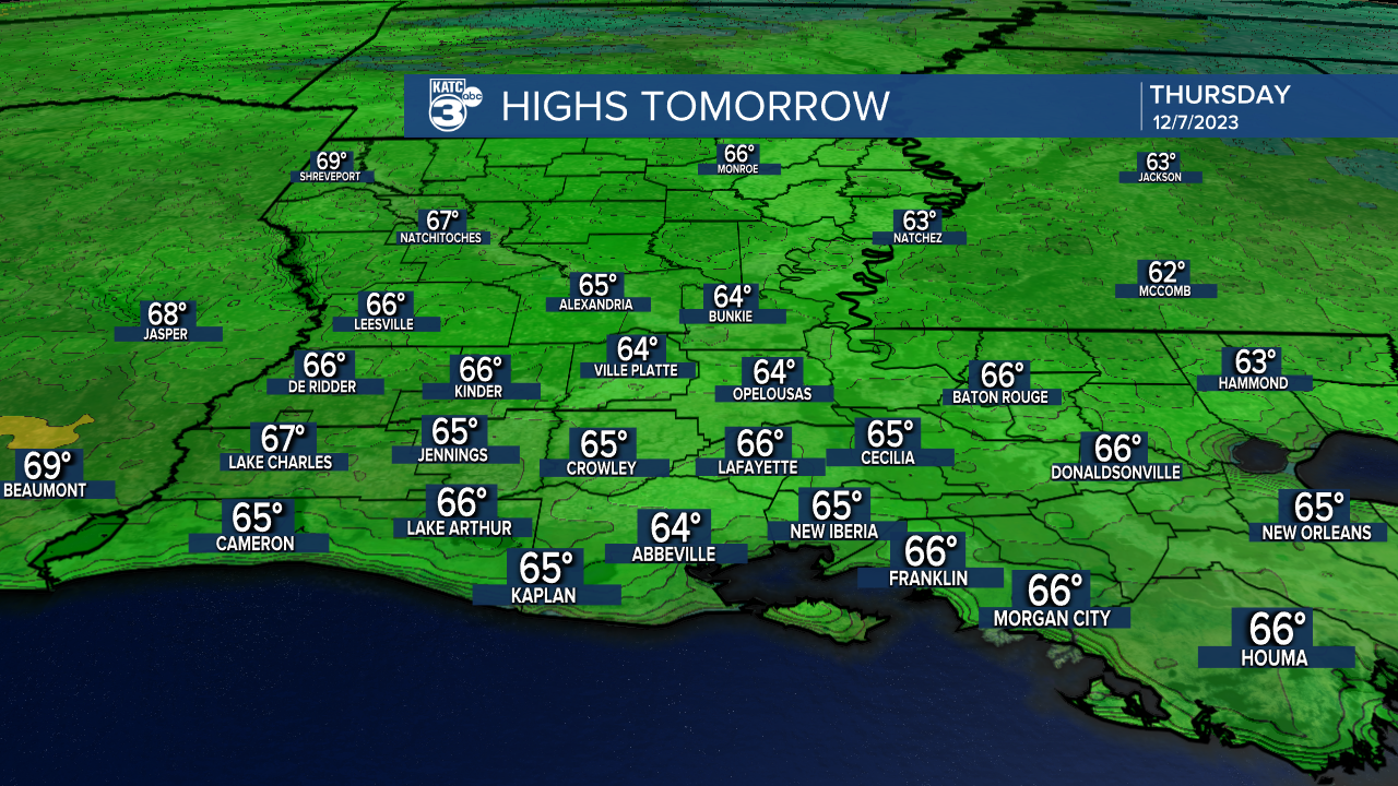
Mostly sunny skies are anticipated for our Thursday with occasional high clouds moving back into the region. Highs Thursday will be in the mid-60s.
Friday will be milder with a morning start in the mid-upper 40s to 50° in Lafayette with temperatures climbing into the low-mid 70s courtesy of breezy southerly winds and despite mostly cloudy skies Friday afternoon.
There will probably be a few light showers or sprinkles Friday with chance of measurable precipitation near 20-30%.

The next weather-maker will arrive to the area Saturday in the form of an upper frontal trough and surface cold front.
Showers and storms are expected to become likely by the late afternoon into the evening hours Saturday with rain chance climbing to near 70% by late afternoon and near 90% into the evening.
While it remains early for the details, the Storm Prediction Center continues to indicate the possibility of severe storms from Eastern Texas through a good chunk of Louisiana into Arkansas and portions of Mississippi Saturday into Saturday night.
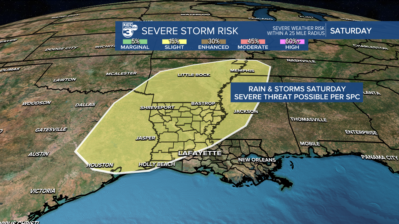
The greatest risk of any severe storms appear to be just north and west of Lafayette at this time, but does include the northwestern parishes of Acadiana.
Damaging winds, isolated tornadoes and some hail (all modes of severe storms) may be possible with Saturday's storm system that are highlighted for a slight risk of severe storms, a level 2 out of 5.
Rain totals per the latest Euro model are more in-line with the current thinking that any storms will be quick moving, and not linger for too long.

Generally 1/2-1" of rain may be possible for most, with some areas seeing less while isolated areas could see up to 2"...flooding is not expected.
After Saturday's system, Acadiana will be in for some weather whiplash with highs Saturday in the upper 70s dropping into the 40s Saturday night, and likely reaching no higher than mid-50s Sunday with blustery northwesterly winds.
Temperatures Sunday night into MOnday morning could drop into the low-mid 30s...so a light freeze might be possible for some.
Much of next week appears cool and dry with our next chance of rain looking to arrive the following weekend.
See the KATC 10 Day Forecast for the latest.
-------------------------------------------------------
Stay in touch with us anytime, anywhere.
To reach the newsroom or report a typo/correction, click HERE.
Sign up for newsletters emailed to your inbox. Select from these options: Breaking News, Evening News Headlines, Latest COVID-19 Headlines, Morning News Headlines, Special Offers
