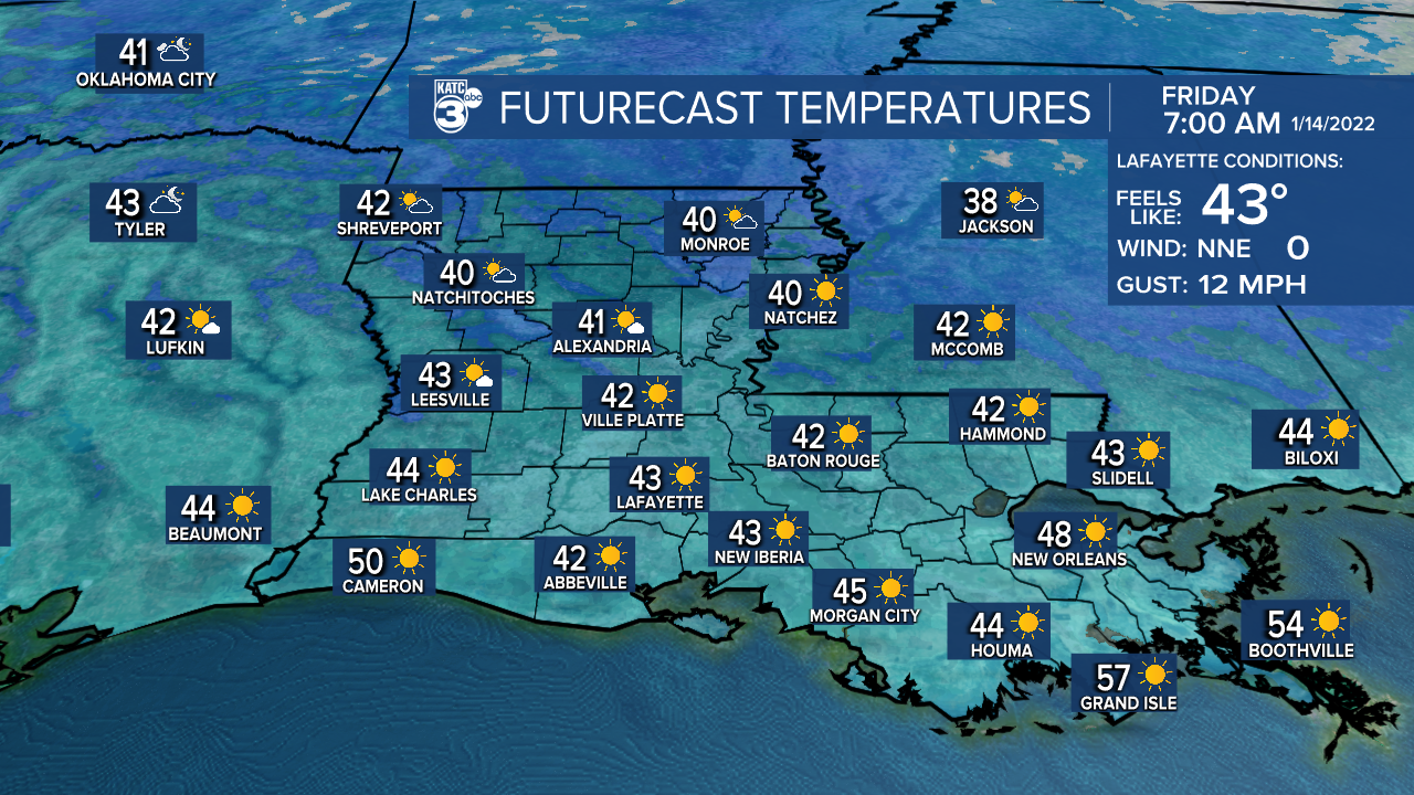
A favorable January weather pattern is on tap for Acadiana for the rest of the week with our next weather-maker in the form of a cold front that will generate showers Saturday, followed by a blustery winter chill Sunday.
In the near term, with clearing skies and light winds, temperatures should drop nicely overnight into Thursday morning with lows ranging mostly from the upper 30s to lower 40s.

Plenty of sun accompanied by a westerly wind should allow our temperatures to rise nicely Thursday with highs pushing the upper 60s to near 70°.

Chilly conditions will return Thursday night into Friday morning with lows closer to the lower to mid-40s.

Mostly sunny skies will be back Friday with highs likely pushing into the lower 70s.

Change will arrive Saturday as a low pressure system gets cranked up north of our area eventually becoming a significant snow storm for portions of the Eastern U.S.
The low pressure system will drag a cold front across the area Saturday with a good chance (70%) of scattered showers, perhaps an isolated storm ahead and accompanying the front with some showers to follow.

It will become windy and colder Saturday night into Sunday (kind of like what we experienced this past weekend) with a blustery winter chill to follow into Sunday and Sunday night.
Temperatures Saturday may go as high as the upper 60s to lower 70s early in the day, but will fall during the afternoon, dropping into and staying mostly in the 40s Sunday accompanied by windy conditions which will yield wind chills in the 30s.
Temperatures Sunday night into Monday morning will get close to or be just above the freezing mark, but wind chills will likely be in the lower-mid 20s.
Interestingly enough, the GFS and Euro model forecasts gets a little more interesting for the northern part of our state come Sunday morning...

Some wrap around moisture associated with aforementioned low may produce a brief "non-significant" wintry mix primarily along and north of the I-20 corridor, but do not expect any of that to reach Acadiana!

Next week is looking to start cool and dry with a moderating temperature trend along with some showers toward the end of the week.
See the KATC 10 Day Forecast for the latest.
------------------------------------------------------------
Stay in touch with us anytime, anywhere.
To reach the newsroom or report a typo/correction, click HERE.
Sign up for newsletters emailed to your inbox. Select from these options: Breaking News, Evening News Headlines, Latest COVID-19 Headlines, Morning News Headlines, Special Offers


