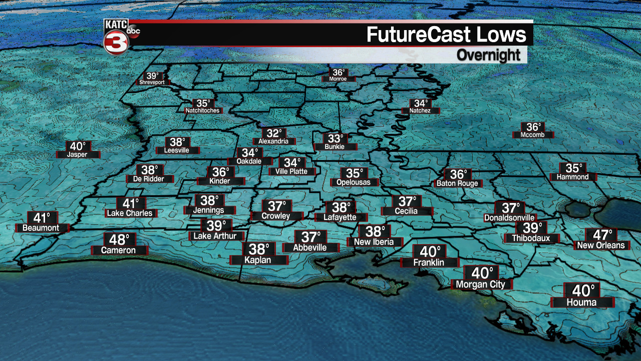
Lots of sunshine is in store fore Acadiana Tuesday accompanied by a large temperature spread...starting out in the 30s but finishing off in the lower 70s.
Look for morning lows Tuesday ranging from the low-mid 30s along with the chance of frost across the northern Acadiana parishes to the mid-upper 30s along and south of the I-10 corridor where frost will be less likely.

Sunshine combined with a return of southerly winds will allow the area to warm-up into the lower 70s Tuesday afternoon.

High pressure will stay in charge into Wednesday, but as it slides eastward toward the Southeast U.S. it will allow for more clouds to move into the region.

Highs Wednesday will top out in the low-mid 70s.

A front is expected to approach area Thursday keeping clouds and adding the chance of showers to the forecast.
The front Thursday is looking to stall just north of the area, maintaining cloud cover, some rain chances and mild temperatures into the weekend.
Little change is expected into much of next week with frontal zone activity staying just north of the area.
In fact, Monday's 10 Day Forecast shows plenty of clouds, some rain chances, accompanied by daytime highs staying in the mid-upper 70s most of next week...it almost seems like someone has flipped the switch from "winter" to "spring" given less than a week ago we were experiencing icy weather with temperatures in the teens!
------------------------------------------------------------
Stay in touch with us anytime, anywhere.
To reach the newsroom or report a typo/correction, click HERE.
Sign up for newsletters emailed to your inbox. Select from these options: Breaking News, Evening News Headlines, Latest COVID-19 Headlines, Morning News Headlines, Special Offers


