


Acadiana will continue to see a changeable weather pattern into this weekend, and for the week that follows which is quite typical for the month of February.
In the near term, look for fair and seasonable temperatures overnight into Friday morning with our next (dry) front pushing across the area Friday afternoon.
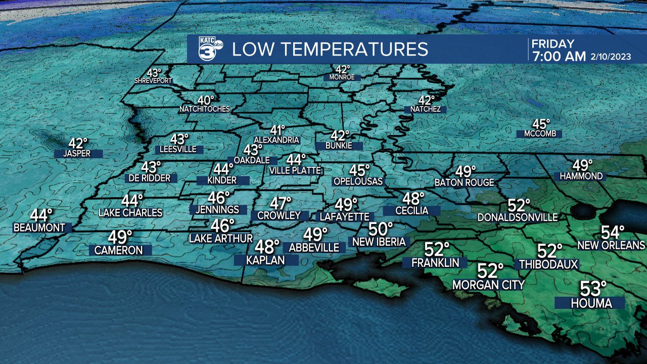
Lows Friday morning will be in the mid-upper 40s for most.
Expect sunny skies initially Friday but high clouds should begin to invade from the southwest during the afternoon.
Friday afternoon highs should reach the mid-upper 60s.

Winds will increase into Friday afternoon into the night as a winter chill takes over for the weekend.
An upper level low will move into the state Saturday bringing plenty of clouds and the possibility of light/misty rain starting as early as late Friday night and continuing into Saturday afternoon.
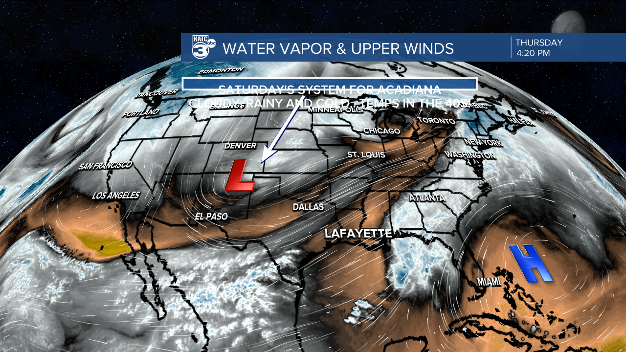
And precipitation is expected to be very light and more of a nuisance than anything else, especially for any Mardi Gras activities Saturday.
Temperatures are expected to drop into the low-mid 40s Friday night into Saturday morning with wind chills likely dropping into the 30s.
And with cloud cover and some light rains (40%) in the forecast Saturday, high temperatures will stay in the 40s...and there will be some wind chill as well.
Clouds should clear out Saturday evening/night but it will be getting even colder with Sunday morning readings generally in the mid-30s, and closer to the light freeze mark for the northern parishes in the area.
Partly sunny skies should return Sunday with temperatures moderating back into the upper 50s.
After another chilly Sunday night/Monday morning look for temperatures to get back into the mid-upper 60s for Monday afternoon under partly cloudy skies.
Thereafter we'll see 70s again for mid-week but rain and thunderstorm chances will be on the rise Tuesday with precipitation chances continuing into Wednesday and Thursday as the sub-tropical jet-stream stays overhead.

It remains unclear at this time as to whether there will be any severe weather threats Tuesday through Thursday.
Drier, cooler conditions should return in time for next weekend.
See the KATC 10 Day Forecast for the latest.
St Landry Parish Tornado Survey:
The National Weather Service (NWS) surveyed the damage near and just west of the Big Cane in Northern St Landry Parish Thursday and found that an EF1 tornado with 105 mph impacted the area.
Shortly after 7pm Wednesday the 100 yard wide tornado touched down near Highway 107 and traveled northeastward for 1.5 miles damaging 5 homes, a few outbuildings and snapped or uprooted several trees.
No injuries reported.
We have a reporter in the field so look for more coverage on our newscasts this Thursday evening.
------------------------------------------------------------
Stay in touch with us anytime, anywhere.
To reach the newsroom or report a typo/correction, click HERE.
Sign up for newsletters emailed to your inbox. Select from these options: Breaking News, Evening News Headlines, Latest COVID-19 Headlines, Morning News Headlines, Special Offers
