


Acadiana's weather pattern will remain changeable over the next few days, with a decided winter chill likely for the weekend.
In the near term, scattered showers are expected through Tuesday evening as an upper disturbance accompanying a frontal trough slowly pushes eastward through the area into Wednesday morning.

Most rains should gradually taper across the area after midnight, with breezy and cooler conditions expected.
Temperatures by morning will range in the low-mid 40s with wind chills close to the upper 30s at daybreak.
Lingering clouds, breezy and seasonably cool conditions should dominate our Wednesday with clouds expected to gradually thin, permitting a few intervals of sunshine into the latter part of the afternoon.
Temperatures Wednesday should top out in the lower 60s.

After another seasonably cool night as clouds clear, look for mostly sunny and milder weather Thursday, with afternoon highs pushing back into the mid-70s.
Friday will be spring-like as well, but we'll likely see a good chance of showers and thunderstorms ahead of a strong cold front into Friday afternoon.
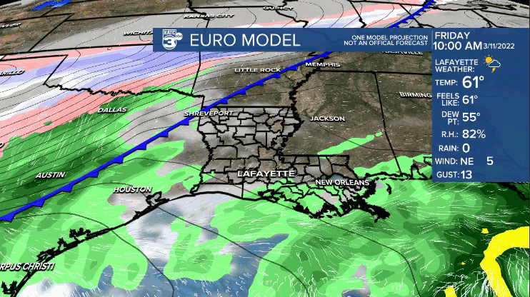
While not an overt severe weather threat is expected for Acadiana, there could be the risk of a few storms containing strong, possibly damaging winds.
Any widespread severe weather threats with system should manifest well east of the region into Saturday per the Storm Prediction Center.
Meanwhile, behind the front, windy and sharply colder conditions are anticipated Friday night into the weekend.
Wind gusts may approach the 35-40 mph range Friday night as the surface pressure gradient behind the front will be tight and will likely also lead to gale conditions offshore in the Gulf of Mexico into Saturday.
Temperatures will likely drop into the mid-30s Saturday morning with wind chills in the mid-20s!
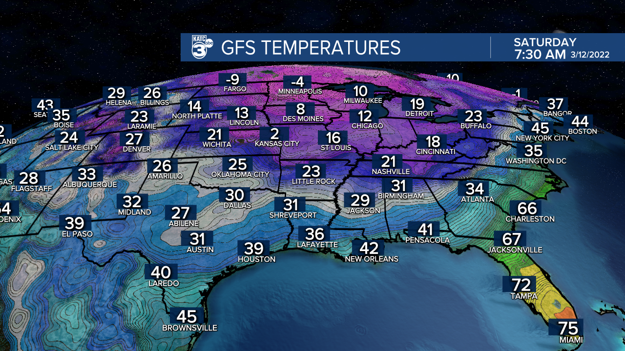
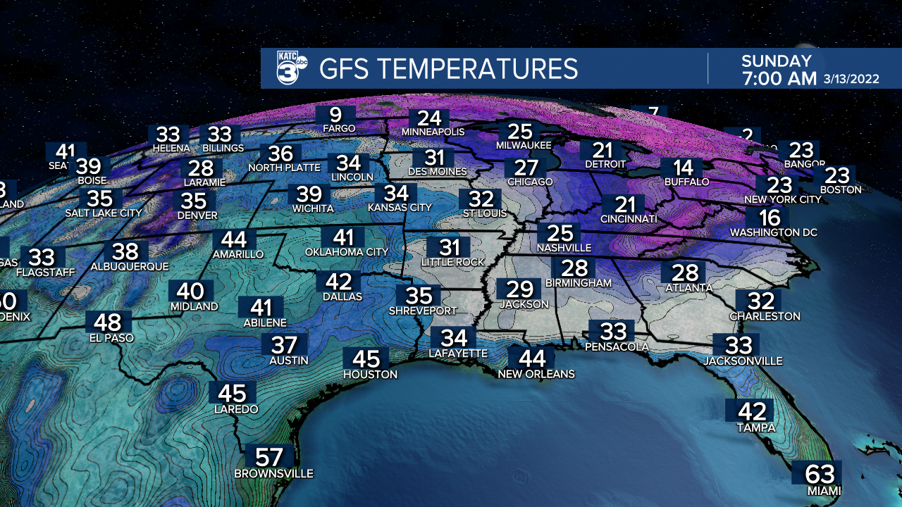
At least we'll see lots of sun this weekend but high temperatures will be limited to the lower to mid-50s Saturday and lower 60s Sunday.
The coldest readings this weekend (and perhaps for the rest of this month/spring) should come Sunday morning with lows in the lower 30s...frost Sunday morning will be quite possible, especially for the northern Acadiana parishes.
Next week promises milder, more seasonable weather with highs migrating back through the 70s and perhaps approaching 80° toward the end of the week.
See the KATC 10 Day Forecast for the latest.
------------------------------------------------------------
Stay in touch with us anytime, anywhere.
To reach the newsroom or report a typo/correction, click HERE.
Sign up for newsletters emailed to your inbox. Select from these options: Breaking News, Evening News Headlines, Latest COVID-19 Headlines, Morning News Headlines, Special Offers
