


If you liked Wednesday's weather in Acadiana you will likely be a fan of Thursday's...but unsettled conditions along with increased chances of scattered showers and thunderstorms await us Friday and into the latter part of the weekend.
In the near term, expect a fair, breezy and overall a pleasant Wednesday evening with winds decreasing while clouds gradually increase after midnight.
Lows will be in the balmy low-mid 70s.
Thursday, the weather playbook remains the same with morning clouds giving way to partly sunny and breezy conditions accompanied by temperatures topping out in the mid-80s.

A frontal system will begin to push through the state Thursday night into Friday increasing the chances of scattered showers and a few thunderstorms from the late night hours (40%) through midday Friday (near 60%).
While no organized severe weather is in the forecast, there could be a few isolated "healthy" storms.
The weather picture for the weekend appears to be becoming better in focus as models are now agreeing that an upper level low will sit back to the west Saturday then make a a slow move eastward into Sunday.

This means that rain chances should decrease Saturday (20%) but perk back up Sunday (60%).

For now, the Storm Prediction Center (SPC) is not indicating the threat of any severe storms for Acadiana this weekend, but Sunday's upper pattern does favor some strong storms capable of producing gusty winds and localized heavy downpours...we'll keep an eye out for the SPC's future updates.
Thereafter, the pattern looks to stay unsettled with the chance of storms through mid-week before drier and nicer conditions return later in the week and into perhaps the following weekend.
See the KATC 10 Day Forecast for the latest.
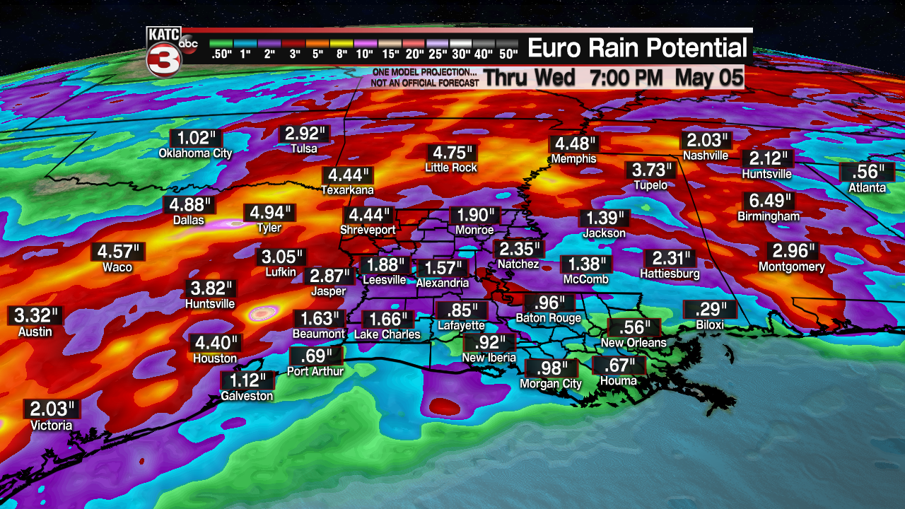
Rainfall for Acadiana over the next 7 days looks to be higher to our west, north and perhaps east.
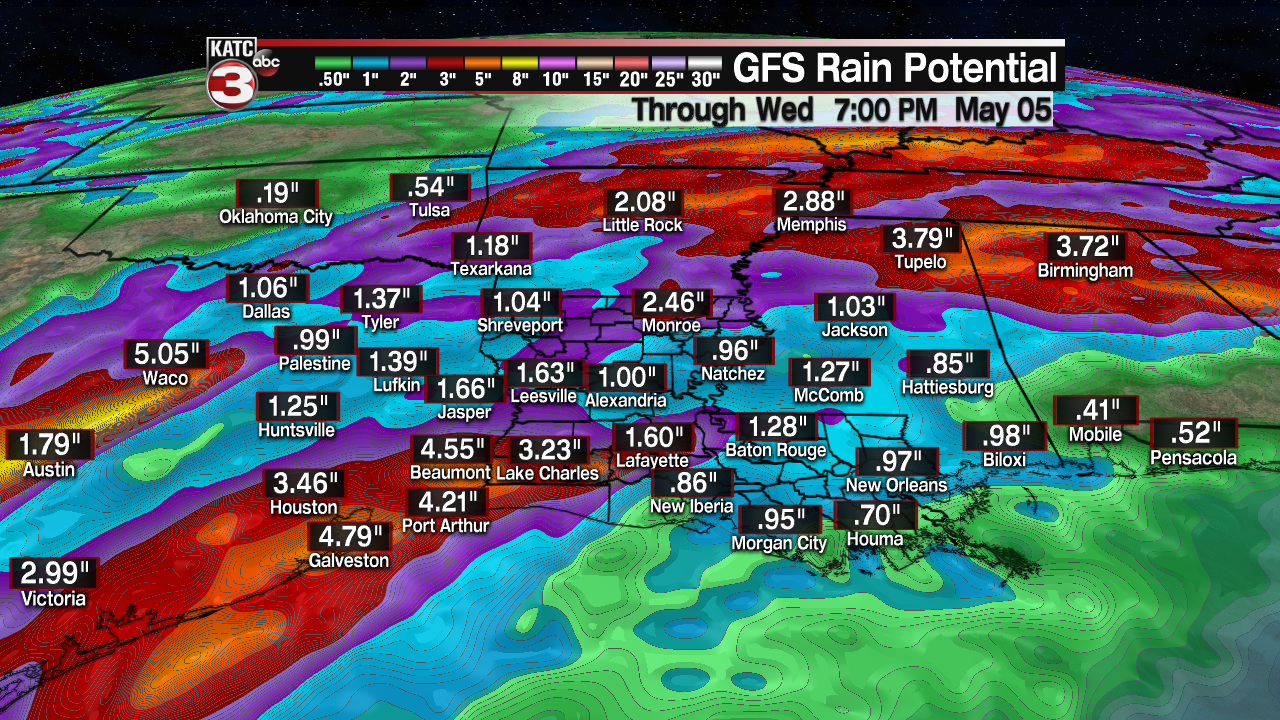
But do look for the possibility of a couple of inches of rain locally...but with higher amounts of 2-4" or more nearby, stay tuned for future rainfall total and storm intensity projections.
------------------------------------------------------------
Stay in touch with us anytime, anywhere.
To reach the newsroom or report a typo/correction, click HERE.
Sign up for newsletters emailed to your inbox. Select from these options: Breaking News, Evening News Headlines, Latest COVID-19 Headlines, Morning News Headlines, Special Offers
