


After briefly flirting with 80 degrees early Monday, a sharp cool front that passed through the region midday promises to shift our weather closer to a winter-time pattern for the 2nd day of meteorological spring Tuesday.
An upper level disturbance combined with an active sub-tropical jet stream will conspire to produce periods of rain shower activity overnight into Tuesday with activity tapering for the afternoon.

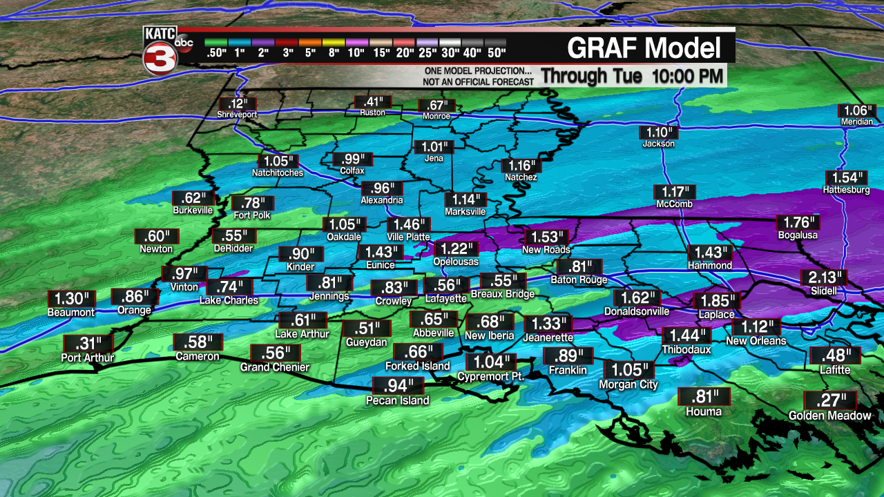
A decent soaking from the rains will be possible in spots with rain totals generally falling between 1/2" and an inch...no flooding is expected.
After a wet and dreary morning, showers are expected to taper Tuesday afternoon.
It will be breezy and quite cool through Tuesday with temperatures falling and staying the in the lower 50s overnight into tomorrow.

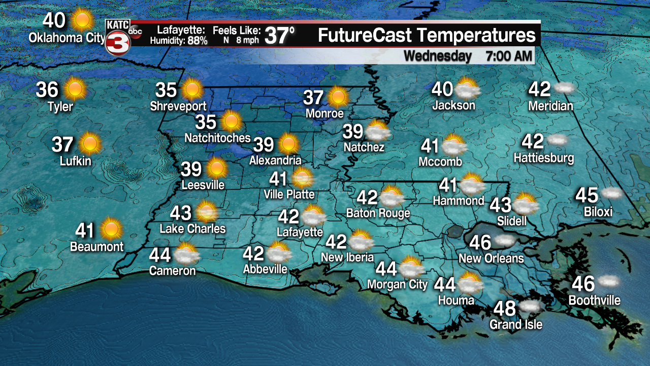
Skies will clear Tuesday night with temperatures dropping into the lower 40s in Lafayette, meaning we could see some readings in the upper 30s in the northern Acadiana parishes Wednesday morning!
Sunshine and seasonably cool temperatures are anticipated for Wednesday and Thursday with the next chance of showers, and perhaps some thunderstorm activity arriving late Friday into Friday night.

The weekend is tentatively looking rather nice and seasonably cool with mostly sunny to partly cloudy skies accompanied by daytime highs in the 60s and lows in the 40s.
Milder, more spring-like temperatures return next week per our latest 10 Day Forecast.
------------------------------------------------------------
Stay in touch with us anytime, anywhere.
To reach the newsroom or report a typo/correction, click HERE.
Sign up for newsletters emailed to your inbox. Select from these options: Breaking News, Evening News Headlines, Latest COVID-19 Headlines, Morning News Headlines, Special Offers
