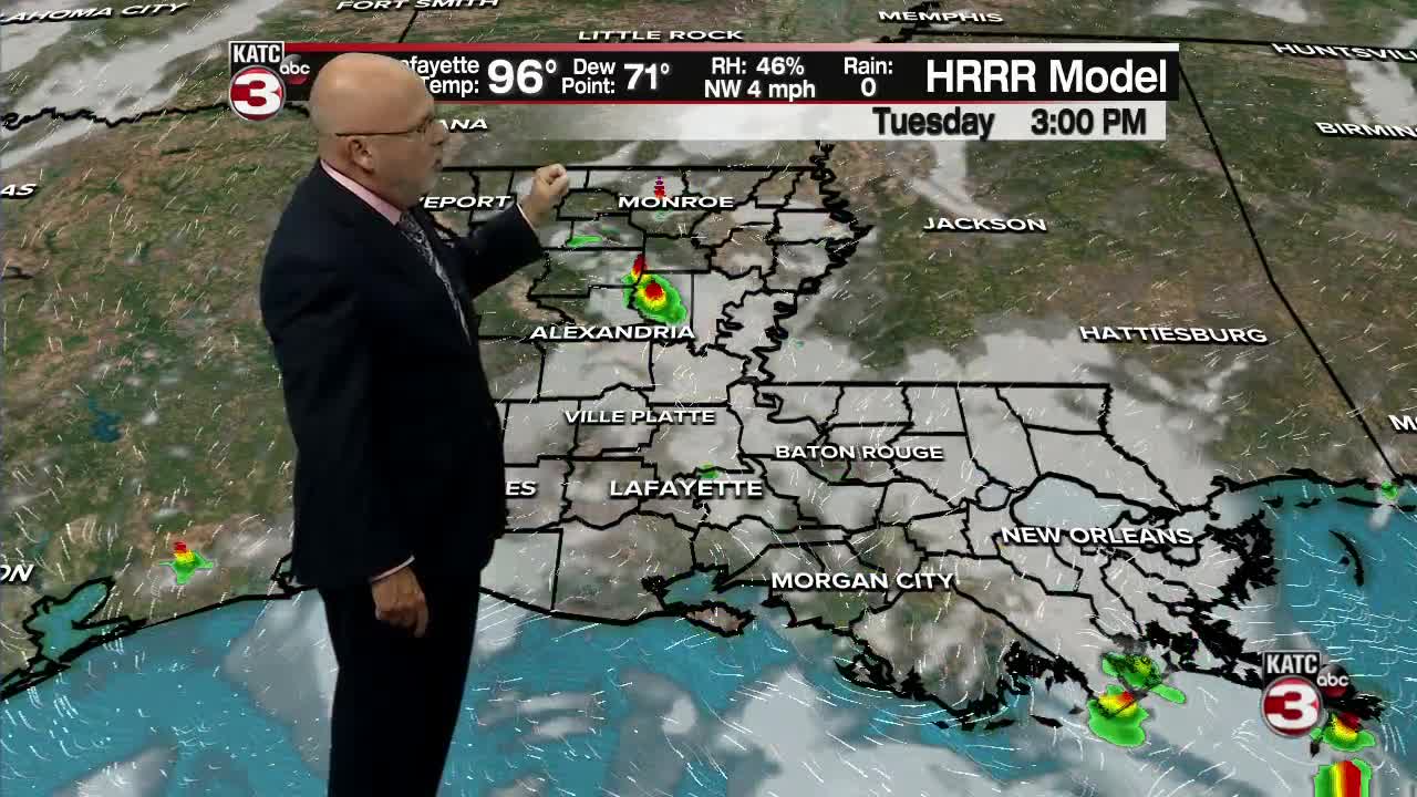


More big heat, humidity and heat indices are on tap for Acadiana Tuesday, but the risk of late afternoon/early evening storms will be back in the forecast.
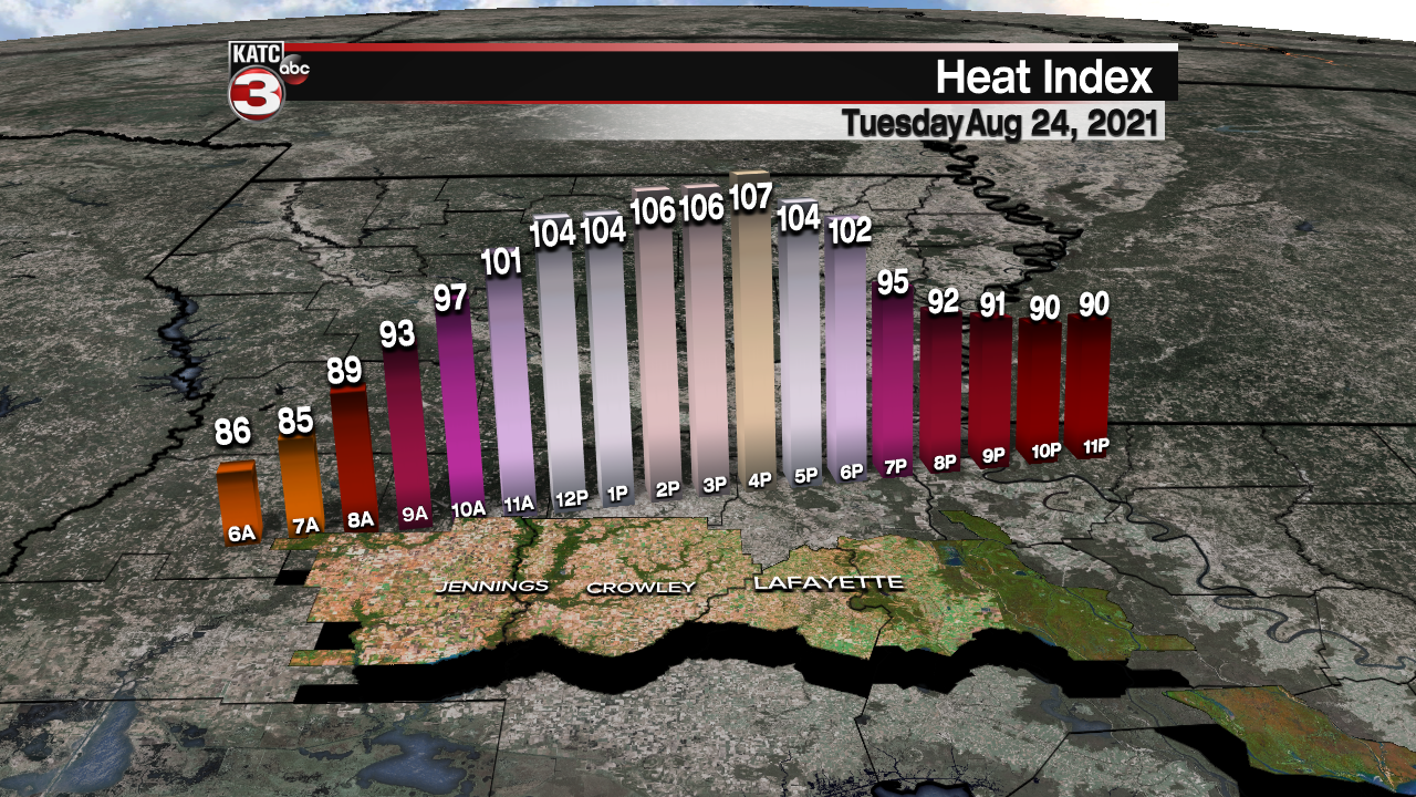
After a morning start in the upper 70s to lower 80s look for high temperatures Tuesday afternoon to reach the mid-upper 90s.
Heat indices will peak near 105-110° across the area.
Scattered late afternoon showers and storms will be possible for our Tuesday with chance of getting wet back up to 40%.

An inverted trough/easterly wave will traverse westward across the Northern Gulf Coast this week allowing for a good chance of daytime showers and storms in the area Wednesday and Thursday.
And with more active weather mid-week, our daytime highs will ease back into the lower 90s...possibly upper 80s, especially for Thursday.
The forecast for Friday into the weekend looks to keep the chance of scattered afternoon storms in the forecast (with rain chances closer to 40%).
See the KATC 10 Day forecast for the latest.
Meanwhile in the tropics, we are fast approaching the peak of hurricane season.
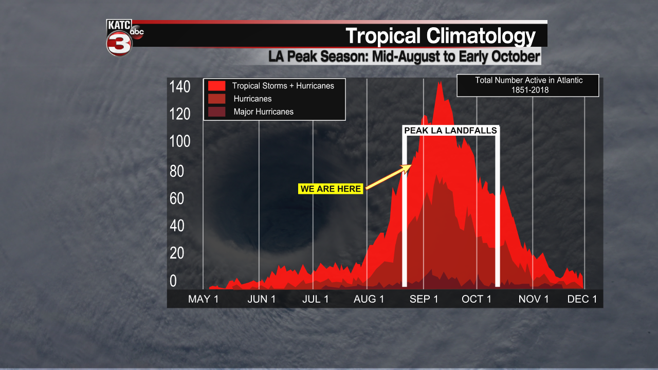
The National Hurricane Center is monitoring three potential systems in the tropical Atlantic...all with a medium (40%) chance of developing over the next five days.
Of greatest interest to us is a tropical wave in the Eastern Caribbean that may have an opportunity to develop later this week.

Development in the Northwest Caribbean will be possible this weekend with a potential system possibly in the Western Gulf by early next week.
While the GFS model continues to suggest a southern track of a possible system across the Yucatan and perhaps again on to Mexico, the Euro model (which just started to pick up on this feature) is indicating more of a Texas threat early next week.
If that will be the case we could see some local impacts...mainly elevated tides...either way will watch this one closely.
And unfortunately, there may be another Gulf system brewing into the first week of September.
------------------------------------------------------------
Stay in touch with us anytime, anywhere.
To reach the newsroom or report a typo/correction, click HERE.
Sign up for newsletters emailed to your inbox. Select from these options: Breaking News, Evening News Headlines, Latest COVID-19 Headlines, Morning News Headlines, Special Offers
