


March will be going out like a "lion" Wednesday as a strong cold front will barrel through the area.
Before the front arrives, expect mostly cloudy and mild/warm conditions Wednesday as temperatures rise from a near 70° morning low to near the lower 80s prior to the front arriving early Wednesday afternoon.

Scattered showers and a few storms will precede and accompany the front, with the Storm Prediction Center keeping our area in a low-end "marginal" risk of an isolated severe storm.

An isolated storm or two could produce gusty, possibly damaging winds, with a very low risk of an isolated tornado.
The primary severe weather risk Wednesday will be in storm weary portions of Mississippi, Alabama and Georgia.

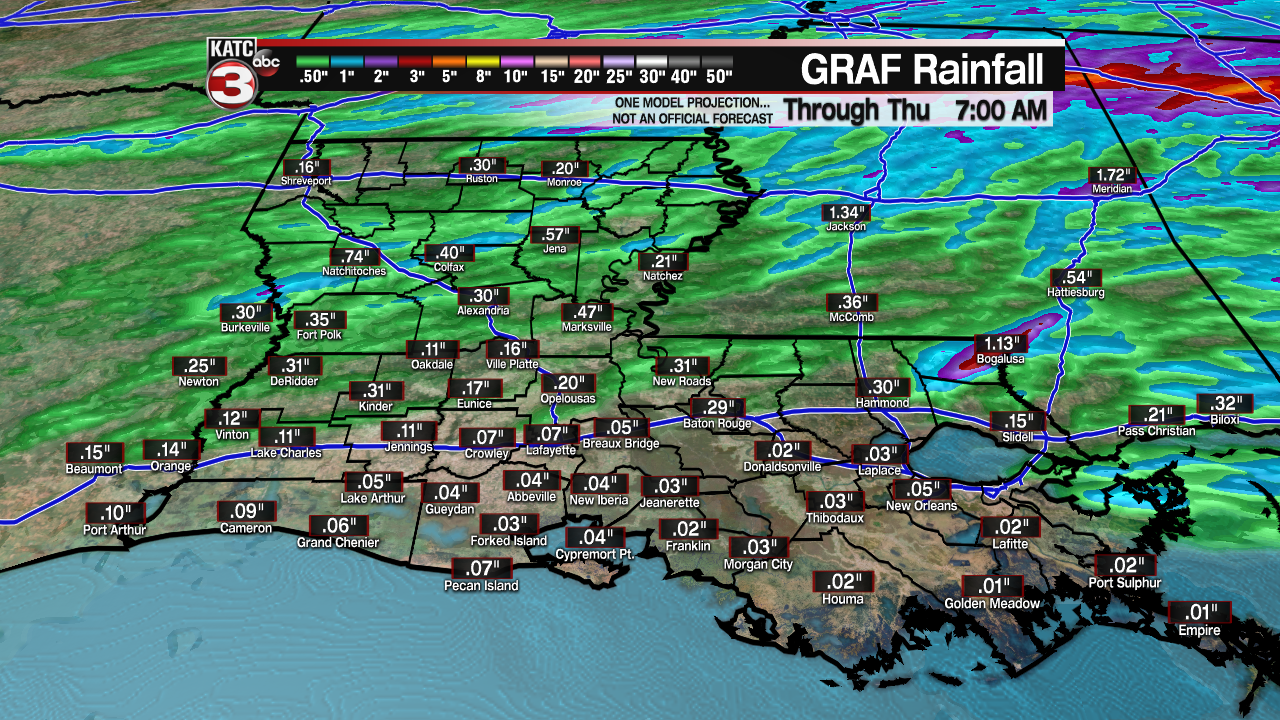
Rainfall totals should be light across the area with most folks seeing 1/4" or less.
Behind the front, a few lingering showers will be possible prior to midnight while temperatures drop dramatically courtesy of gusty northerly winds.
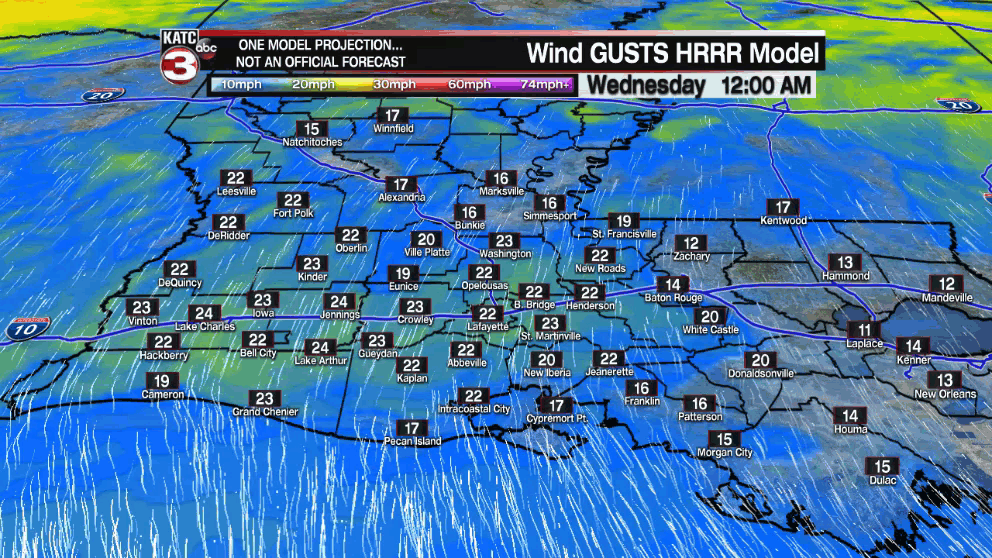
Gusts in the 30-40 mph range are expected for later Wednesday afternoon and into the evening hours, with those gusts gradually abating toward daybreak Thursday.
Temperatures will drop some 40° from their afternoon highs Wednesday, into the lower 40s by Thursday morning...wind chill not included!
While full sunshine is expected for Thursday, Friday and a good part of the weekend, temperatures will be more reflective of what is normal for January with highs barely reaching the lower 60s Thursday and Friday.

Meanwhile, temperatures will drop into the chilly upper 30s to lower 40s for Thursday, Friday and Saturday mornings.
The Easter weekend is looking quite nice with a gradual moderating trend as afternoon readings get back into upper 60s Saturday and lower 70s Sunday.
Next week's weather for now looks rather quiet, as temperatures moderate back to the upper 70s to lower 80s by midweek.
See the KATC 10 Day Forecast for the latest.
------------------------------------------------------------
Stay in touch with us anytime, anywhere.
To reach the newsroom or report a typo/correction, click HERE.
Sign up for newsletters emailed to your inbox. Select from these options: Breaking News, Evening News Headlines, Latest COVID-19 Headlines, Morning News Headlines, Special Offers
