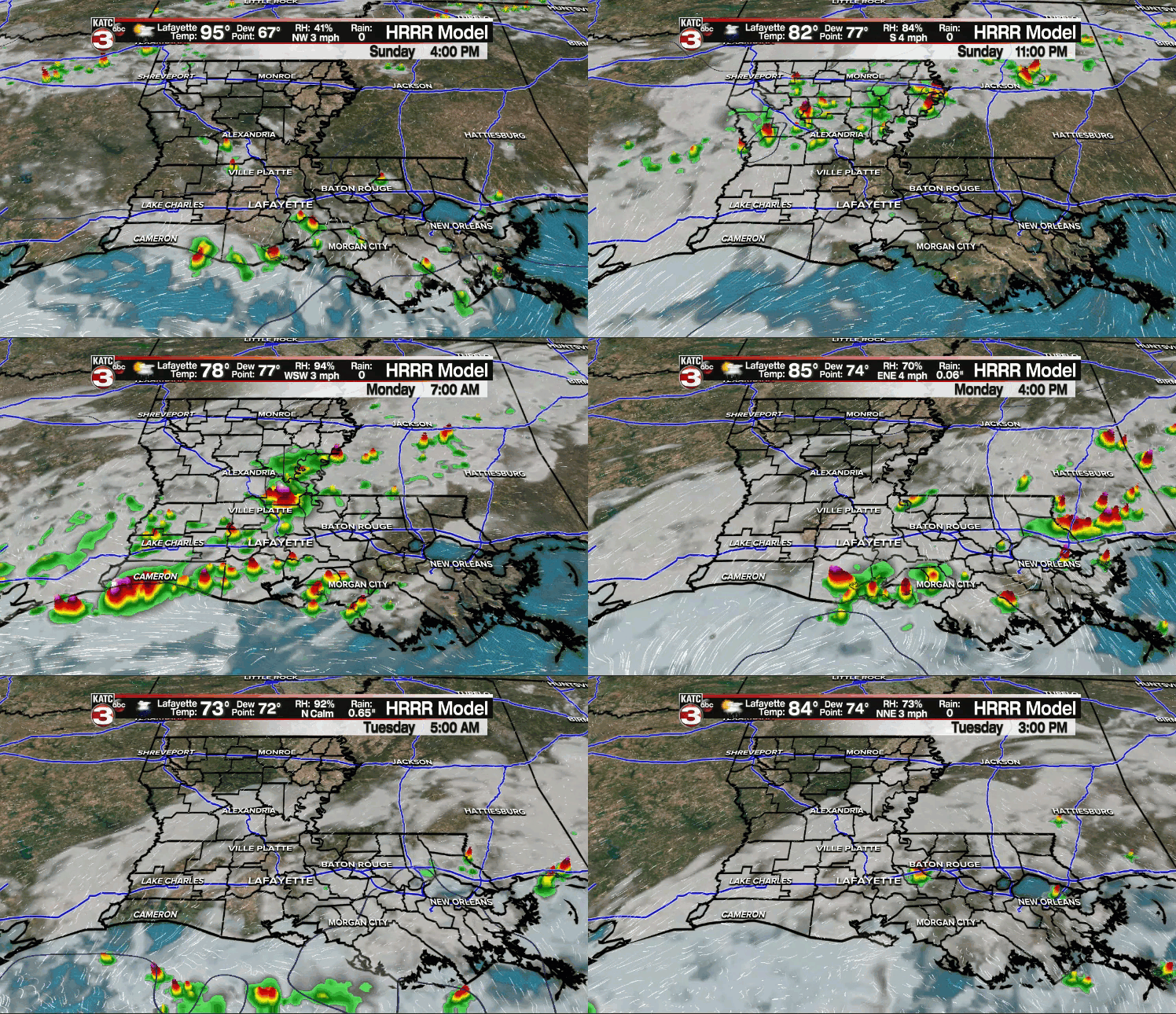
It was another hot one across the area as temperatures easily made their way into the 90s.
A few isolated storms have managed to pop-up this afternoon.
Any leftover activity will come to an end after sunset.
A frontal trough will be advancing southward and traversing the area tonight.
As a result, I would not be surprised if we saw scattered activity developing across the region as early as tomorrow morning.

It won't be a complete washout for our Labor Day, but scattered showers and storms will be lurking around.
After a morning start in the middle 70s, high temperatures will top out in the middle to upper 80s.
I have to maintain at least some rain chances through the middle parts of the week as that boundary remains draped across the area,
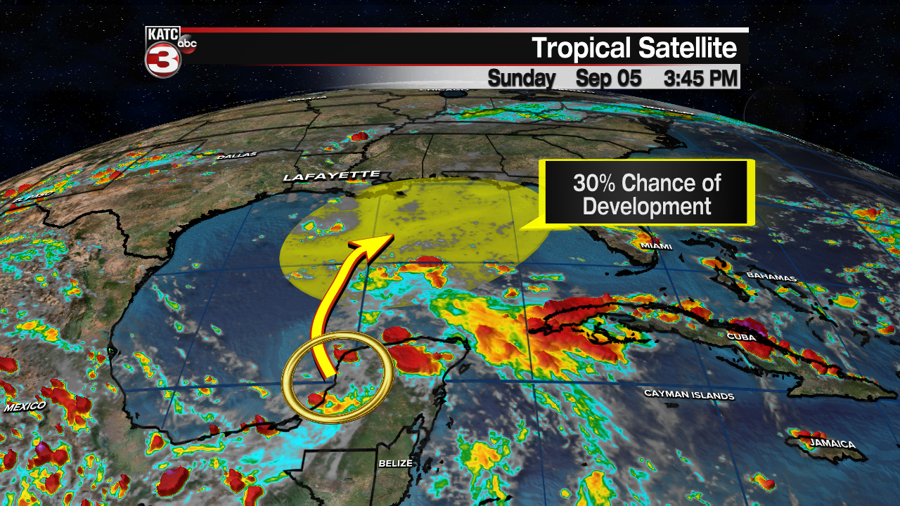
Furthermore, Invest 91L still has a low, 30% chance of development into a depression in the next 5 days.

However, unfavorable wind shear and dry air in the Gulf will limit any sort of significant development of the system.
It will likely just be a rainmaker for portions of the northern Gulf coast with the highest moisture content setting up just east of Acadiana.

That feature will continue to slide east on Thursday, and then I think we'll get enough of an upper-level boost to help push a front through on Thursday as drier, more comfortable air filters in for the end the week.
We could be talking morning starts in the 60s for Friday and into the weekend with afternoon highs settling into the mid-upper 80s under mostly sunny skies.
We'll see how the pattern continues to evolve this week, so stay tuned!
Hurricane Larry is a major hurricane out in the Atlantic.

It will brush the island of Bermuda before recurring out to sea.
The rest of the tropics are quiet at this time.
Have a great week, y'all!


