


While record heat returns to Acadiana into this weekend, there could be some minimal relief from a tropical wave early next week...unfortunately, it looks like the bulk of the much needed moisture with this system most likely will stay offshore.
In the near term, with highs pressure building overhead once again, temperatures (and humidity) will inch upward Friday into the weekend with highs near 103° Friday and Saturday and near the all-time August record of 104° Sunday.

The aforementioned wave looks to scoot east to west across the Gulf Monday and Tuesday, but today like most other models, the European Model is also suggesting that best moisture and rains may stay offshore.
We could still see more cloud cover and a few showers Monday into Tuesday (set at 30-40% respectively) so our high temperatures may ease closer to 100° on those days.

And unfortunately, it appears that record heat will once again return mid-late next week with perhaps the hottest temperatures of the summer pushing the 104-106° range...that's temperature, not heat index!
See the KATC 10 Day Forecast for the latest.
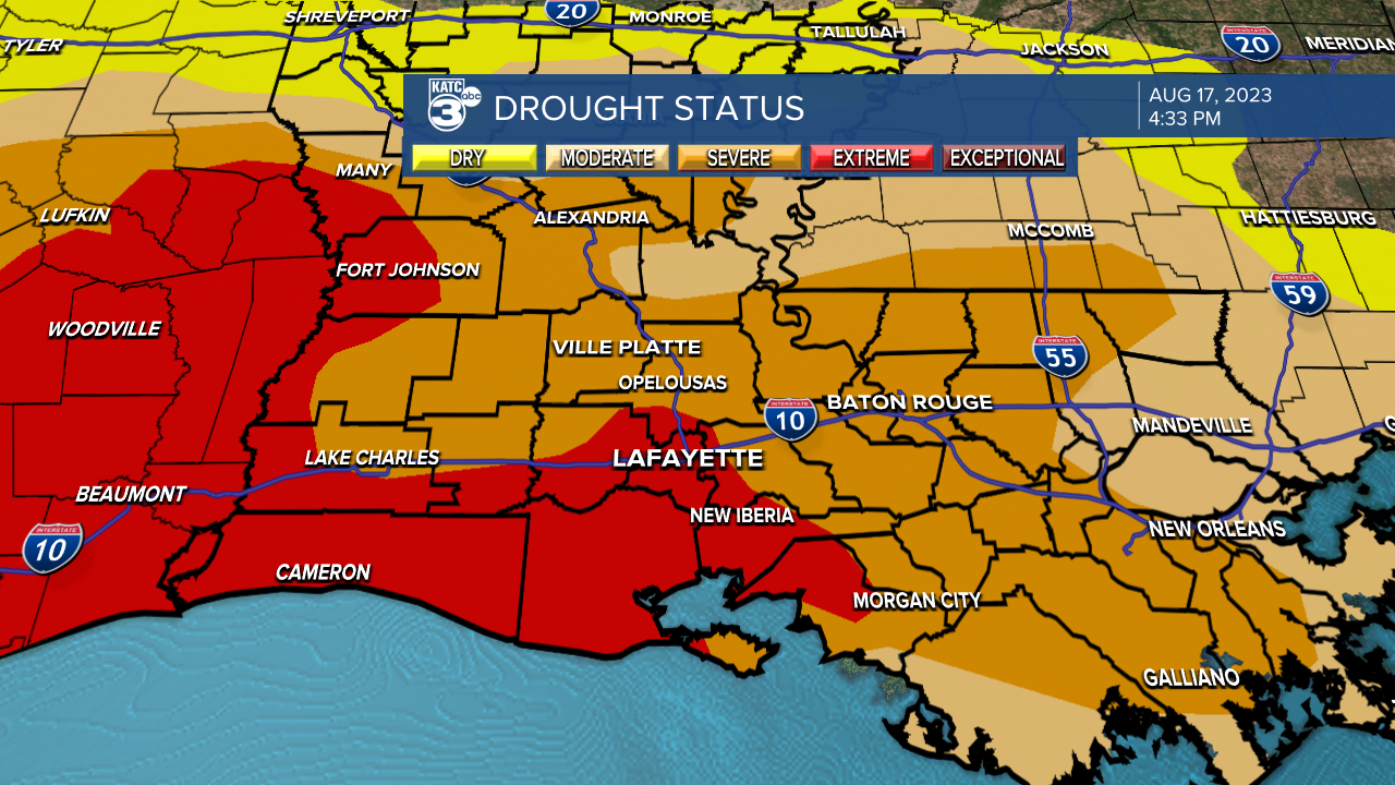
And with all the high heat and lack of rain for the better part of the last two months plus, the drought in the areas continues to worsen with most of Acadiana in a severe to extreme drought status.
Meanwhile the tropics are coming alive, and on schedule, with two Atlantic systems having a medium (60%) chance of development while the wave in the Gulf has a low chance of development in the 30% range.
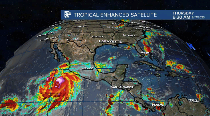
If the Gulf system were to get more organized, that would most likely occur as the bulk of the system approaches somewhere along the Texas Coast Tuesday...but it shouldn't be anything more than a depression, perhaps low-end tropical storm.
The bottom line, we'll watch for any changes on our thinking of this system...and look for changes, and they'll be either hotter or wetter.
Meanwhile in the Eastern Pacific, Hurricane Hilary is expected to become a major storm within 24 hours and should bring strong winds/surf to the Baha Peninsula, MX in the next few days before dumping some heavy, perhaps flooding rains, albeit as a much weaker system, to portions of Southern California and perhaps Nevada Sunday into early next week.
------------------------------------------------------------
Stay in touch with us anytime, anywhere.
To reach the newsroom or report a typo/correction, click HERE.
Sign up for newsletters emailed to your inbox. Select from these options: Breaking News, Evening News Headlines, Latest COVID-19 Headlines, Morning News Headlines, Special Offers
