Acadiana will be facing it's second heat wave of meteorological summer this week with daytime highs approaching triple digits accompanied by dangerous heat indices.

An upper ridge of high pressure will settle over the area this week keeping rain chances in the 5-10% range or less at best, while highs will be in the upper 90s Tuesday and likely reach the 100° mark each afternoon thereafter into the weekend.

Along with our dew points flirting with the 80° mark our heat indices will rise into the 112-118° range, which is a range we rarely visit for just a few days in any given summer...and this year it's been a slew of days.

An Excessive Heat Warning is in effect for Acadiana Tuesday...with more warnings likely for the rest of the week.

Overnight lows will remain near the 80° mark so there won't be any relief at night with the exception of an early evening breeze.
By the end of the KATC 10 Day Forecast, the ridge of high pressure looks to flatten a bit possibly re-opening the door for scattered afternoon storms into next week.

But don't hold your breath for temperatures less than the mid-90s anytime soon.
At least the tropics look quiet for the next week to 10 days.
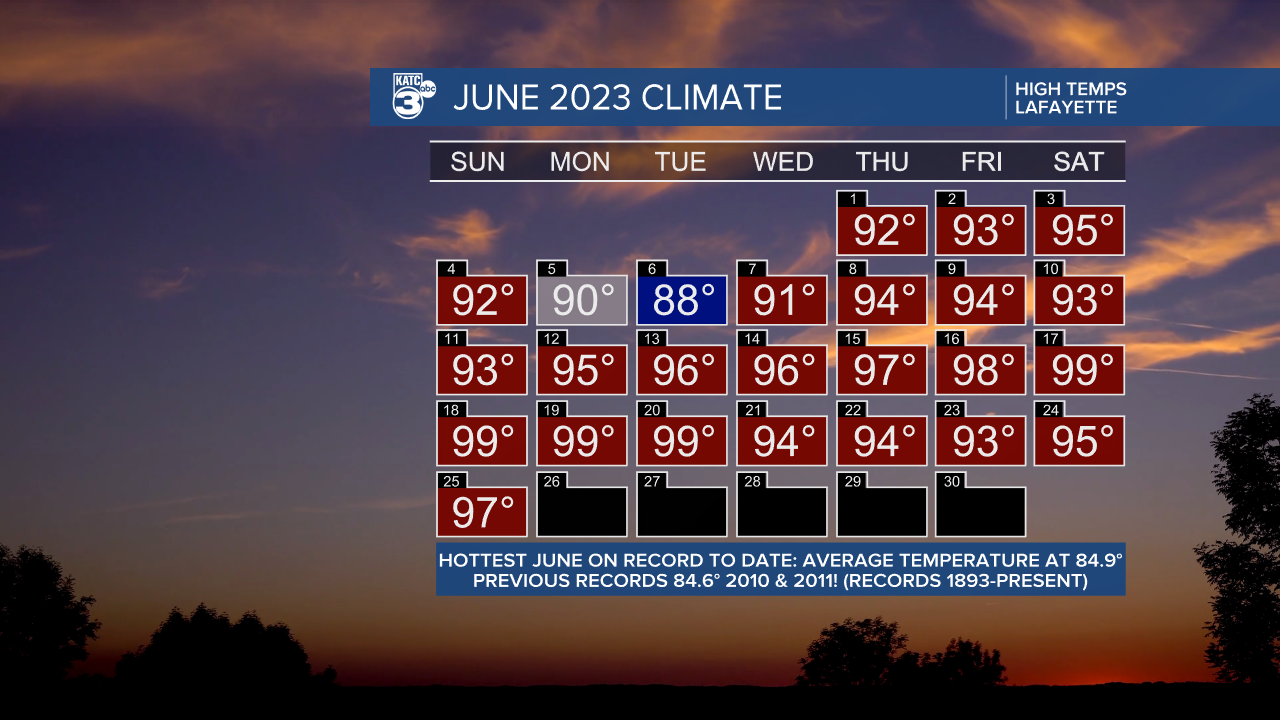
Climate Notes: While the month is not over, June 2023 will very likely be the hottest June on record given the forecast this week.

Our average of high and low temperatures for the month as of today is at 84.9°, which is ahead of the pace of the hottest Junes since 1893, edging 84.6° set in the successive years of 2010 and 2011...climate change rearing it's hot head!
------------------------------------------------------------
Stay in touch with us anytime, anywhere.
To reach the newsroom or report a typo/correction, click HERE.
Sign up for newsletters emailed to your inbox. Select from these options: Breaking News, Evening News Headlines, Latest COVID-19 Headlines, Morning News Headlines, Special Offers


